![]()
![]()
Since its inception in 1945, FAO has been charged with the responsibility of providing information on the world's forest resources. To date, four world forest inventories have been conducted (1948, 1953, 1958, and 1963) and the results published in the FAO world forest inventory series.
The information presented in appraisals has been obtained by sending questionnaires to individual countries and then collating the results. Where insufficient or no information was provided, the best estimates have been made by FAO staff.
There is a wide variance in the reliability of the data for individual countries, but these four major efforts at world forest inventory over a 20-year period have provided previously unattained knowledge of the world's forest resources. They have demonstrated the global extension of forest areas and quantities of wood in broad terms. Knowledge of this type is always useful and informative, but it now seems timely to consider whether this information meets the present needs of international forestry and, if not, whether it is possible to furnish information which will do so.
This requires an assessment of what are the forest inventory needs on an international scale which can be met by FAO. Past world forest inventories have tried to present a broad picture of the extent of the world's forests and their productiveness, in the hope that this would be useful for forest policy formulation. Experience has shown that such generalized information has been used more in analysing trends and capabilities than for policy formulation on a national scale. It has served a useful purpose and should continue to do so. But it must be recognized that such generalized information does fall short of what is required for forest policy formulation or development planning.
Evidently, the kind of information presented in past world forest inventories needs to be supplemented by additional data on the location, extension, and composition of forests and their potential to a degree not covered in past FAO world forest inventories. The most feasible and practicable approach would be the presentation of forest resource data by regions which have some basis of homogeneity. This information is also needed in planning investment studies since it permits singling out areas of interest requiring more detailed forest resource evaluation. Further, land-use planning requires this information for the intelligent determination of those areas best suited to forestry according to their productive potential or protective functions. This kind of resource information would be especially valuable to the FAO Indicative World Plan for Agricultural Development.
A step in modifying the objectives and methodology of FAO's world forest inventories has already been taken. Instead of attempting to compile an assessment of the entire world's forest resources at each inventory, attention is now going to be focused on selected regions for each inventory effort. An inventory of the European region is currently being compiled and preparations are well under way for Africa, with other regions to follow in succeeding years. When inventories have been compiled for all the world's regions, a world summary will then be made. Although this modification will yield forest resource information more specifically related to the varying conditions of the regions, an even greater improvement would be to provide additional information not now presented because of lack of funds and personnel.
Also worth investigating for forest resource evaluation is the use of space satellites as remote sensing devices. This has been under investigation for some time and the practicability of these observational platforms for evaluating earth resources has been demonstrated. From these satellites, with photographic techniques already in use, it is possible to construct maps showing land use, crops, and forest and other vegetative cover. Although the detail is much less and the scale smaller than can be prepared by more intensive land-based or conventional photographic methods, there is a particular advantage in that synoptic coverage of the entire world can be obtained at any time and repeated as needed. Thus a total, although extensive, view of the extent of the world's forests can be obtained when desired, repeated at some chosen interval, and evaluation made of the changes during that interval.
The day may not be too far off when space satellite information will be used in much the same way as conventional aerial photography is now employed in forest inventories. Thus, instead of relying entirely on questionnaires and the compilation of existing information, space satellites, employing sampling techniques, may bring into the realm of possibility a world forest inventory designed on a uniform basis.
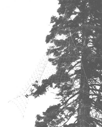
Collecting cones for seed trials from an example of a California redwood growing in England.
FORESTRY COMMISSION OF GREAT BRITAIN
![]()
![]()