![]()
![]()
![]()
The potential to develop CBF depends on the kind and size of water bodies as well as a defined need. Natural water bodies usually have well-established fish populations adapted to their particular environmental conditions. In Ghana the apparent opportunities for culture-based fisheries are in artificial water bodies--the small community water supplies called dugouts and dams found mainly in the north and reservoirs throughout the country. Natural lakes, with the exception of Lake Botsomtwi, are few and small. Rivers, oxbows and floodplain lakes are annually self-replenishing. Large, open systems such as Lake Volta would require a massive effort to stock periodically that would be more expensive than other forms of management of its fisheries.
The potential for the development of culture-based fisheries is considered from a number of perspectives. These include an inventory of numbers and kinds of water bodies that culture-based fisheries could operate in and an assessment of their potential to contribute to increased fishery yield. Information needs are appraised and recommendations are given for overcoming the constraints identified.
2.1.1 Results from Satellite Remote Sensing
There is a lack of comprehensive data on kind, surface area, permanence and location of water bodies in Ghana all of which is fundamental information for fishery planning and development. For this reason an inventory of water bodies was made during the preparatory assistance phase of project “Integrated Approach to Aquaculture Development in Africa, RAF/87/077”. The inventory was based on visual interpretation of Landsat TM images at a scale of 1:250,000. The images were from the end of the rainy season of 1986. Nearly all of the country was covered (Fig. 1) For the small portion of the SE of the country not included in the satellite imagery, water bodies were digitized, but as there were few lagoons along the south central coast, also not included, they were not added. Likewise, the extreme NE parts of Northern and Upper East Regions were not included in the satellite coverage (Fig. 1).
Verification of the inventory was carried out by field visits, checking results against aerial photography made along some portions of the coast and checking against maps. As anticipated, verification has shown that the smallest water bodies, those of 1–2 ha or less, have not been adequately inventoried by remote sensing. Those water bodies mapped as points, that is, those that were too small to digitize, have not been included in the inventory. These correspond to dugouts and temporarily inundated low-lying areas of small size. However, water bodies of 4 ha and greater have been included. There were few omissions of the water bodies of this size and larger, especially in Northern Ghana in the savanna where the contrast between land and water is good.
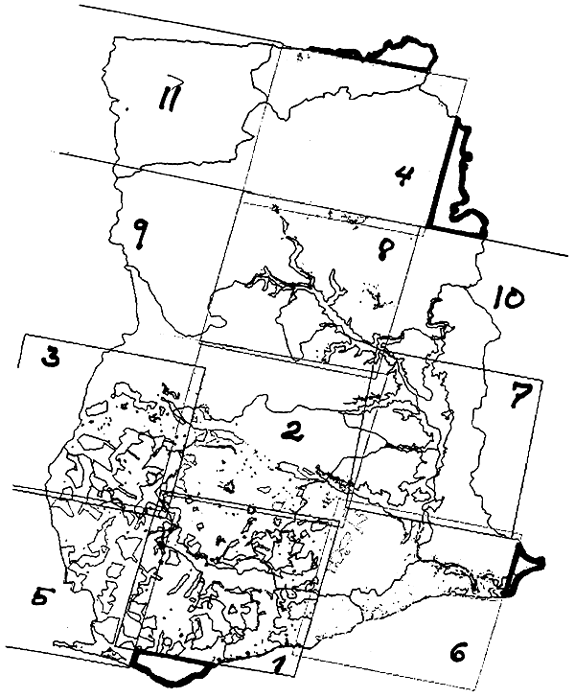
Figure 1. Approximate boundaries of 11 satellite images used to inventory water bodies. Areas not covered by the imagery by wide borders.
Verification showed that there were some misinterpretations of kinds of water bodies. For example, identifying a lake for a reservoir. In Ghana where the relief is not great, reservoirs, especially the small ones, tend not to have the dendritic shapes usually associated with them.
Additional information on the water body inventory is given by Kapetsky (1989).
In all, the inventory disclosed about 73,000 ha of water surface at the end of the 1986 rainy season, not including Lake Volta and dugouts (Table 1). The area of Lake Volta was obtained by digitizing the map of Ghana. Dugout area was obtained as explained in Section 2.2.2.
Table 1. Inventory of water bodies: lakes, dugouts, reservoirs, floodplain lakes, lagoons, swamps and Lake Volta.
| Surface Area (km2) | |||||||||
| Reg. | LAK | DUG | RES | FPL | LAG | SWA | LVO | Total | |
| UW | 0 | 76 | 435 | 32 | 0 | 0 | 0 | 543 | .05% |
| UE | 0 | 164 | 4276 | 0 | 0 | 0 | 0 | 4440 | .41% |
| NO | 0 | 1022 | 1197 | 2197 | 0 | 21503 | 182875 | 208794 | 19.27% |
| BA | 0 | 31 | 95 | 1568 | 0 | 0 | 233458 | 235152 | 21.71% |
| AS | 3194 | 24 | 327 | 415 | 0 | 0 | 8451 | 12411 | 1.15% |
| VO | 0 | 98 | 805 | 628 | 9541 | 5830 | 255840 | 272742 | 25.18% |
| EA | 0 | 0 | 115 | 876 | 0 | 145 | 253830 | 254966 | 23.54% |
| WE | 0 | 0 | 31 | 0 | 1156 | 1620 | 0 | 2807 | .26% |
| CE | 0 | 0 | 405 | 0 | 2197 | 964 | 0 | 3566 | .33% |
| GA | 0 | 28 | 4134 | 822 | 4501 | 3992 | 0 | 13477 | 1.24% |
| 3194 | 1443 | 11820 | 6538 | 17395 | 34054 | 934454 | 1008898 | ||
| .32% | .14% | 1.17% | .65% | 1.72% | 3.38% | 92.62% | |||
After Lake Volta, swamps have the largest surface area, about 34,000 ha; however, much of the swamp area is in Northern Region and it is highly likely that the great part disappears during the dry season. Lagoons, with about 17,000 ha are next in importance. Much which might have been understood to be lagoon area in the lower Volta estuary proir to Lake Volta has been reclassified as floodplain lakes for this inventory as it appears that they are isolated for most of the year and that when connected, the supply is fresh, not brackish. Reservoirs, occupying nearly 12,000 ha, follow lagoons in importance. About 92% of the reservoirs are of 100 ha or less. Reservoirs in this size category account for about 20% of the total surface area. Floodplain lakes and river backwaters occupy about 6,500 ha. These were especially abundant around the Daka River in Northern Region. Some of the lakes in this category were residual pools of what was Lake Volta before the drought of the early 1980s. As Lake Volta has continued to expand since the imagery was acquired in 1986, some of these will have been re-incorporated in the reservoir. The only large natural lake is Botsomtwi of about 3,200 ha.
The results of the inventory underline the fact that Lake Volta very much dominates the inland waters of Ghana. The implication is that, if the fishery potential of Lake Volta can be fully realized, then much of the available inland fishery potential will have been fully realized.
Looking at the results of the inventory from an administrative viewpoint shows that four regions, Eastern, Volta, Brong-Ahafo and Northern, individually have from 19 to 25% of the inland water surface area.1 Collectively this amounts to 96% of the inland water surface. The remaining six regions have only about 4%. This significant for the allocation of Fisheries Department personnel among regions.
As part of this project, and in order to complement the inventory of water bodies made be remote sensing, the FD undertook a country-wide inventory of fish farms and of dams and dugouts. The survey was in two parts. For the first part the regional fishery officers were to organize basic information on fish farms and dugouts in each district. For the second part the project provided funds to purchase fuel for verification of the tabular data and to acquire more detailed information about fish farming and reservoir fishing on a sub-sampling basis of 20% by district. The tabular data arrived for most regions in time to be included in this report, but the verification data from only one region could be included.
2.2.1 Fish Farm Survey
The results of the fish farm survey are not of direct relevance to this report. Therefore, they are found in Working Paper No. 11.
2.2.2 Survey of Dams and Dugouts
Dugouts are small water bodies enclosed by U-shaped dikes that are constructed in relatively flat areas, or in shallow depressions. Much of the water volume is achieved by excavation and the remainder by the dikes formed with the excavated earth. Dams are small reservoirs built across intermittent streams, or in areas with steeper contours.
Dams and dugouts are primarily community water supplies for drinking water and stock watering. Some of the larger dams have been constructed to irrigate dry season gardening. They continue to be constructed for livestock watering and for drinking water in areas where wells (boreholes) cannot provide a sufficient supply.
Based on results of the survey and information from other sources the distribution of dugouts and small dams less than 4 ha is listed in the following table.
Table 2. Numbers and surface areas of dams and dugouts of less than 4 ha by region.
| Region2 | Number | Area (ha) | Footnote |
| UW | 63 | 76 | 1 |
| UE | 137 | 164 | 2 |
| NR | 786 | 1022 | 3 |
| BA | 7 | 31 | |
| AS | 19 | 24 | |
| VO | 144 | 98 | |
| EA | - | - | 4 |
| CE | - | - | 4 |
| WE | - | - | 5 |
| GA | 27 | 28 | 6 |
| Totals | 1183 | 1443 |
2 See Appendix 2, Abbreviations.
One-hundred and eight dams and dugouts were listed by the FD in UW with area estimates for 82. Of these, 48 were less than 4 ha and had a mean area of 1.2 ha. Thus, it is assumed that (48/82) = 58% of the 108, 63, are less than 4 ha and have a total area of (63 x 1.2) 76 ha.
No survey was made in this region. Numbers are based on a list of 152 IDA water bodies, for which no surface areas are given. Remote sensing disclosed that there were 15 reservoirs greater than 4 ha in UE. Thus it is assumed that there are at least (152-15) = 137 dugouts. Using the average area from UE, 1.2 ha, the total dugout surface is estimated as 164 ha.
There were survey returns from only 6 of the 14 districts. Numbers for the 8 other districts are based on information from IDA. The area estimate comes from the mean area calculated from survey data, 1.3 ha.
,5 Only larger reservoirs were reported, or there were no area
data supplied. IDA has not been active in CE.
6 Not all water bodies were accompanied by area estimates. The
total area has been raised from the mean, 1.0 ha.
Because of incomplete coverage, the region-wise estimates of numbers and surface areas of dugouts and dams have to be regarded as minimums.
In order to have the basis for an assessment of CBF potential it is first necessary to put CBF in the context of overall inland fisheries potential. This is done by using the results of the water body inventory combined with yield estimates for the same kinds of water bodies as derived from the literature.
2.3.1 Yield estimates based on kind of water body and surface area
Apart from some of the larger reservoirs in the northern part of the country, there are no catch statistics for inland waters. For this reason it has been necessary to use data compiled from the same kinds of water bodies in other countries to generate potential yield estimates, except for Lake Volta for which there are historical data available.
Yields from rivers were estimated from a model developed by Welcomme (1985) which uses drainage basin area as the independent variable:
Catch = 0.03 (Basin Area in km2)0.97; r=0.91
Drainage basin areas were obtained from the by digitizing the World Bank (1986) map of Ghana's river drainage basins. The model provides an estimate of riverain catch of about 5,300 t. I believe this to be an underestimate based on estimates of numbers of fishermen in river zones in Northern Region provided by a fishermen's association and because of the large floodplain area in Northern Ghana. However, it is true that rivers in the forest zone would be expected to be relatively unproductive as compared with those in the savanna.
Potential yields from standing waters were estimated by region (Table 3) based on the information presented in the following paragraphs.
Lagoon yield potential is based on a set of 107 coastal lagoons worldwide assembled by Kapetsky (1984). The mean yield is 113 kg/ha/y. The W. Africa subset of the lagoon yield data, in all, 7 lagoons with those with substantial contributions from acadjas eliminated, yielded a mean of 158 kg/ha/y. Although this is considerably higher than the world mean, it was not used because of the small sample size involved.
The reservoir yield estimate, 110 kg/ha/y, takes into account the many small reservoirs of less than 100 ha which should have higher yields than larger reservoirs. Reservoirs in this size category were assigned a yield of 150 kg/ha. The remaining reservoirs were assigned a yield of 100 kg/ha. The is the average yield from a set of 53 tropical and subtropical reservoirs ranging in size from more than 100 to less than 5,000 ha (Kapetsky, unpublished data) equivalent to the size range found in Ghana.
The yield from Lake Volta, 53 kg/ha, is based on an estimate made by Kapetsky (1986). It employs catch data from 1969 to 1979 and calculates yield per unit area using the actual annual surface areas pertaining to the catches in the respective years.
Apart from the Amansuri Wetlands which are believed to yield 48 kg/ha based on high water area (Gordon, 1989a), the characteristics of swamp fisheries in Ghana are unknown. Swamps, as indicated in Section 2.1, are believed to be quite transitory in the north and it is not know to what extent they are fished. Thus, a relatively conservative yield of 5 kg/ha has been assigned.
An explanation of floodplain lake yield potential is in Section 2.4.2.
An overall yield potential of 300 kg/ha has been assigned to dugouts. This takes into account the relatively large area of dugouts in the Northern Region which appear to be self-stocking from floodplains and for this reason are expected to have yield characteristics similar to floodplain lakes, about 500 kg/ha. Also taken into account is that the dugouts in UE, UW and VO are probably not of this type, but may need careful management combined with annual stocking to reach a potential of from 200– 300 kg/ha.
Given these assumptions, inland fishery potential for Ghana is conservatively estimated at 58,200 t from standing waters and an additional 5,600 t from rivers, say 65,000 t.
As indicated by Table 3, Lake Volta, with about 85% of the potential inland catch, dominates all other sources of inland fish. Substantial improvements would have to be made in yield performance from other systems in order to make a significant contribution to inland catch in comparison with Lake Volta's output.
As already has been stated, dugouts, dams and reservoirs best lend themselves to culture-based fisheries. As can be seen from the table, this potential is relatively small for the present, amounting to only about 2,150 t equivalent to less than 4% of potential output from standing waters.
The following section focuses on CBF and makes recommendations for CBF development.
Table 3. Yield potential in kg/ha/y and potential catch in t/y for the inland waters of Ghana: lakes, dugouts, reservoirs, floodplain lakes, coastal lagoons and Lake Volta.
| Yield Potential kg/ha/y | |||||||||
| 100 | 300 | 110 | 500 | 113 | 5 | 53 | |||
| Potential Catch in t/y | |||||||||
| LAK | DUG | RES | FPL | LAG | SWA | L VOL | Total | ||
| UW | 0 | 23 | 48 | 16 | 0 | 0 | 0 | 87 | .15% |
| UE | 0 | 49 | 470 | 0 | 0 | 0 | 0 | 520 | .89% |
| NO | 0 | 307 | 132 | 1099 | 0 | 108 | 9692 | 11337 | 19.49% |
| BA | 0 | 9 | 10 | 784 | 0 | 0 | 12373 | 13177 | 22.65% |
| AS | 319 | 7 | 36 | 208 | 0 | 0 | 448 | 1018 | 1.75% |
| VO | 0 | 29 | 89 | 314 | 1078 | 29 | 13560 | 15099 | 25.96% |
| EA | 0 | 0 | 13 | 438 | 0 | 1 | 13453 | 13904 | 23.91% |
| WE | 0 | 0 | 3 | 0 | 131 | 8 | 0 | 142 | .24% |
| CE | 0 | 0 | 45 | 0 | 248 | 5 | 0 | 298 | .51% |
| GA | 0 | 8 | 455 | 411 | 509 | 20 | 0 | 1403 | 2.41% |
| 319 | 733 | 1410 | 3769 | 2079 | 175 | 49579 | 58164 | ||
| .72% | 1.26% | 2.42% | 6.48% | 3.57% | .30% | 85.24% | |||
This section examines the present fishery situation of dams and dugouts, estimates their fishery potential and makes recommendations for management and development based on investigations and projects.
2.4.1 Fisheries in Dams and Dugouts
Based on interviews at dams and dugouts and discussions with knowledgeable people elsewhere, there are a number of patterns of exploitation. Where dugouts and dams serve as the sole source of drinking water fishing is seen as making the water turbid and fishing is not permitted. About 24% of the NR dams and dugouts fall into this category. The implication is that some permanent water bodies may never be fished. But in those which dry out, or when the water is very low in perennial water bodies, there may be an organized community fish-out just before the water disappears. About 56% of the NR dams and dugouts were fished in this way. However, no fishing may be permitted before the fish-out. In others, children and adults daily hook and line fish or use set and cast nets for subsistence and sale. In the Upper Western Region many dams appear to be exploited daily by farmers who fish part-time as well as by children. They use cast and set nets and hook and line. Traditional aspects of fishing dams and dugouts are presented by Braimah (1990). In essence, in many water bodies it is up to the local community authority in many water bodies it is up to the local community authority to decide on when, by whom and with what gears fishing will take place.
2.4.2 Fishery Potential of Dams and Dugouts
In the absence of reliable information on catch from dams and dugouts, it is necessary to estimate potential yield by comparison. For this purpose, the reasoning was as follows: Many dams and dugouts in Ghana, especially in the Northern Region, appear to be the functional analogs of floodplain lakes and oxbows. According to descriptions, much of the area is flooded during the rains allowing fishes to leave permanent parts of rivers and dams and dugouts for a period of reproduction, high growth and low mortality. As water levels fall, fishes seek deeper waters and at the same time become more concentrated. Some, inevitably, would find dugouts and dams as refuges. As with floodplain lakes, dams and dugouts probably have large standing crops at the end of the rainy season because of the concentration effect and because fishes are in good condition. The amount of repopulation by this process is probably closely related to the distance from the water body to a permanent river or reservoir as measured along the natural drainage pattern from the one to the other.
Using the analogy of floodplain lakes, one would expect high standing crops in the "floodplain-type" dams and dugouts in the early months of the dry season. Tropical floodplain lakes average 570 kg/ha in the dry season according to data tabulated by Welcomme (1985, Table 6.11). On the conservative side I have assumed a biomass of 500 kg/ha. For nearly all of the river systems listed by Welcomme (op cit.) the production to biomass ratio exceeds 1. Here we assume that the P/B is sufficient to provide a yield equal to biomass, i.e., 500 kg/ha/y.
Perennial dams and dugouts that are isolated from floodplains have to depend on reproduction and growth that takes place entirely within the water body. Keeping in mind that these are directly or indirectly fertilized by livestock, these probably could provide a maximum of 300 kg/ha/y of fish, if well managed.
Seasonal dams and dugouts have lower fishery potential because the period of growth is reduced and because environmental conditions are less favourable for growth and survival than in perennial waters. These probably have a maximum potential of 200 kg/ha/y, if stocked early in the rainy season.
2.4.3 Management and Development of Dams and Dugouts
There are a number of aspects that have to be considered to decide on the appropriate management measures and amount of effort that should be allocated. These include:
• Permanence: The seasonality of water bodies can be a justification for culture-based fisheries. In the northern part of Ghana many community water bodies are not permanent. To the extent that they are, or could be fished, and are not self-replenishing, annual stocking could be justified, if the potential benefits to the communities are significant. Therefore, an important consideration to evaluate stocking requirements is the permanency of the water body. Data on IDA-developed water bodies in the Northern Region indicate that of 12 large dams (no area or volume data given) all are permanent. Of 24 medium dams, 88 % are permanent and of 115 small dams, 59 % are permanent. Only 12 dugouts were listed of which 25 % were permanent. In contrast, a survey of 54 dams and dugouts carried out by the Fisheries Department averaging 1.3 ha and ranging from 0.1 to 4.4 ha in the Northern Region gave the following results:
| Duration of Water (Months) | Percent |
| 12 | 54 |
| 11 | 15 |
| 10 | 4 |
| 9 | 7 |
| 8 | 9 |
| 7 | 11 |
In the Upper West Region 82% of the 39 water bodies listed were permanent.
Taken together, these results indicate that most of the larger water bodies, the dams, are perennial and that in the Northern Region less than one-half of the small water bodies are seasonal.
• Size: Size, in so far as potential catch is concerned, has to be taken into account because, apart from the numbers of fish to be stocked, the time, effort and expense of the FD (Fisheries Department) is the same no matter the size of the water body. Therefore, up to a point, the larger water bodies yielding more fish will give the greatest benefit per unit of cost expended by the FD. This is discussed in some detail in the report of the economist (Working Paper No.1). I have taken the practical upper limit of size for annual stocking as 2.6 ha using as the basis the idea that stocking should produce a minimum yield of 200 kg/ha/y to be worthwhile and that the water body should be stocked only once per year to save on transport costs.3 The upper limit for one-time introduction of desirable species is, of course, much higher, although relatively large quantities of brood stock or fingerlings would be required to guarantee success.
• Use: Where dams and dugouts are used as community water supplies, increasing biological productivity by using manures or compost probably would not be permitted. Even in the “new” type dugout in which potable water is obtained from below the dam by filtering and in which stock also are watered below the dam, introduction of manure probably would not be acceptable.
Brush parks could be introduced in dams and dugouts in the Volta Region; however, in Northern Ghana, where trees are not so plentiful, acquiring the wood could be a problem. An artificial substrate could be considered.
• Presence of Fish: Perennial water bodies are likely to have fish present. The NR survey showed that of 53 water bodies, only 3% of the perennial water bodies did not have fish and of 23 seasonal water bodies, only 13% did not have fish. This suggests that many of the fish populations of these water bodies are self-sustaining or that they are annually replenished from nearby floodplains. The implication for management is that the “floodplain-type” water body is naturally relatively rich in fish and that little or no stocking is required. In those where fish are not present naturally and where the water bodies are seasonal, fish would have to be provided as fingerlings or breeders each year. Either way, this is the most expensive situation. If this can be justified, then larger water bodies should be selected.
• Continuity of Fishing: From the point of view of making best use of the fishery productivity of the water bodies, year around fishing is to be preferred. At the time the water bodies become isolated biomass is near maximum and few nutrients will enter the water after the rains have ceased. Although growth and reproduction may add new biomass, conditions become increasingly severe as fish compete for a limited food supply and living space. The natural mortality rate through predation and other causes is high and increases. Therefore, the general fishing strategy should be to fish heavily and continually as the water volume decreases in order to capture as much of the biomass as possible that otherwise would be lost through natural mortality. Where water bodies are already being exploited on a continuing basis, about 30% of them in NR by the survey, there is little need for FD intervention, or it should be at a low priority. Where fishing is on going it is likely that hooks are plentiful and that fishing skills do not need to be taught. Where fishing is only one time per year, when the water is lowest, the FD should encourage continual exploitation with hook and line and other passive gears, if the size of the water body warrants it. Promotion of fishing should be undertaken only after close consultation with traditional and local government authorities to ensure that the people to be involved and the methods will be acceptable.
The tentative management activities and their priorities are:
Priority 1. Promote fishing in water bodies with fish, but where there is no fishing at present. Among these, give priority according to permanence and size, favouring the larger of the permanent dams and dugouts. This can make the greatest contribution to local food security in the shortest time. Introduce methods that do not affect the water body as a source of potable water (hook and line, traps, set nets). Introduce hook and line fishing first. It is the cheapest and easiest taught method. Where crocodiles are present, promote gears that cannot be damaged by them (and which will not cause their death or injury as they are traditionally protected) such as hook and line and cast nets.
Priority 2. Annually stock seasonal water bodies that do not have fish present with priority given to those which are largest and retain water for the longest time and which are closest to sources of fingerlings. Fish should be stocked as fingerlings in water bodies that are continually fished. If spawners were stocked, there is a likelihood that they would be quickly fished out.
Priority 3. Periodically stock perennial water bodies that are heavily fished, but only after ensuring that there is a real need for such intervention. Alternatively, with the help of local authorities, invoke a closed season or gear restriction that will reduce the effort to the point that the water bodies become self-replenishing.
For each management activity, a programme to evaluate the results and costs has to be built-in.
The management activities listed above are tentative because there is insufficient information to formulate a management and development plan. The recommendation below calls attention to this need.
Recommendation: The Fisheries Department should undertake a study of the status of fisheries and fish population in dams and dugouts in Northern Ghana and Volta Region. The purpose is to set the stage for a CBF development project to follow.
With the results of the investigation to hand, it will be possible to design a project appropriate to the needs identified. More detail on this investigation is contained in Annex C11.
![]()
![]()
![]()