![]()
![]()
By
1 Fisheries Officer (Biologist/Statistician), Fisheries Department, P.O. Box 4, Entebbe, Uganda.
1. INTRODUCTION
Lake Victoria is the second largest lake in the world with a surface area of 68.000 Sq. Km. The lake is shared by three riparian states : Uganda, Kenya and Tanzania with Ugandas' part constituting 30.720 Sq. Km. The shoreline consists of numerous sheltered bays surrounded by papyrus swamps, gulfs and forests at some places. The problem of fisheries statistics in Lake Victoria has bedevilled the three riparian states for a long time. There is need to standardize and harmonize the terminology and methods of collecting fisheries statistics in the Lake (CIFA, 1985; Bernacsek, 1987).
Several surveys of fishing factors have been carried out in the Ugandan waters of Lake Victoria. Methods used included aerial count of canoes (Graham, 1970) and aerial censuses supported by onwater coverage check surveys to provide estimates of the the size of the entire frame (Dhatemwa and Walker, 1972; Wetherall, 1972a; Wetherall, 1972b). The exact information (number of fishing, non-fishing, disused, non-local, and hidden canoes etc.) gathered from the selected segments of shoreline (Area Sampling Units) was compared with corresponding aerial survey data. This provided correction factors and estimates of errors associated with the aerial survey (Wetherall, 1972b). Information from this survey has been widely utilized amongst others, to estimate Maximum Sustained Yield (MSY) for the lake (Marten, 1979). Since then, the ability to carry out basic inventories of the fisheries frame suffered over the last 10–15 years as a result of lack of means and/or insecurity. During this period, baseline information concerning fishing factors was partly updated using time series and monthly or annual reports from the fisheries regional offices. It was only in 1988 that an on land frame survey was conducted but it had inherent weaknesses in its design and consequently the results of this frame survey were to be treated with caution (Frielink, 1989; Nyeko, 1990).
The Uganda Fisheries Department (UFD) and the FAO/UNDP project (UGA/87/007) is currently preparating to launch an on-water frame survey of fishing units in July 1990. The planned frame survey is within the general frame work of providing basic information on the inventory of fishing factors and for the setting up of a CAS for Lake Victoria. Initial design and testing of questionnaires has been done through various pilot testing exercises from mid-1989 to early-1990 (Nyeko, 1989; Nyeko, 1990; Odongkara, 1990; Nyeko and Tumwebaze, 1990). Through the training of all cadres to be involved in the survey, acquisition of survey equipments, adequate survey design, coordination and monitoring (measures for quality check), analysis and reporting of results, from which a reliable picture of the Lake fisheries frame is expected to be realized. A regular temporal frequency of these kind of survey should be maintained in future in order to update the inventory/frame of existing fishing factors.
2. STATISTICAL ITEMS
The items of information to be collected through a Frame Survey (FS) should enable to establish the distribution of fishing sites; temporal and spatial migratory patterns of fisherfolks; the permanency of fish landing places, size and area distribution of such landing places; number of active fishing boats by type and function; kind of fishing gears (gillnets, seines, castnets, traps, etc.); number of persons involved in active fishing and fish transport as well as facilities/amenities at surveyed landings and market destination of catches. An example of a proposed questionnaire form format is given in Annex 1.
Standardization of these survey characteristics is essential if the results are to be uniform within the survey area. An attempt was made by Nyeko (1990) to define Key survey Characteristics. In response to the practical realities of the numerous small fish landing places along the shoreline, a “Fish Landing” was defined as “a place on the shore where fresh catches are landed. It may have smaller satellite places where catches are landed, still representing the same landing, on the condition that any fisheries officer surveying that landing is able to adequately sample incoming boats”. The delimitation of active and non-active canoes was also attemped. An “active boat” was defined as “one which is either operating or is expected to resume operation after a temporary ‘rest’ due to loss of nets, disrepair of boats, non use of transport boats due to inadequate catches etc.”. A “non-active boat” was defined as “one which is abandoned or un-serviceable and not able to resume operation”. These boats were structurally defined as planked, dug-out or trawlers. The former could either be powered (fixed with out-board engine) or not. They could either be used for fishing only; fishing as well as transporting catches from other boats; or transporting fish and non fish items. Bazigos (1974) defined a “fisherman” as “a person who engages in actual operation of capture or culture of aquatic resources”. An attempt is hereby made to define a fisherman as a person who goes out in the water with or without craft to fish. Those involved in both fishing and transport of fresh catch would be classified as part-time fishermen.
The complexity of a total count of fishing gears (canoe and non-canoe based) was appreciated in terms of time and cost. Only qualitative information on gears and fish species is possible in a 21 day FS. It is practically impossible in the FS to check on the gears because of the practices on Lake Victoria whereby nets are left on the water for a number of days. The same is true for units not involving boats because of diel pattern of setting and lifting of nets. A more reliable quantitative estimate of fishing gears may be obtained from the CAS to follow an inventory survey. However, on other water bodies where fishing gears togather with the catch are returned to the landing every morning, a quantitative count for each canoe is possible under the FS exercise.
3. METHODOLOGY
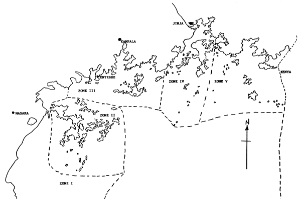
There are two methods of carrying out frame surveys on fishing factors viz Aerial and Water/Land. The merits and demerits of aerial surveys are discussed elsewhere (Dhatemwa & Walker, 1972; Bazigos, 1974). A method based on Water/land approach to fishing sites is proposed. The lake is divided into five parts corresponding to established Limnological Zones (Fig. 1). A complete staff disposition list was prepared and their residence marked on a 1 : 500,000 scale map to enable contact during the survey period. Similarly, their area of coverage were indicated to ensure equitable distribution of man-power along the shoreline. The census is to be carried out for a period not exceeding 21 days. Before this period, questionnaires form designed by the Statistical Unit (SU) at the Fisheries Headquarters are taken to the survey area through the Regional Fisheries Officers (RFOs) who are survey administration supervisors. The RFO ensures participation of the field staffs by coordinating their schedules with that of the a survey team consisting of 1 member from the SU and 2 trained staff per region. The former would be observing while the latter would be assisting the observer in turns. The team would carry out a landing site by landing site coverage of the shoreline while noting down such points on a 1 : 50,000 scaled topographic map by way of a code already inset on the questionnaire forms. These are filled for each fish landing site. Information on the number of active boats are filled in with answers given by the the respondents, which answers are counter-checked by gross inspection. The team would be in close liason with the resident fisheries staff who must accompany them in respective areas. Survey units would be scored according to established definitions outlined in their field manuals. The team should plan their operations and schedule within the survey period.
4. QUALITY CHECKS AND CONTROL OF ERRORS
Potential errors involved in surveys of this kind were discussed in detail by several authors (Cochran, 1963 ; Graham, 1970; Bazigos, 1974; Orach-Meza, 1990). The nature of the shoreline presents a problem because some landings are hidden from on-lake view and may not be effectively accessible from water. The survey team may encounter bad weather and poor on-land paths which may make it impossible for supportive local staff to reach their rendezvous during the period of the survey. One way to detect non-covered fishing factors would be to revisit selected areas along the shoreline and carry out a thorough mile to mile survey to serve as a check. This is carried out by headquarter personnel who have to adjust the results of the survey. Some fishermen on mainland live far off from the lake and may not be available at the time of the visit. This problem of not-at-landings fishermen was solved in the Trial Frame Survey (TFS) by interviewing knowledgeable respondents at an adjacent landing. In some instances the team would reschedule visits to some of the missed landings before further continuing with the survey. An eligible respondent at times may fail to answer all the questions. There are instances when they are unwilling to give correct answers. The interviewer usually selected two reponsible persons with a resident fisheries staff in the forefront. Gross inspection is carried out where answers on boats are gauged inaccurate. Similarly, qualitative data on gears, species of fish landed and fish products are varified by personal inspection at the Fish Landing. These errors are reduced by further training and selection of reliable field personnel constituting the teams. The possibility of the qustionnaire being unclear in expression has been reduced by various pilot frame surveys which allowed for modifications.
A possible source of error due to omission of survey units may arise from entrusting the whole exersise to the RFOs since they are involved in Law enforcement. Ultimately some fishermen may go into hiding on the days of the FS. The statistical Unit could participate in conducting the FS possibly with additional manpower from UFFRO.
5. DATA PROCESSING, ANALYSIS AND REPORTING OF RESULTS
At the end of each survey day, a member of the SU cross checks the completed forms. At the end of the survey period in a region, a member of the SU returns with the completed forms to the Headquarters. Using the available softwares, a data base is created, using Dbase III and Lotus 1-2-3 inclusive of all the survey characteristics. Index and report files are created by extracting relevant information for specified needs. Hard copies of such files are represented in a tabular format. This summarised data enables simple calculations and where possible graphical representation are carried out.
The results of the surveys are presented by way of a report. These reports are structured such that the purpose, duration and areas covered in the survey are noted. Methodology used in the conduct of such a survey inclusive of survey design are stated. Results of the survey are presented and discussed.
6. FACILITIES AVAILABLE
Implementation of surveys of these kinds requires considerable resources in terms of manpower and equipment.
6.1 Personnel
The Fisheries Department is in a good position to carry out the manifold tasks required. The primary cadres are the Fisheries Assistants (FAs) who all have “O” or “A” level and are graduates of the Fisheries Training Institute (FTI) with certificates. A total of 75 in number, these lower level of field staff are posted at fishlandings around the lake shore. They are supervised by more senior staff holding the posts of Principal Assistant Fisheries Development Officers (PAFDOs) and Assistant Fisheries Development Officers (AFDOs) who are diploma graduates from FTI. There are 33 of these middle level cadres around the lake reporting directly to their Regional Fisheries Officers (RFOs). The RFOs are university graduates holding the posts of Fisheries Officers (FOs) and Senior Fisheries Officers (SFOs). There are 5 of such officers in the five regional fisheries bounderies of the lake. At the fisheries headquarters in Entebbe, there is a team of Biologists/Statisticians in the Statistics Unit (SU). These are all university graduates responsible for planning, implementing and monitoring the departments' statistics and information services. The headquarter and field personnel undergo various training courses to improve on efficiency. This altogather constitute sufficient manpower resource for carrying out the survey. They are at the moment being assisted by FAO experts under the overall coordination of the Deputy Commissioner for Fisheries.
6.2 Equipment
Each FA has been provided with a bicycle to ease transport to the survey rendezvous. Some of these are provided with low capacity solar calculators. The regional survey teams are supplied with maps, binoculars and a survey boat. Supervisors (RFOs) were allocated motor-cycles to facilitate communication between offices and survey areas. All have high capacity solar calculators. At the HQ, where overall planning, scheduling and co-ordination are conducted, there are four 4-WD vehicles. The Statistical Unit of the FDU is equipped with a survey boat, 2 tents with camping outfits, 1 binocular, 1 field compass, 3 low and 2 high capacity PCs. The latter are input with two Dot Matrix Printer hardwares. The software components installed are: Dbase III+ and Lotus 1-2-3 which are used to enter, store and retrieve data as well as for statistical analysis and graphics.
7. CONCLUSION
The failure to implement the FS developed in 1972 (Graham, 1970; Bazigos, 1971; Dhatemwa and Walker, 1972) indicated that perhaps the system of Aerial Census followed closely in time by CCS may not be sustainably adopted.
An on-land approach only would probably miss a number of survey factors (small hidden landings with no accessible on land path). A combination of water and land approach to fishery sites is proposed.
Ideally an annual survey would be desirable.
In all this exercise the Statistical Unit of the Fisheries Department should be physically and actively involved in the field work.
UFFRO scientists should participate in these exercises.
Aerial Surveys have in the past been contracted to foreign companies which inevitably requires payment in foreign currency and is very expensive. Experience elsewhere in Uganda has shown that Frame Surveys conducted on water and land are viable and inexpensive.
8. REFERENCES
BAZIGOS, G. P., 1971. Statistical Analysis of the results of the Aerial Survey. St. S/1, Lake Victoria Fisheries Research Project, UNDP/SF/URT/71/012.
BAZIGOS, G. P., 1974. The design of fisheries statistical surveys: inland waters. Fish. Tech. Pap., (133). Rome: FAO. 122 p.
BERNACSEK, G. M. 1987. Kenya, Tanzania and Uganda: Evaluation of statistical services for Lake Victoria. Mission Report. CIFA:DM/LV/87/Inf.4.
CIFA, 1985. Report of the Third Session of the Sub-committee for the Development and Management of the Fisheries of Lake Victoria, Jinja, Uganda, 4 – 5 October 1984. FAO Fish. Rep. 335. Rome:FAO. 145 pp.
COCHRAN, W. G., 1963. Sampling Techniques. New York: John Willey & Sons. 413 pp.
DHATEMWA, C. M., and WALKER, R. S., 1972. The use of aerial surveys for fisheries management in Uganda with references to the 1972 Aerial Survey. UFD. (Unpublished).
FRIELINK, A. B., 1989. Artisanal Fisheries Rehabilitation Project and Uganda Freshwater Fisheries Research Organization : Joint Fisheries Survey. Report No. 1., Methodology. Kampala: EEC/AFRP.
GRAHAM, A. D., 1970. A census of fishing canoes in Uganda. Report to the Uganda Fisheries Department by Wildlife Services Limited. UFD.
MARTEN, G.G., 1979. Impact of fishing on the inshore fishery of Lake Victoria (East Africa). J. Fish. Res. Board Can. 36:891–900.
NYEKO, D., 1989. Report on the tour of southwestern lakes: George & Edward Landings. BIOSTAT Field Reports No. 7, FISHIN Notes and Records. Fisheries Statistics and Information Systems, FAO/UNDP Project UGA/87/007.
NYEKO, D., 1990. Report on the trial frame survey conducted around the northern side of the Kome Islands Complex (14–16 Feb. 1990). BIOSTAT Field Reports No. 9, FISHIN Notes and Records. Fisheries Statistics and Information Systems, FAO/UNDP Project UGA/87/007.
NYEKO, D. and R. Tumwebaze, 1990. The Lulamba Island Complex Fisheries: Report on a Trial Frame Survey (10–12 April, 1990). BIOSTAT Field Reports No. 11, FISHIN Notes and Records. Fisheries Statistics and Information Systems, FAO/UNDP Project UGA/87/007.
ODONGKARA, C. K., 1990. Socio-economic aspects of the Kome Island fisheries: report of a trial frame survey. SEC Field Reports No. 12, FISHIN Notes and Records. Fisheries Statistics and Information Systems, FAO/UNDP Project UGA/87/007.
ORACH-MEZA, F. L., 1990. Statistical sampling method for improving the catch assessment of lake fisheries. Paper presented at the International Symposium on Catch Effort Sampling Techniques and their Application in Freshwater Fisheries Management. Humberside Int. Fish. Inst., Hull, UK, 2–6 April, 1990.
WETHERALL, J. A., 1972a. Catch assessment surveys in Lake Victoria. Paper prepared for Fish. Tech. Comm. Tanga, Tanzania.
WETHERALL, J. A., 1972b. On the catch assessment survey (CAS) of Lake Victoria. EAFFRO. Occ. Pap. (14). 57 p.
Annex 1
TRIAL QUESTIONNAIRE FOR FRAME SURVEY
| NAME OF RECORDER | DATE: |
| TIME: |
Name/Title Person Interviewed:
Landing Characteristics.
| Name of landing: | Name of parish: |
| Subcounty | County |
| District | Map code: |
| Nearest village | Km to main road (i.e. served by public transport) |
| Access to landing: (tick) Tarmac road Murram road Footpath Only by water | |
If landing is on island, specify name:
Staff Establishment.
Landing staffed by: ,
(Name/Designation) ,
If NOT permanently staffed, is it ever visited by fisheries staff?
NO
YES How often?
For what purpose?
When was this landing established (since when in use)?
Is the landing used all year round? Yes No
If YES, Do fishing operators also use any other landing(s)?
NO
YES Which landing(s)? , ,
,
If NO; during which period(s) is it not used?
(Month) from (Month) to
Reason:
(Month) from (Month) to
Reason:
Is processed fish landed here? (Y/N)
If YES;
Type(s) ? Origin? How often ?
Mode/number of transport ?
Number of non-active boats:
Number of active boats :
TOTAL:
| ACTIVE BOAT CHARACTERISTICS | PLANKED CANOE (No.) | DUG-OUT | TRAWLER | |||
| Powered | Non Powered | No. | No. | |||
| TOTAL No. | ||||||
| FISHING ONLY | ||||||
| NO. CREW | Remarks: | |||||
| NO. OWNERS | ||||||
| FISHING/TRANSP. | ||||||
| NO. CREW | ||||||
| NO. OWNERS | ||||||
| TRANSP. ONLY* | ||||||
| NO. CREW | ||||||
| NO. OWNERS | ||||||
Gears used (√ )
| Remarks: | ||||||
| Gill nets | B-seines | |||||
| S-Gill nets | M-seines | |||||
| “Set” | M P-nets | |||||
| “Sekeseke” | L-Line | |||||
| Cast nets | Traps |
Fish Species (√ )
| Remarks: | ||||||
| Lates | Protop. | |||||
| Tilapia | Mormy. | |||||
| Bagrus | Rast. | |||||
| Clarias | Hapl. |
Are the fisherfolk (operators and/or traders/processors) of this landing organised into any society/societies?
(Y/N)
If YES, Specify society name (s) and no. of members:
Market Destinations for Catch: Market at landing site? (Y/N)
Othermarkets (specify): ,
Facilities/Amenities at Landing only (No.)
| FEATURE/SERVICE | NO. UNITS | FEATURE/SERVICE | NO. UNITS | |
| Bicycle | Frying unit | |||
| Pick-up | Boat repair/const. | |||
| Lorry | Fish display table | |||
| Bus | Fisheries office | |||
| Van | Petrol station | |||
| Wheelbarrow | Piped water | |||
| Weighing shed | Public latrine | |||
| Cleaning slab | Net repair | |||
| Drying rack | Outboard repair | |||
| Smoking pit/Kiln | Fishing equip.shop | |||
| Storage unit |
Fishing risk:
For each landing, note the following particulars under the “General Remarks” section of the survey form.
During the calender year 1989, were any fishing/transport craft from this landing involved in any capsizing or sinking accidents? (Yes/No)
How many separate accidents occurred and how many craft from this landing were involved in each?
Was there any loss of life? If so, specify for each accident.
Was there any loss of property (Boats, Equipment, etc.)? If so, specify for each accident.
General Remarks:
Source: UFD, FAO/UNDP Fish. Stat. Info. Syst.
Fig. 1. SKETCH MAP SHOWING LIMNOLOGICAL ZONES OF LAKE VICTORIA - UGANDA
![]()
![]()