![]()
![]()
![]()
1. SHORELINE
The coast of mainland Jamaica (area 11 430 km2) is characterized by rising hills starting from outside Kingston Harbour eastward and continuing almost to the western tip along the north to Negril; then long stretches of gradually sloping land and beaches on the southwest where most of the country's coastal plains are located.
The northern coast is a series of bays and coves, a few of which are quite protected from the effects of the prevailing tradewinds. Fewer protected areas are found along the southeast, but at the southwest, protected by the underbelly of the island, the waters are relatively calm.
The shoreline is surrounded almost in its entirety by fringing coral reefs, some of which are just a few hundred metres from land. Coralline sand and gravel, therefore, form the basic component of most of the beaches.
2. INTERTIDAL AND MANGROVE ZONES
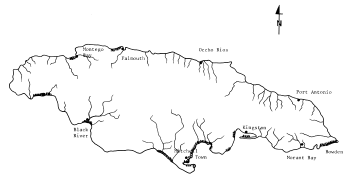
These are narrow, low areas in Jamaica usually extending up to 1 kilometre inland and covered in most parts by mangrove trees. These marshy lands are found along the Great Morasses on the eastern and western tips of the island; at Falmouth and vicinity; in sections of Montego Bay; at Savanna -la-Mar; at Black River and at Rocky Point. At Portland Bight, a low-lying mangrove area extends between West Harbour to Galleon Harbour to the east. Figure 10.1 shows the location of these areas.
The four major species of mangrove are Rhizophora mangle, Avicennia germinans, Laguncularia racemosa and Conocarpus erectus. The Rhizophora mangroves are characterized by prop-roots extending from the trunk to the ground and are generally in the deeper portions or edges of the swamps along deeper waters. Avicenna and Laguncularia inhabit the higher areas in the intertidal zone. These have numerous slender, short roots that stick out of the bottom for exposure to air. C. erectus are found above the high water mark.
The soil types found in those marshes range from peat to loam, influenced by the nature of the surrounding land and the dominant stands of mangrove trees. Along the northern coast, particularly Falmouth, the heavy growth of Rhizophora have created a peaty substrata, composed mainly of root material. At West Harbour, loam soil with higher clay content was observed in sections where the major component of the mangle were Avicennia and Laguncularia, and where clayey alluvium have been washed down from the wide inland plains.
3. WETLANDS AND MARGINAL AGRICULTURAL AREAS
Strips of flat lands covered with Typha, Phragmites and other rooted aquatic vegetation can be found in some parts of the country quite close to the shore just back of the mangrove belts. These are idle lands with soils ranging from loamy clay to peat. They are usually water logged although their elevation is higher than sea level. Often they are extensions of the morasses or situated near perennial rivers, or beside hills, from where fresh water seeps into the area. These, as also some dry lands close to the sea, seem affected by salt water intrusion as evidenced either by the presence of some halophytes or by the poor appearance of the agricultural crops.
4. TIDES
Tides are diurnal during the spring period and semi-diurnal during the neap periods. In the tide tables for January and February 1983 (these were the only ones then available from the Meteorological Service), the maximum difference between absolute levels was 42.6 cm at Kingston Harbour. An analysis of the tidal pattern during the year 1982 showed a curious phenomenum: as high tide levels rise during the spring tide seasons, so does the level of low tides, so that diurnal amplitudes very rarely exceed 30 cm. For example, the highest spring tide in Kingston Harbour in February 1982 was 18.3 cm, the lowest 12.2 cm; in October of the same year, 27.4 cm and 0.0 cm respectively. Normal diurnal tidal amplitudes are between 15 and 20 cm.
Fig. 10.1 - Map of Jamaica showing mangrove areas
5. CURRENTS
Jamaica lies in the track of the North Equatorial current which flows west and north-west at rates of one half to one knot. It is believed therefore that there is a tendency for the natural fish stock, especially during their early period of development, to be carried away to other areas.
6. SALINITY
The study group took salinity readings, using a refractometre, at the different sites it visited and noted salinities of 34–36 ‰ in the open bays and coves, but where there was influence of fresh water, readings of 8–24 ppt were encountered close to the effluence, with the tide going down. Data from Siung1 showed very little difference in levels noted in September 1972 (middle of the rainy season) with salinity between 31.5 ‰ and 35.6 ‰ in the open bays and between 5.0 ‰ and 29 ‰ where fresh water was coming in (Martha Brae, Pear Tree Bottom, Salt River vicinities). Considering the long drought that had been plaguing the country for the last six months previous to the Mission's arrival, it would be quite safe to assume that the salinity levels of 36–36 ppt could be maximum values.
7. WATER TEMPERATURES
From data gathered by the University of the West Indies, surface water temperature showed variations between 26.5°C and 29.5°C in inshore Negril from April 1974 to February 1976 and between 25.7°C and 28.8°C from July 1974 to August 1975 off Pigeon Island, Portland Bight as shown in the following table.
Table 1
Average Water Surface Temperature from two sites in Jamaicaa
| Inshore Negril | Pigeon Island, Portland Bight | |||
| Date | Temperature (°C) | Date | Temperature (°C) | |
| 10–19.4.74 | 27.4 | 5.7.74 | 28.1 | |
| 10–11.7.74 | 27.2 | 7–8.8.74 | 28.8 | |
| 9–10.10.74 | 29.5 | 11–12.11.74 | 28.2 | |
| 22–23.1–75 | 26.5 | 18–19.2.75 | 25.7 | |
| 25–26.8.75 | 28.3 | 30.7.75 | 27.8 | |
| 20–21.2.76 | 27.5 | 1.8.75 | 27.6 | |
In the same study, the range in surface temperature at Port Royal was between 25.5°C and 29.5°C, with July and August being the warmest and January to March the coolest.
8. TURBIDITIES
Siung further recorded measurements in suspended matter in areas where oysters were found. Table 2 shows the levels as observed in September 1972.
Table 2
Suspended Matter
| Sites | Suspended matter (Mg/l) |
| Discovery Bay | 0.46 |
| White Bay | 1.95 |
| Long Bay | 0.37 |
| West Bogue | 8.31 |
| Negril | 0.31 |
| Pear Tree Bottom | 2.48 |
| Bogue Island | 14.80+ |
| Port Royal | 10.96+ |
| Little Laughlands Bay | 54.8 |
| The Rock, Oyster Bay, Falmouth | 49.48 |
| Black River Coast | 37.76 |
| Fort Rupert Lagoon | 12.4+ |
| Martha Brae | 76.56 |
| Lucea West River | 51.66 |
| Black River | 55.20 |
While these were observed only for one month, the figures nevertheless indicate what to expect during the rainy season.
9. WINDS
Trade winds blow throughout the year. Directions are generally easterly to east-northeasterly over the Caribbean Sea in the vicinity of Jamaica, but during the day the sea breeze shifts to NE to ENE along the north coast and ESE to SE along the south coast. During the daytime (10 a.m. to 4.00 p.m.) the sea breeze blows with a speed of more than 15 knots from February to July, and reaches more than 20 knots with gusts of over 25 knots, during the rest of the year.
Jamaica is affected occasionally by tropical storms. The hurricane season starts in June and ends in November. Most of the storms, however, occur from August to October. Between 1880 and 1970, 65 hurricanes and tropical storms passed over Jamaica or within 320 km of the island. Fifteen affected Jamaica, seven with winds of hurricane strength (over 80 km/h1). The last hurricane to cause considerable destruction on the eastern part of the island occurred in the summer of 1980.
1 Source: Statistical Yearbook of Jamaica, 1980, Ministry of Statistics, Kingston, Jamaica
![]()
![]()
![]()