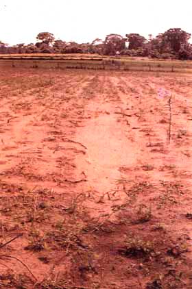
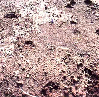
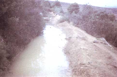
PLATE 1: SHEET EROSION
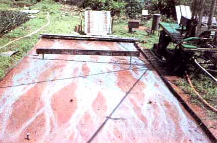
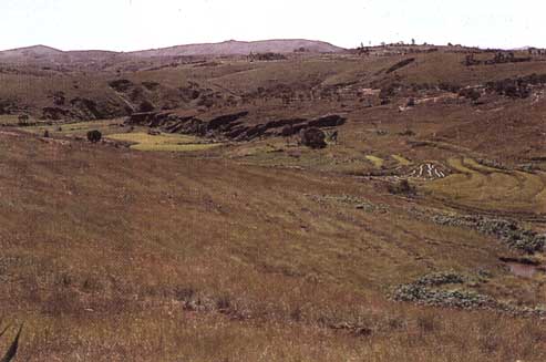
PLATE 2: ERODIBILITY OF VARIOUS SOILS
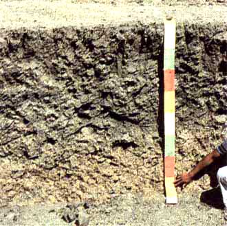
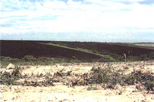
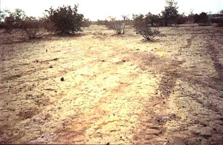
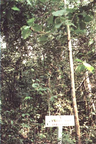
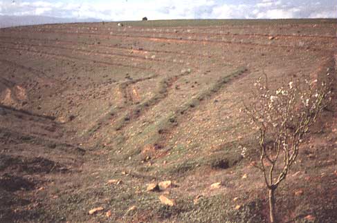
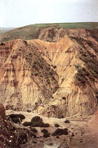
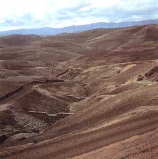
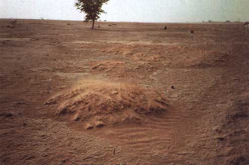
PLATE 3: SOIL DEGRADATION
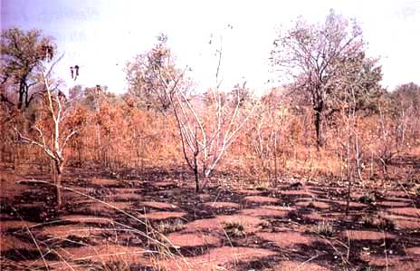
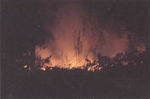
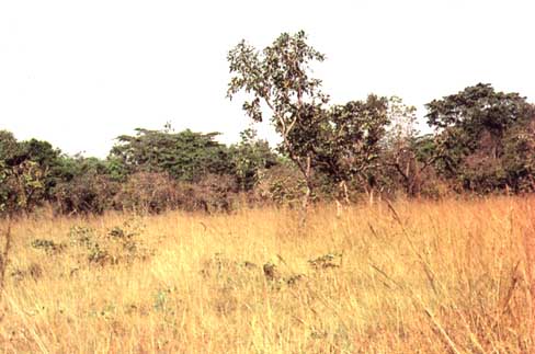
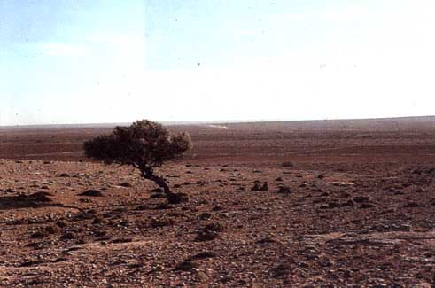
PLATE 4: EFFECTS OF FIRE
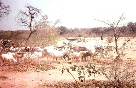
A great deal of Africa that is at present under savannah would naturally revert to forest if it were protected from fire and grazing.
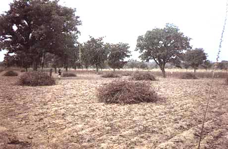
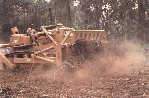
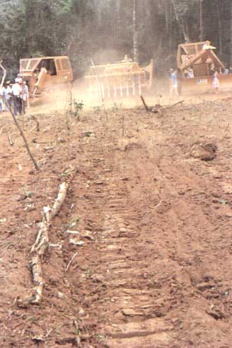
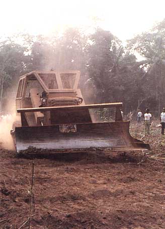
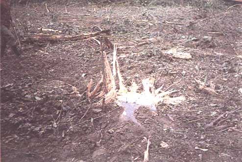
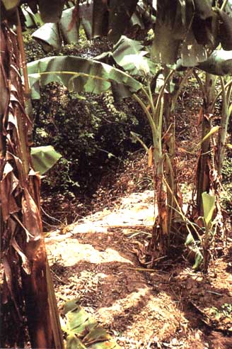
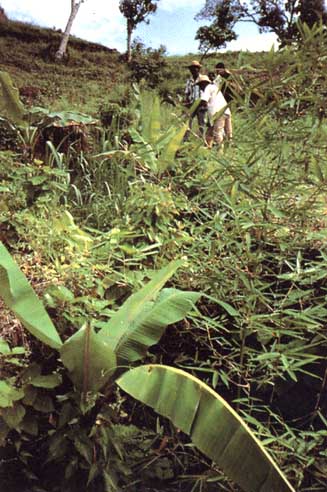
PLATE 5: MECHANIZED CLEARING
When branches cannot be left in place (since soil is tilled mechanically), it is better to burn the brushwood on the spot in order to release the mineral load rather than relegate it to the edges of the plot.
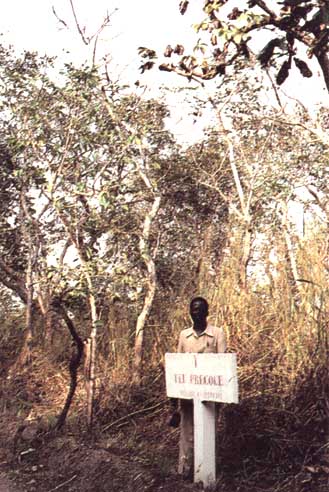
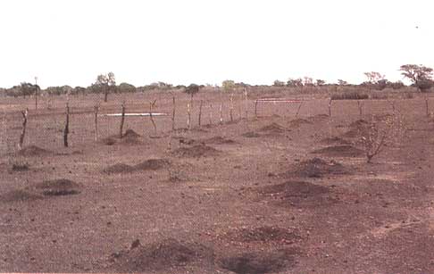
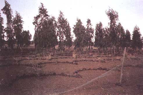
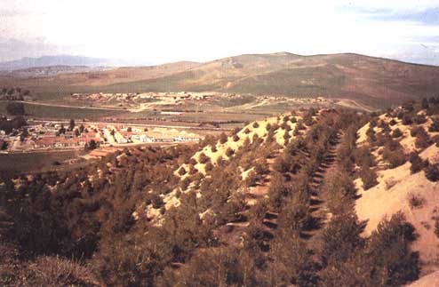
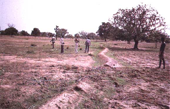
PLATE 6: REFORESTATION IN A SUDANO-SAHELIAN ZONE
PLATE 7: REFORESTATION IN A SUDANO-SAHELIAN ZONE
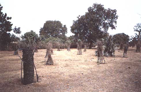
PLATE 8: SPR
PLATE 9: SPR
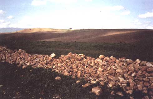
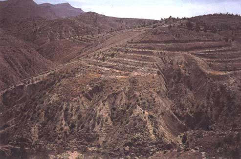
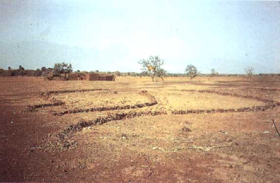
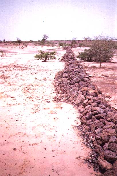
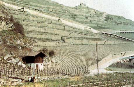
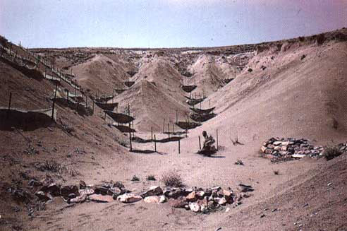
PLATE 10: EROSION CONTROL STRUCTURES IN A SUDANO-SAHELIAN ZONE
PLATE 10: EROSION CONTROL STRUCTURES IN MOUNTAINOUS ZONE
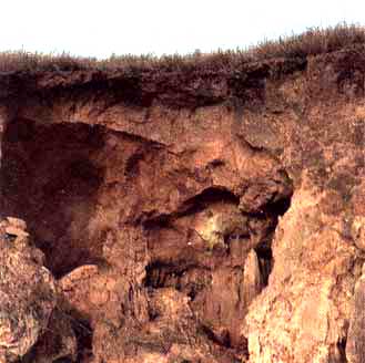
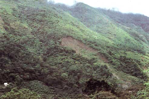
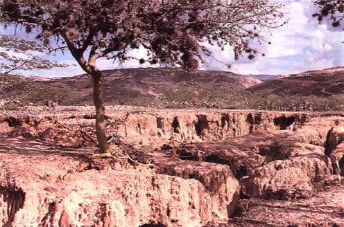
PLATE 12: MASS MOVEMENT
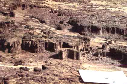
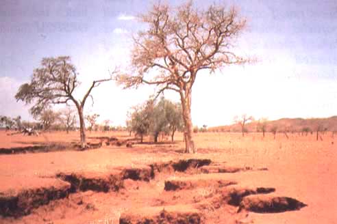
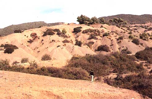
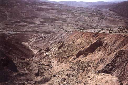
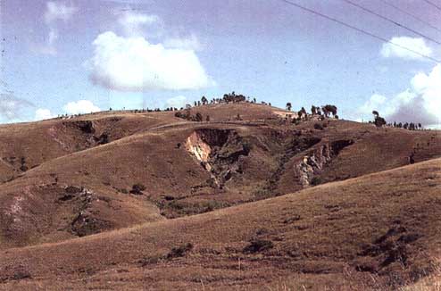
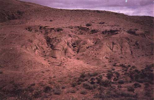
PLATE 13: GULLYING
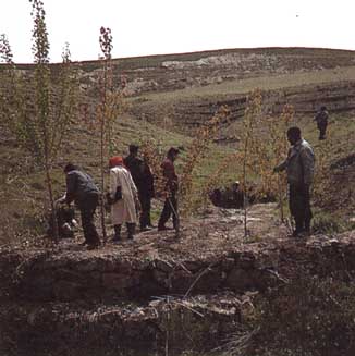
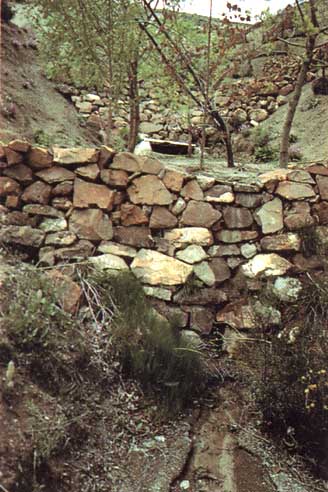
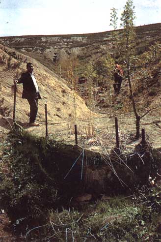
PLATE 14: GULLY CONTROL
PLATE 15: GULLY CONTROL
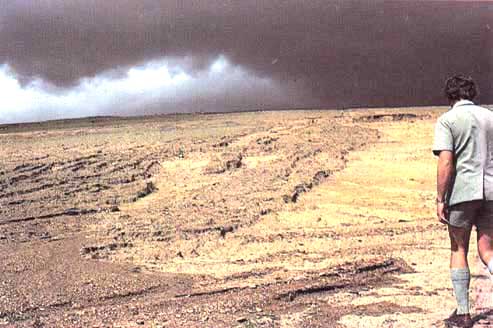
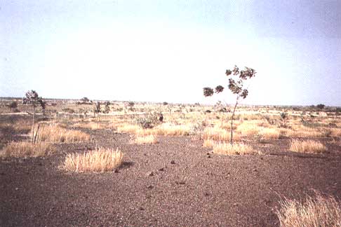
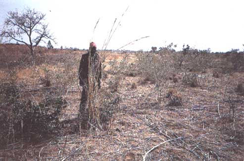
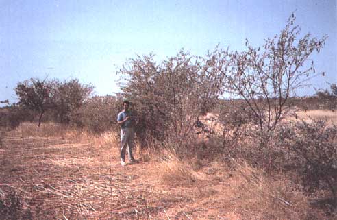
PLATE 16: WIND EROSION
A Texas landscape invaded by sand dunes: saltation at Big Sprint. [Photograph Fryear]
TABLE 25
Cropping systems (C)
efficiency surveys and erosion control practices (P) in Brazil
(cf. Leprun, da Silveira and Sobral, 1986)
P |
C |
|
Cotton on contour lines (tillage +
2 conventional weedings) |
0.41 |
|
+ maize + contoured beans |
0.75 |
|
+ maize + contoured beans + buffer
strips |
0.48 |
|
Maize on contour lines (tillage +
2 weedings) |
0.87 |
|
+ alternate hoeing |
0.16 |
|
+ alternate hoeing + perennial
plant strips |
0.08 |
|
Tomato + bi-annual bean rotation |
0.56 |
|
+ soil preparation |
0.08 |
|
+ rotation with legumes as mulch |
0.11 |
|
+ rotation with dug-in fallow |
0.38 |
|
+ rotation with 2 years fallow as
mulch |
0.01 |
|
+ maize + green manure as mulch |
0.07 |
|
+ rotation of green manure + grass
strips |
0.04 |
|
Soybeans with no soil preparation |
0.67 |
|
Wheat-soybeans + minimum
preparation |
0.37 |
|
Wheat-soybeans with no preparation
or tillage |
0.17 |
|
Wheat-soybeans with no preparation
or tillage + mulch |
0.09 |
|
Barley-soybeans + oats with no
soil preparation |
0.46 |
|
Wheat-maize with no tillage |
0.14 |
|
Wheat-maize + fertilizer |
0.31 |
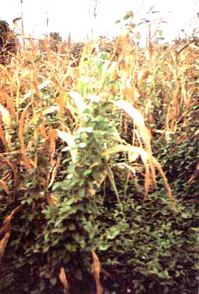
One of the main focuses of present research on soil conservation is the use of crop residues and tillage, and there is as yet no real proof of the long-term positive agricultural and economic effects of such techniques as minimum tillage, localized tillage with the space between rows being protected by stubble, partial ploughing in of stubble (stubble mulching) and no-till, leaving stubble on the surface (mulch tillage) - techniques that all seem to have a positive effect on water management and soil conservation. In any case, there are still various practical obstacles in the way of using these methods in which organic residues are left on the surface: weed control (herbicides are expensive), machinery to break up the soil without turning it over (vibrating teeth in place of a plough), machinery to sow through a mulch, and pest-control problems (particularly grasshoppers and snails).
In Brazil, Leprun, da Silveira and Sobral (1986) collated the results of experiments on erosion plots in the north-eastern, central-western and southern regions (Table 25). These show the remarkable efficiency of simple farming and biological practices that are easy and inexpensive for farmers to apply, and that ensure long-term productivity. In the best situations, these biological practices allow control of erosion and a decided reduction in runoff.
The most effective mechanized cropping techniques are minimum tillage, sod seeding in the mulch made up of residues from the previous crop, or else contour cropping. The best biological techniques are crop rotation, cropping on a mulch of crop residues or green manure, and permanent contour buffer strips.
TABLE 26
Erosion, runoff and
yields as a function of soil preparation techniques (Saria
Station near Koudougou, Burkina Faso: tropical leached
ferruginous soil on ironstone, 0.7% slope)
Rainfall |
Bare soil |
Shallow cultivation |
Digger ploughing |
Digger ploughing +
tied mounding |
|||||||
E (t/ha) |
E (t/ha) |
KR % |
Yield (t/ha) |
E (t/ha) |
KR % |
Yield (t/ha) |
E (t/ha) |
KR % |
Yield (t/ha) |
||
1983 |
771 |
24.2 |
18.4 |
36 |
1.34 |
20.3 |
31 |
1.57 |
15.0 |
13 |
1.86 |
1984 |
700 |
9.3 |
7.3 |
31 |
0.82 |
6.3 |
27 |
1.73 |
3.5 |
14 |
2.46 |
1985 |
596 |
11.8 |
15.6 |
30 |
0.68 |
7.0 |
18 |
1.45 |
4.2 |
15 |
1.99 |
1986 |
933 |
23.5 |
19.6 |
32 |
1.40 |
20.8 |
18 |
2.89 |
11.1 |
10 |
2.88 |
1988 |
935 |
18.5 |
13.1 |
22 |
0.73 |
13.9 |
13 |
2.54 |
3.0 |
4 |
2.29 |
Average |
17.5 |
14.8 |
0.99 |
13.6 |
2.04 |
7.4 |
2.30 |
||||
TABLE 27
Effect of mounding on an
almost bare soil (7% slope, Adiopodoumé 1956) (cf. Roose
1973)
May-August: rainfall = 1534 mm |
E t/ha |
Average rainfall % |
Max. rainfall % |
Cassava planted late, almost bare
soil on mounds |
89.6 |
26.6 |
48 |
Cassava planted late, flat bare
soil |
79.0 |
28.2 |
52 |
In view of the difficulty of maintaining infiltration under major mechanized crops and reducing erosion through control structures on contour lines (Murundum in Brazil, the Monjauze embankment in Algeria), Séguy et al, (1989) worked with co-operatives to develop a holistic farming system that reduces tillage to a minimum and entails selection of disease-resistant seed, development of material for sod seeding plus fertilizer applications in stubble mulches (from manual planting canes to mechanized seeders), sowing legumes as catch crops under maize, dressings suited to the production level, a range of herbicides and pesticides compatible with mulch cropping, and a research and marketing network.
All these methods are at present being tested in Cameroon by IRA and CIRAD scientists within the framework of intensive cotton and cereal farming under Sudano-Sahelian conditions on typically fragile tropical ferruginous sandy soils.
SHALLOW TILLAGE (HOEING)
Since the formation of a thin slaked surface has a marked effect on infiltration, it might be hoped that shallow tillage would be enough to save both soil and water. And at Adiopodoumé (Roose 1973) it has been observed that the effects of hoeing a bare, sandy soil are similar to, though more ephemeral than, those of ploughing. Following a shallow scratching with the hoe, the soil can absorb only a single fairly gentle rainfall of 10 to 30 mm and erosion is contained for one to eight days after which it exceeds that on the control plots. While runoff is temporarily slowed, turbidity rises considerably, falling only with the formation of a new thin slaked surface.
The same conclusions could be drawn from cropping technique trials under simulated rainfall on steep-sloping loam-clay soil in the Lauragais region in south-western France. A rainfall of 40 mm in one hour produced a slight increase in infiltration, but the thin slaked surface then re-formed and with the higher turbidity soil loss in the end matched that on the control plot (Table 23).
At Bouaké (Table 21), shallow harrowing of bare soil barely reduced runoff compared to the untilled control plot but increased erosion considerably (Kalms 1975).
On the other hand, on the broad, gently sloping, tropical ferruginous pediments of Burkina Faso, Nicou, Ouattara and Some (1987) showed that yields close to those obtained after tillage could be obtained so long as the surface was broken up each time the slaking crust re-formed (Table 26). The point is that in these semi-arid Sudano-Sahelian zones, tillage necessarily entails later sowing than that traditional among the Mossi farmers, while simply scratching the soil allows the plants to take root faster and the runoff to start later if the slaking crust is broken up regularly. In places where people have never adopted tillage, scratching the surface with a donkey-drawn implement is a fast and inexpensive operation within the reach of small farmers.
Shallow tillage unblocks the macropores of the soil surface, and can thus improve infiltration in semi-arid zones and even in temperate zones, so long as the soil is kept free of a thin slaked surface until plant cover can take over. On the other hand, harrowing is a dangerous practice everywhere, especially on steep slopes; it serves very little purpose and should be avoided during the period of major rainstorms.
MOUNDING AND RIDGING
These techniques are widely used in Africa to ensure good root development (cassava, yam), and good drainage in temporary wetlands (including Sudanian areas), and to collect fertile soil around plants grown on the most degraded soils. Ridging also facilitates weed-control by giving the crop an advantage of 10 to 20 cm in height over the weeds. However, mounding - and, to a slightly lesser degree, ridging - is a dangerous practice, for although it theoretically increases the infiltration surface (hence in principle reducing runoff), it also increases the average slope of the land, reduces soil cohesiveness, and concentrates runoff along specific lines. It also increases erosion, which rises exponentially with the slope of the land (Table 27) (Roose 1973).
Two temporary experiments carried out during the 1956, 1967, 1968 and 1969 seasons at Adiopodoumé suggest a slight reduction in runoff and an increase in erosion and turbidity on a ridged soil under cassava or maize. However, these phenomena are not always very clear.
It would be easy to reduce soil and water loss for crops grown on mounds and ridges by tying and mulching them. However, it would then be impossible to avoid the formation of a very unfavourable surface structure in the furrows and pans they form which would reduce soil infiltration capacity at the end of the rainy season. In semi-arid Sudano-Sahelian areas, level planting on unridged ground followed by hoeing and hoe-mounding at three-weekly intervals, then by tying, allow broad, tropical, ferruginous pediments to absorb rainstorms of 50 to 70 mm - the levels to be expected at the start of the rainy season when the cover has not yet taken over. Studies by Rodriguez (1986) in Burkina Faso have shown that tied mounding allows considerable improvements in infiltration -and also in crop yields (+ 500 to 1000 kg/ha/yr for additional working days = 220 FF). Trials carried out by the CTFT at Gampela (Roose and Piot 1984) on gravelly soils have shown that tied contour ridging is in fact the only way of appreciably reducing runoff and erosion in Sudano-Sahelian areas. Unfortunately, on the relatively shallow gravelly soils on ironstone which are so common in the region, the water storage capacity and soil fertility are so low that the additional infiltration rarely has much effect on crop yields. Reference is made to the trials by Collinet and Lafforgue under simulated rain in the Lake Bam region (Figure 29), which showed that tied ridging on slopes of under 1% allows 60 mm/hr of rain to infiltrate, and more than 100 mm to be stored in the soil, i.e. three times more than if the soil had not been tilled.
TABLE 28
Effects of tied contour
ridging on a sandy soil in southern Côte d'Ivoire under
pineapple (cf. Roose 1973)
1956 to 1958 |
E t/ha |
Average KR % |
Max. KR % |
Pineapple flat-planted 1st yr |
15.5 |
1 7 |
51 |
contour planted 2nd yr |
0.2 |
1 |
5 |
Pineapple on tied ridges 1st yr |
1.6 |
1 |
2 |
contour planted 2nd yr |
0 |
0.2 |
1 |
The effect of contour tillage, but especially contour ridging, is difficult to test on such small erosion plots (5 × 20 m long) - and such tests could in any case give unreliable results. However, many authors do recognize that tilling the soil along the contours considerably reduces the erosion risk, at least on slopes of less than 10%. On steeper slopes, the sheet of water retained by the contour ridges decreases, correspondingly increasing the risk of a succession of breaks in the ridges all down the slope. It is therefore vital to tie ridges in order to keep water and sand in place, and to set up spillways to lead off the excess (Table 28) (Roose 1973).
Deep drainage can also have an effect on runoff and erosion. On loamy soils in central France, Trévisan (1986) used simulated rain to show the considerable effect of the proximity of drains, which reduce persistent moisture in the macropores, improve structure, and maintain infiltration. More rainwater is retained and the final infiltration capacity is greater. However, in a good number of these soils with a plough sole or a fairly impervious B horizon, the improvement from such drainage is confined to the immediate vicinity of the drains.
The major role of crop residue management should also be emphasized here. When pineapple residues are burned and ploughed in, erosion and runoff increase much faster than when residues are simply ploughed in (Table 11), whereas when they are left on the surface, erosion and runoff become negligible, whatever the slope (Roose 1980a). In a semi-arid region (where increasing seed density does not increase yields because soil water storage capacity is too low), the future lies in better management of the soil surface, partly by eliminating the thin slaked surface and increasing the depth reached by crop roots, and partly by keeping as many crop residues as possible on the surface.
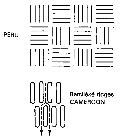
On the very rich volcanic soils of south-western Cameroon, the Bamiléké traditionally multicrop half a dozen species on large ridges running perpendicular to the contour lines on steep slopes (Fotsing 1992a) (Figure 31). Inexperienced agricultural scientists felt that these large ridges should be perpendicular to the greatest slope, but then saw that in heavy rains, water would collect at certain points on the slope, overflow the ridges, and form more serious gullies than in the traditional system. It must be emphasized that on slopes steeper than 25% the advantages are greatest if ridges are oriented in the direction of the greatest slope, which limits the catchment area and hence the volume of runoff between ridges. In the case of small and medium rainstorms, damage will obviously be greater when mounding follows the direction of the slope and will certainly lead to quite considerable erosion in the course of the year, but it does help to reduce the major risks of landslips or gullying. Thus the contour ridging method is not universally applicable. One elegant solution might be large ridges on a gentle slope (under 1%) toward a prearranged spillway, with ties between these ridges every 1 to 5 metres. Such ties must be lower than the ridges themselves in order to allow progressive lateral drainage during exceptional rainstorms. However, the secret of the success of the Bamiléké's ridging method lies in keeping a very thick permanent cover thanks to the combination of a large number of different crops throughout the year (see Part III).
In mountainous areas, tillage entails some serious hazards:
• it temporarily improves infiltration but reduces soil cohesiveness, thus heightening the risks of erosion and sliding;
• it allows organic matter to be turned in, but exposes the subsurface, which is poorer in humus, to rainfall impact;
• above all, it accelerates dry mechanical creep, since the implements move the clods.
The following solutions have been put forward:
• rough tillage by two to four people working together turning large clods in order to dig in plants, grass and manure;
• mounding is dangerous, for it concentrates runoff into rivulets which soon carve channels on steep slopes;
• ridging is often used to dig in the fallow and crop residues:
• it collects a great deal of well-drained, friable soil for tubers;
• it stores water (60) to 22 mm if the slope increases from 2 to 40%) if it is perpendicular to the slope (a risk of landslips in the heaviest rains);
• it drains slopes if it is oblique or follows the direction of the slope,
• it gives crops an advantage in height over weeds.
In Peru, depending on the season, the farmers may choose full tillage, ridging prior to sowing, ridging a considerable time after sowing, or tractor tillage (Figure 32). It has been seen that yields can be increased while reducing tillage time - and hence increasing the benefit for farmers. For tractor tillage, however, this obviously greatly increases the risk of degradation, for tillage has to follow the direction of the greatest slope if the tractor is not to overturn.
FIGURE
31
Direction of ridging in
relation to slope
Gentle
slope:
• tied ridging
• contour ridging, slope up to
P = 0.1 |
EROSION CONTROL PRACTICES
EFFICIENCY RATE |
|
2% |
0.2 |
|
3% |
0.3 |
|
16% |
0.4 |
|
25% |
0.6 |
Steep
slope > 25%, the effect of roughness on runoff quickly
decreases,
due to the reduction in water storage capacity,
but risks of overspill and sliding increase
• during mild rainfall, erosion is less with contour ridging
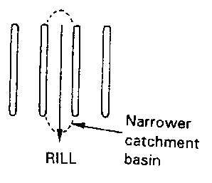
• during heavy rainfall, there is a danger that runoff will spill over, causing a break: all the water held back by the ridge will then flow out at this point, forming a gully - which is much more difficult to eliminate than all the small rills that drain ridges set in the direction of the slope (smaller catchment basin).
Gully
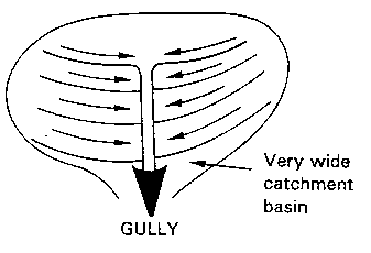
Rill
• In PERU, at altitudes of 1500 to 4000 m, the farmers try to adapt their cropping methods to local conditions of season and climate:
Figure
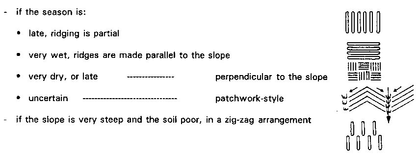
• In CAMEROON, in Bamiléké country, at between 1000 and 2000 m, the farmers make:
• large contour ridges on gentle slopes
• wide, short ridges on steep slopes, in the direction of the slope, or staggered
(effectiveness depends on the plant cover provided by mixed cropping)
IN
CONCLUSION, giving advice on the orientation of ridges is a
tricky matter!
On gentle slopes, ridging
and tied mounding are very effective.
On steep slopes, depending
on the greatest risks, there is a choice:
If draining
is required
: oblique ridges draining towards a grassed spillway
: well-covered, wide, short, staggered ridges
if
landslides are likely
: step microterraces or slanting ridges
FIGURE 32 Direction of ridging in mountainous areas (Peru and Cameroon) as a function of rainfall risk
Moreover, in dry years the farmers make their ridges perpendicular to the slope in order to store as much water as possible, whereas if it looks like a very wet year, they follow the direction of the greatest slope in order to facilitate drainage, and if the year looks uncertain, they make one square set perpendicular to the slope and the next in the direction of the slope, creating a patchwork of little plots that allows runoff to circulate slowly.
The C factor (influence of plant cover and cropping techniques in Wischmeier's equation)
In Wischmeier's equation, the C factor is the relationship between erosion measured on a bare fallow reference plot under a given crop. It expresses the interaction between the crop and cropping techniques and how this affects the reaction of a soil type to rainfall. The C factor changes as the plants grow and the state of the soil surface alters, and can be calculated for each of the main periods of the cropping cycle and the region under consideration: five periods are recognized in the United States, and up to nine in high-rainfall tropical areas with two cropping seasons. Taking account only of an annual overall measurement, the following figures have been obtained in West Africa (Roose 1973) (Table 29) and Tunisia (Table 30).
TABLE 29
Importance of plant
cover and cropping techniques (C) for various crops in West
Africa Annual average C
Annual average C |
||
min. |
max. |
|
Bare soil |
1 |
|
Forest, dense thicket, crop
well-mulched |
0.001 |
|
Savannah and pasture in good
condition |
0.01 |
|
Savannah, or burnt or overgrazed
pasture |
0.1 |
|
Slow-developing or late-planted
plant cover, 1st year |
0.3 |
0.8 |
Fast-developing or early-planted
plant cover, 1st year |
0.01 |
0.1 |
Slow-developing or late-planted
plant cover, 2nd year |
0.01 |
0.1 |
Maize, millet, sorghum (as a
function of yields) |
0.4 |
0.9 |
Intensively cropped upland rice |
0.1 |
0.2 |
Cotton, second-cycle tobacco |
0.5 |
0.7 |
Groundnut (in relation to yields
and planting date) |
0.4 |
0.8 |
Creeping cowpea |
0 3 |
|
Cassava, 1st year, and yam (as a
function of planting date) |
0.2 |
0.8 |
Palm, rubber, coffee, cacao, with
cover plants |
0.001 |
0.3 |
Flat-planted pineapple (as a
function of slope), planted early |
0.001 |
0.3 |
- with burnt-off residue |
0.2 |
0.5 |
- with dug-in residue |
0.2 |
0.3 |
- with residue on the surface |
0.001 |
0.01 |
Pineapple on tied ridges (7%
slope), planted late |
0.1 |
|
TABLE 30
Importance of plant
cover (C) in Tunisia
Average annual C |
|
On bare soil bare fallow |
1 |
Fruit trees |
0.9 |
Winter wheat |
0.7 |
Cereals in rotation |
0.4 |
Forage crops |
0.2 |
Cereals in rotation + forage crops |
0.1 to 0.01 |
Improved pasture |
0.01 |
CONCLUSIONS ON PLANT COVER AND CROPPING TECHNIQUES FOR DIFFERENT REGIONS Whatever the slope gradient, the cropping techniques or the aggressiveness of the climate, full plant cover ensures a high level of soil and water conservation and has a greater influence than all the other factors. Plant architecture and botanical composition are fairly irrelevant, so long as cover is almost total. This means that biological methods encouraging such cover must have priority (to ensure water-saving, optimum productivity and soil conservation) over conventional erosion control measures (terracing), which are generally uneconomical and difficult to maintain, and often of dubious efficacity. If cover is not complete, the gradient of the slope exercises the next greatest influence on the amount of soil loss, but not necessarily on runoff, which is largely dependent on the hydrodynamic properties of the toposequence. Mechanical cropping techniques can help reduce erosion risks in the short term. Tillage temporarily increases infiltration but also detachability and erodibility. However, it also has a positive effect on root establishment and speed of plant-growth - and in some regions on yields so that it can in the final analysis reduce soil loss, at least in the case of certain soils. Nevertheless, a serious effort still has to be made to develop economically viable cropping techniques with reduced inputs that are truly suited to the crops and environmental conditions of high-rainfall tropical regions. In the United States, where farming has been very highly mechanized, efforts are now apparently being made to cut the number of passes of machinery across the land (minimum tillage or no-till) in order to conserve soil macrostructure. In low-rainfall tropical regions (Charreau and Nicou 1971a, b), where there is a lack of water at the start of the season and soils are rich in fine sand and loam and poor in organic matter, and hence sensitive to rain splash, tillage seems helpful in order to allow good growth of the root system of crops. Hoeing and tied ridging can also improve water use and production. In
very high-rainfall tropical regions, mulching with
crop residues could offer a tidy solution to erosion
problems, but this still leaves the question of whether
crops can take satisfactory root when hard rains heavily
compact the soil - or alternatively what instrument would
be best to turn mulched soil without disturbing it too
much. Experiments in Brazil under high-rainfall tropical
conditions on large-scale plantations of maize, soybean,
rice and other cereals on ferralitic soil have shown that
cover plants - generally deep-rooting pulses - can be
combined with broadly spaced crops such as maize for
on-site production of the plant cover needed to cover the
soil and offset the rain splash factor, and also to
increase organic matter and mesofauna activity in the
surface horizon. The mesofauna, particularly earthworms,
would thus be chiefly responsible for aerating the soil
and perforating the megapores. This method has not been
widely used in Africa to date, but is enjoying much
success in the United States (Séguy et al. 1989). |
The fundamental effect of plant cover and of the adaptation of cropping techniques to regional environmental conditions are subsumed under the C factor in the USLE model. Taking account only of an annual overall measurement, this factor varies from 0.9 to 0.1 for the main crops grown in West Africa. It can fall to 0.01 under a forest crop with cover plants and under grassland, and to 0.001 under a mulched crop and under forests of varying densities.
![Bench or Mediterranean terraces built in the 14th century by the Incas, irrigable and still used to grow cereals. This method requires a huge investment in labour (600 to 1200 days/ha) and upkeep (3 to 10 t/ha/3 yrs of manure + 2 to 5 t/ha/2 yrs of lime). It is acceptable only if land is scarce, labour abundant and cheap, and the crop economically viable. Machu-Pichu, Peru. [Photograph De Jaegher]](t1765e15.jpg)
![Stone risers in the valleys: systemas andenes in Peru. In order to make the best use of the colluvial deposits trapped in the valleys, the farmers have built stone risers which allow control of runoff water and protection of cultivated land. Cuzco, Peru. [Photograph De Jaegher]](t1765e16.jpg)
![In Nepal, slopes of up to 60% are converted in traditional style into narrow progressive terraces. The risers are grassed. Steeper slopes are covered with hay fields. Valley bottoms are irrigated and farmed intensively. Gulmi District, Nepal. [Photograph Ségala]](t1765e17.jpg)
![In a mountainous area, after a saturating downpour, gravity combined with runoff and alternations of frost and thaw to move huge boulders downhill. Ecuador. [Photograph De Noni]](t1765e1a.jpg)
![Such wholesale slides of soil cover over schist illustrate the dangers of working very steep slopes, which are further unbalanced by tracks and overgrazing. Gulmi District, Nepal. [Photograph Ségala]](t1765e1c.jpg)
![Cloud of fine dust (in suspension) raised by the approach of a "tornado" at Déou, north-eastern Burkina Faso. [Photograph Ségala]](t1765e1p.jpg)
![A Texas landscape invaded by sand dunes: saltation at Big Sprint. [Photograph Fryear]](t1765e1r.jpg)