TOTAL RAINFALL AND CROP YIELD FORECAST MAPS


The first map indicates the total rainfall amount for the whole month to which the bulletin refers. Data are extracted from the RainFall Estimate (RFE) Satellite Imagery as produced by NOAA/USGS/FEWS/USAID project. The RFE images are obtained by interpolating various parameters recorded at ground and obtained through remote sensing measurements as: rainfall, relative humidity, wind speed, elevation, cold cloud temperatures.

Map of total rainfall from 1st to 30 September


The map below shows the forecast yield of cereals (Maize, Sorghum, Millet) for the Sahelian countries for the 1998 cropping season, as percent of the average yield of the last five years (1993-97). The map is obtained by applying to each country a yield function related statistically to the period 1982-97, the output parameters from the FAO crop specific water balance model to the crop yield. For 1998, the water balance model uses average rainfall from 1st October to the end of the crop cycle.

Cereal Yield forecast for 1998

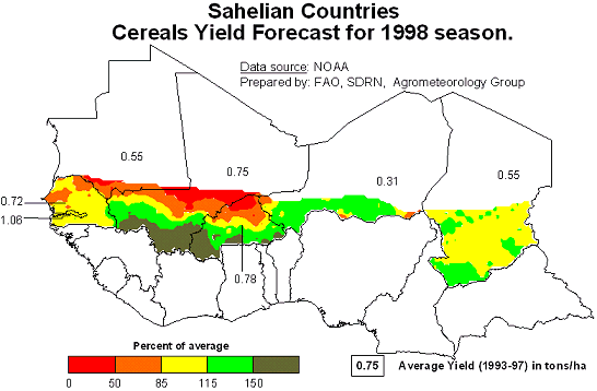
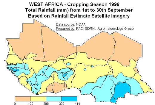
  Source: NOAA - Prepared by FAO, SDRN, Agrometeorology Group


Previous Page Next Page See File