0184-C1
Stanislaw Zajac[1]
The paper presents the Polish model of rationalisation of the country’s natural space structure and development of rural areas in connection with the implementation of the concept of sustainable, balanced and multi-functional forest management. The National Programme of Increasing Forest Cover (NPIFC) is a basic element of this model. Current and future tasks of the NPIFC at the country, regional and local levels are also discussed in the paper.
The assessment of the supply of post-agricultural lands foreseen for afforestation until 2020 is an important element of the model. The paper provides an original method for assessment of the supply of lands designed for afforestation and of afforestation needs (demand) in this respect. Attaining a balanced state between land supply and afforestation needs leads to attaining a rational natural space structure at the level of the country, region, county and commune. Rationalisation of this structure is the basic parameter of spatial planning at individual levels of the country’s administrative structure, and an element stimulating the development of rural areas, as well.
Poland’s forest cover accounts for 28.8% and is lower than the average for Europe, which is 32%. From the point of view of land-use structure and the shaping of the environment, Poland’s cover at the present stage of development and under geographic and climatic conditions should equal 33-34% (Zajac, Kwiecien 2001). At the same time, 25% of arable land representing 4.6 million hectares is unsuitable for agricultural production.
In 2002, the National Programme of Increasing Forest Cover (NPIFC) was revised. The amended Programme anticipates afforestation of 1.5 million hectares of post-agricultural land by 2050, of which 680 thousand hectares will be afforested at the first stage by 2020 (Zajac, Kwiecien 2001). This means an increase in the proportion of the country under forest to 30% and 33%, respectively.
The aims of the NPIFC comply with the principles laid down in the governmental programme for the policy of structural development of rural areas and agriculture. It has been stated in the programme that changes in agriculture require permanent transformations of rural areas and integration of productive, economic, social and environmental aims.
The NPIFC is the main document defining the framework of tasks to be taken to increase country’s forest cover. It formulates assumptions of the optimal spatial distribution of afforestation based on ecological, economic and social criteria with a view of strategic spatial conceptions both at the country and regional levels. In some regions utilisation of all marginal lands is not possible for such reasons as soil quality structure, cultural, landscape, demographic aspects, etc. It is not only the quantitative transfer of lands from agriculture to forestry but also a more complex question of rationalisation of country’s natural space structure whose economic reasons should be linked with social aspects and with the protection of man’s natural environment.
In Poland, utilisation of the excessive amount of farmlands of low production capacities (marginal lands) is observed. Agricultural production in Poland is significantly worse than in the countries of the Atlantic climate zone (Belgium, The Netherlands, France, Germany) due to soil quality, agroclimate, topography and water relations. Lands used for farming purposes in Poland account for 18.5 million hectares, arable lands - to 14.1 million hectares, grasslands - to 4.1 million hectares and orchards - to 0.3 million hectares. The share of marginal lands in the structure of lands used for agriculture is high.
Marginal lands are soils currently used for farming or classified in the land register as arable lands, which show low productive capacities or are not qualified for the production of healthy food due to unfavourable natural and anthropogenic conditions. These lands should be classified into other land-use categories, for example, as lands designed for afforestation, construction, areas of ecological utility, recreation, etc. Marginal lands comprise four groups of soils specified below.
1. Unfertile soils. Unfavourable natural conditions and soil erosion make agricultural production unprofitable. Nearly 90% of unfertile soils are light, dry, sandy soils. They cover ca 1700 thousand hectares. Unfertile soils also take in eroded lands (ca 370 thousand ha), which mainly occur in the Malopolska and Podkarpackie Provinces (Voivodships).
2. Soils contaminated by chemistry. They cover an area of ca 140 thousand hectares - mainly in the Slaskie Province.
3. Destroyed or mechanically transformed soils. They lack the humus layer. They cover an area of ca 50 thousand hectares, mainly in the Dolnoslaskie and Slaskie Provinces.
4. Lands with unfavourable natural and topographic conditions. This group includes arable lands with difficult access for transport and mechanical cultivation.
Marginal lands cover ca 2.3 million hectares, which correspond to ca 11% of lands used for farming. Farming production on these lands is unprofitable and thus they can be used for afforestation. Some part of marginal lands, however, will have to be used for farming. These will be small areas located within larger complexes of land of higher quality. Lands of a very poor quality with a high share of green lands and a great volume of livestock can also be used for farming.
At the beginning of the nineties, fallow (not cultivated) lands in Poland rapidly increased (more than 1.5 million hectares in 1994) among other things as a result of the collapse of the state farming system. The most badly affected were regions in northwest and northeast of Poland where state farm holdings prevailed. About 20-30% of land used for farming in these regions was excluded from agricultural production.
From the point of view of the optimal execution of the National Programme of Increasing Forest Cover, spatial distribution of fallow lands in Poland is unfavourable. Provinces with the greatest share of marginal lands have higher forest cover than the average for the country. In addition, these lands are not given preferences in terms of increasing forest cover for environmental reasons.
To ensure the necessary amount of arable land one cannot exclude all fallow lands from agricultural production. Rationalisation of land use is oriented towards decreasing the area left fallow, which is most valuable for agriculture. The impact of organisational and economic factors on differences in distribution of fallow lands between regions in Poland is higher than the impact of natural and agrotechnical conditions.
According to Siuta (2000), arable lands composed of loose sands are a good indicator of afforestation needs, and in Poland they amount to more than 1.6 million hectares. This is the minimal area of future afforestation. In his opinion there is an urgent need to afforest soils of classes IV and V (Siuta 1996). Soils of class VI amount to nearly 1.7 million hectares of arable land and ca 0.3 million hectares of dry pastures. An overall area of those lands equals ca 5.0 million hectares.
The optimal land-use structure will require afforestation of slope soils degraded by water erosion. Besides, arable lands of soil classes IVb and lands of higher bonitet classes in the regions where demographic and economic reasons limit crop production will also be afforested. Thus, Siuta assumes that by 2050 afforestation will cover ca 5.5-6.0 million hectares.
Michna (1998) represents different approach to the actual supply of lands for afforestation. He says that the share of production on light soils (class V and VI) is high and amounts to 23% of the country’s agricultural production. Not only economic reasons (income is lower by 30% than the country’s average) but also social aspects (lack of an alternative to obtain income from other sources) decide about uses of these lands.
Elimination of poor and the poorest soils would create “economic deserts” in many regions of the country. According to Michna (1998), 1.5 million hectares can be the upper limit of land transfer from agriculture to forestry by 2050. However, by 2015, ca 500 thousand hectares of soil classes VI and VIz can be used for afforestation. He anticipates that by 2015 ca 1.0 million hectares of the poorest soils will be continuously or with short intervals used for farming purposes.
In 2000, questionnaire surveys were done to establish the supply level of lands planned for afforestation, and conditions of execution of the National Programme of Increasing Forest Cover (Zajac, Kwiecien 2001). Questionnaire forms were sent to all communes (2489) in the country. A total of 1909 responses (76.6%) were obtained by mid 2001.
On the basis of information obtained from the survey it was established that the area of agricultural lands planned for afforestation in the years 2001-2020 equals ca 700 thousand hectares. The analysis of the results obtained indicated that 1.5 million hectares is the upper limit of land transfer from agriculture to forestry over an undefined time perspective.
Afforestation needs and preferences of communes as basic units for analyses in the country were the basis for the construction of the model of increasing forest cover of the country. The practical aim of this model is categorisation (ranking) of communes necessary for a rational allocation of means for the execution of the National Programme of Increasing Forest Cover.
The NPIFC has adopted twelve characteristics to rank communes for their afforestation preferences:
1) the share of the poorest soils in the total area of lands used for agriculture (%),
2) the quality of agricultural production space (points),
3) topography (points),
4) the occurrence of steppization processes (ha),
5) the threat of run-off erosion (ha),
6) the supply of lands for afforestation (ha),
7) forest cover (%),
8) the area share of meadows and pastures in a commune (%),
9) the level of the increasing of forest cover for the needs of nature protection (%),
10) main watersheds (ha),
11) protected catchments (ha),
12) protection of underground waters (ha).
The main precondition for determining the synthetic indicator was to make characteristics having different measure units comparable. For this reason absolute values of each characteristic were calculated into relative values. Relative values were the ratios of the absolute value of a given characteristic to the maximal or mean value of that characteristic. Then, relative values calculated for all the characteristics were summed for each commune. The sum of relative values for all communes was a synthetic indicator of the assessment of commune’s afforestation needs.
The starting point in the construction of a synthetic indicator of commune’s afforestation preferences was the N x K matrix (set of characteristics) defining those preferences:
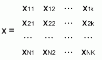 ,
,
where:
rows (n = 1, ... N) represent basic units - communes, and columns (k = 1, ..., K) of the matrix - numerical values of characteristics present in communes.
One of the shortcomings of the method of calculating a synthetic indicator of commune’s afforestation needs using the “sums of relative values” is an adoption of weights equal for each characteristic. However, in expert’s opinions and from a few scientific works it can be said that certain characteristics have a stronger effect on commune’s afforestation needs than others. Thus, some characteristics have been assigned weights (1, 2 and 3), which reflect the impact of a given characteristic on the value of an indicator of afforestation needs and preferences of communes.
Taking into consideration the above presented methodical assumptions, 2918 units of the country’s administrative structure (2489 communes and 429 towns) were ranked for their afforestation preferences using three variants: 1) with weights equal for all characteristics, 2) with weights greater for characteristics which affect rationalisation of land use structure, 3) with weights greater for characteristics which support environmental functions.
The second and the third variant were selected for further analyses. This means (variant II) that communes having unsuitable or the worst land use structure should have a high position in the ranking of commune’s afforestation needs and preferences and thus improve this structure and in final effect, ensure high social benefits. Variant III, with greater weights for characteristics that support environmental functions (water protective, soil protective and those associated with nature protection) was used in the NPIFC to rank communes for their afforestation preferences
Ranking results based on variant III (environmental) pointed to significant variations in the values of an indicator of afforestation preferences ranging from 2.32 points (Pomorskie Province) to 61,81 points (Podkarpackie Province) i.e. at a proportion of 1:26.6. In individual provinces differences between communes with the highest and lowest indicator values were smaller. The smallest differences between communes with extreme indicator values were found in nine provinces (Dolnoslaskie, Kujawsko-Pomorskie, Lubelskie, Lodzkie, Opolskie, Swietokrzyskie, Warminsko-Mazurskie, Wielkopolskie and Zachodniopomorskie) and ranged from 1:4.4 to 1:6.9. In four provinces (Lubuskie, Malopolskie, Podlaskie and Slaskie) they ranged from 1:7.8 to 1:9.4. In three provinces differences between communes with extreme indicator values were particularly high: Mazowieckie Province - 1:12.1, Podkarpackie Province - 1:15.2 and Pomorskie Province - 1:20.2.
The comparison of communes with particularly high (more than 20.0 points) and high (15.0-20.0 points) values of the indicator of afforestation preferences indicate that 919 communes and towns (31.5% of their total number) in Poland have particularly high and high afforestation preferences including 348 (11,9%) - particularly high and 571 (19,6%) - high. The share of communes with particularly high afforestation preferences in individual provinces was highly variable: in Opolskie Province - was absent, in four Provinces (Dolnoslaskie, Lodzkie, Slaskie and Zachodniopomorskie) this share ranged between 1.9% and 4.6 %, in eight Provinces (Lubelskie, Lubuskie, Malopolskie, Mazowieckie, Podkarpackie, Podlaskie, Pomorskie and Swietokrzyskie) this share ranged from 8.2% to 14.5%. However, a very high share of communes with particularly high afforestation preferences was noted in three Provinces: Kujawsko-Pomorskie 24.8%, Warminsko-Mazurskie 23.4% and Wielkopolskie 28.8%.
As appears from the analysis of the supply of lands for afforestation there are large areas of land in Poland that suit this purpose. These lands, however, generally occur in provinces with a high forest cover indicator.
To construct the model, the supply of lands for afforestation for each commune, county and province in the years 2001-2020 was estimated on the basis of questionnaire surveys and evaluation of social, economic and environmental afforestation preferences. The estimates for areas of land foreseen for afforestation in each province in the years 2001-2020 are presented in the Table.
|
Item |
Province (Voivodship) |
Area of lands planned for afforestation in 2001-2020 (thousand ha) |
||
|
Public sector |
Non-public sector |
Total |
||
|
1 |
2 |
3 |
4 |
5 |
|
1 |
Dolnoslaskie |
18.1 |
15.6 |
33.7 |
|
2 |
Kujawsko-pomorskie |
2.4 |
10.7 |
13.1 |
|
3 |
Lubelskie |
7.3 |
56.7 |
64.0 |
|
4 |
Lubuskie |
10.6 |
8.8 |
19.4 |
|
5 |
Lodzkie |
2.5 |
56.1 |
58.6 |
|
6 |
Malopolskie |
0.9 |
31.1 |
32.0 |
|
7 |
Mazowieckie |
2.5 |
72.7 |
75.2 |
|
8 |
Opolskie |
3.0 |
8.0 |
11.0 |
|
9 |
Podkarpackie |
4.2 |
31.4 |
35.6 |
|
10 |
Podlaskie |
5.9 |
31.4 |
37.3 |
|
11 |
Pomorskie |
5.9 |
13.7 |
19.6 |
|
12 |
Slaskie |
2.9 |
24.3 |
27.2 |
|
13 |
Swietokrzyskie |
1.6 |
54.1 |
55.7 |
|
14 |
Warminsko-Mazurskie |
25.1 |
24.9 |
50.0 |
|
15 |
Wielkopolskie |
19.6 |
91.1 |
110.7 |
|
16 |
Zachodniopomorskie |
17.5 |
19.4 |
36.9 |
|
POLAND |
130.0 |
550.0 |
680.0 |
|
The public sector encompasses Treasury-owned lands (130 thousand hectares), and the non-public sector - mainly lands of private owners (550 thousand hectares). Numerous scientific works concerning spatial distribution of country’s afforestation needs (Michna 1998; Siuta 1996 and 2000) demonstrate that the increase of forest cover is most required in the Provinces: Wielkopolskie, Kujawsko-Pomorskie, Lodzkie, Podlaskie, Lubelskie and Swietokrzyskie. Low forest cover (below the country’s average), steppization processes, erosion and large agglomerations in these provinces confirm these needs.
1. Michna W. 1998. Racjonalizacja wykorzystania gleb marginalnych - raport koncowy. Dokumentacja IERiGZ. Warszawa.
2. Siuta J. 1996. Ekologiczno-produkcyjne wymogi zalesiania nieefektywnych gruntow rolnych. Prace IBL, seria B, nr 27.
3. Siuta J. 2000. Agroekologiczne uwarunkowania modyfikacji Krajowego programu zwiekszania lesistosci. Dokumentacja IOS, Warszawa.
4. Zajac S., Kwiecien R. 2001. Niektore aspekty modyfikacji Krajowego programu zwiekszania lesistosci. Sylwan, 10: 23-34.
| [1] Associate Professor, Forest
Research Institute, Department of Forestry Economics and Policy, Bitwy Warszawskiej
1920 r., No. 3, 00-973 Warsaw, Poland. Email: [email protected] |