![]()
![]()
![]()
Barbados is the most easterly of Caribbean islands. It has a land area of 430 sq. km. The 1990 census reported 260 491 inhabitants, with a population density of 605 residents per km2, making Barbados the most densely populated of the Caribbean islands. The population growth rate is 0.27 percent per annum. The rural population accounts for 52 percent of the total population.
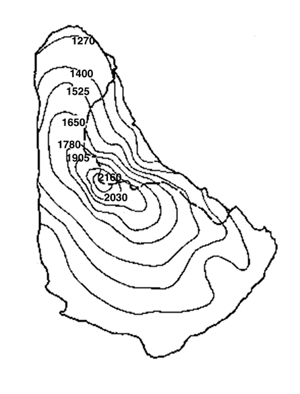
Annual rainfall ranges between 1 140 and 2 150 mm/yr (Figure 1), with a mean annual rainfall of 1 422 mm/yr. Evapotranspiration is estimated at 1 540 mm/yr and renewable water resources at 82 km3/yr.
FIGURE 1 Rainfall in Barbados
Average annual rainfall |
Agriculture accounted for 4 percent of GDP in 1997 and employed 5.1 percent of the labour force. The main agricultural outputs are sugar, vegetables, cotton, cut flowers, bananas, sheep, chicken and pork.
|
Glenn Marshall |
Institutional arrangements for land, water and plant nutrient resources are presented in Table1 below.
TABLE 1
Institutional Responsibilities of Land, Water and Plant Nutrition Resources Management
Institution |
Responsibility | |
Town and Country Planning Department |
Overall responsibility for development applications guided by the Physical Development Plan | |
Ministry of Agriculture and Rural Development |
Crops Section |
Food crops and
floriculture. |
Fisheries Division |
Fisheries resources | |
Soil Conservation Unit |
Scotland District
conservation | |
Meteorological Department |
Meteorological forecasting | |
Analytical Services Lab. |
Soil, plant, water analysis | |
Pesticide Control Board |
Agrochemical import certification | |
Quarantine Unit |
Sanitary and phytosanitary certification | |
Land and Water Use Unit |
Hydrology and Agromet
data | |
Extension section |
Crop husbandry advice and extension | |
Ministry of the Environment, Energy and Natural Resources |
Environmental Unit |
Environmental policy and
international treaties |
Coastal Zone Management Unit |
Coastal area management | |
National Conservation Commission |
Parks and beaches | |
Energy Division |
Mined resources and energy | |
Ministry of Health |
Environmental Engineering Division |
Water quality |
Solid Waste Unit |
Landfills and solid waste disposal | |
Barbados Water Authority |
Assessment, development,
management, licensing of island's water resources. | |
Barbados Agricultural Development and Marketing Corporation |
Government irrigation water supply schemes | |
Barbados Agricultural Management Company |
Manages Sugar lands for Government | |
Lands and Surveys Department |
Cartography, map production | |
Educational institutions |
Barbados Community College |
Associate degree in Agriculture |
SJP Polytechnic |
||
Caribbean institute for Meteorology and Hydrology |
Certificates in meteorology and hydrology | |
OTHER: Barbados Agricultural Society, FAO, IICA, CARDI, etc | ||
Cultivated lands are increasingly being lost to non-agricultural uses, particularly in the tourism sector for the establishment of golf courses and in the housing sector. Between 1992 and 1997 the extent of cultivated land was reduced from 22 472 ha to 17 000 ha.
Pollution is also an area of concern, especially groundwater and near-shore pollution.
Water is inefficiently used in the area of water resources management and the potable water delivery system is also inefficient. A significant number of small farmers are dependent on potable water supply for irrigation. A 1997 Water Resources Study suggests that as much as 60% of water in the potable water supply is unaccounted for. There are ongoing efforts to reduce this level by at least 30%. A draft Policy Framework for Water Resources Development and Management was accepted in 1997, but key components have not yet been implemented.
Area Development Plan proposals for the agricultural sector were made in 1999 but they have not yet been accepted by Government.
In the area of plant nutrition management, very little soil and plant nutrient testing is carried out, nor are there attempts to optimize fertiliser application . Generally, agricultural research is inadequately applied in the areas of plant nutrition, irrigation agronomy and water use. There is also inadequate knowledge of soil infiltration rates and water storage capacities.
Other issues include a municipal landfill to be operated in the proposed Scotland District National Park and inadequate training in GIS modeling and analysis tools.
The bright spots include:
To address the problems of inefficient water use , leaks and unaccounted-for water, the Government has launched a number of public awareness/sensitisation initiatives to encourage use of water saving devices. A potable water tariff structure adjustment and a leak detection and mains replacement programme are also planned. There will also be universal metering.
A desalination plant became operational in 1999 to augment the potable water supply and mitigate against impact of drought.
Other noteworthy initiatives include:
The main challenge in the area of land resources management is the threat to food security caused by the reduction of available arable land for agriculture. This reduction is due to increased demand for housing.
For water resources management, the challenge is insufficient water for agriculture, as there is increased competition from other sectors in terms of price, quantity and quality. Optimising water use efficiency in agriculture is therefore a major challenge. The establishment of Water Resources Authority to assume regulatory and assessment functions, thereby enabling the Barbados Water Authority to concentrate on potable water supply and sewerage systems operation, is another challenge.
In the agricultural sector, the loss of the preferential markets for sugar will result in a reduction of foreign exchange earnings for the country. Moreover, replacement of the sugar crop could result in reduced protection against erosion. The challenge is therefore to develop new markets for agricultural produce for export and to promote linkages with the tourism industry.
As more tourists visit the island the challenge is to determine the carrying capacity of the key attractions, nature trails, beaches and the near-shore environment. Sewerage and other waste disposal systems must also be able to handle the considerable amounts of waste generated by increasing numbers of tourists visiting the island. There are also implications for maintaining acceptable groundwater quality.
With the removal of trade barriers, the importation of produce which possibly carries new pests and diseases is also a threat and the challenge is for the quarantine unit and the government analytical services laboratory to detect them and prevent their entry.
The establishment a of Code of Agricultural Practices is seen as another challenge.
The following data are readily available:
Table 2 shows the types of data collected by various institutions in Barbados, and the institutions with a GIS capacity.
TABLE 2
Types of data collected by various institutions in Barbados and their GIS capability
PARAMETER MONITORED |
Land and Water Use Unit |
Soil Conservation Unit |
Meteorological Department |
Barbados Agric.
Dev. & |
Barbados Agricultural Management Company |
Barbados Water Authority |
Coastal Zone Management Unit |
Environmental Eng. Div. |
Caribbean Institute for Hydrology & Meteorology |
Private plantations |
Environmental Unit |
Town and Country Planning Department |
Rainfall Total |
4 |
4 |
4 |
4 |
4 |
4 |
4 |
|||||
Rainfall Intensity |
4 |
4 |
||||||||||
Wind Speed |
4 |
4 |
4 |
|||||||||
Sunshine |
4 |
|||||||||||
Temperature and Humidity |
4 |
4 |
4 |
|||||||||
Evaporation |
4 |
4 |
4 |
|||||||||
Ground Water Abstraction |
4 |
4 |
4 |
4 |
||||||||
Ground Water Quality |
4 |
4 |
4 |
4 |
4 |
|||||||
Spring/Stream Flow Rate |
4 |
|||||||||||
Spring/Stream Water Quality |
4 |
4 |
||||||||||
Established GIS |
4 |
4 |
4 |
4 |
4 |
![]()
![]()
![]()