![]()
![]()
![]()
Improved quality and consistency of data
is
required to develop more accurate global and
regional hydrological forecasting and management
BACKGROUND
Global observing systems continue to attract interest, not only among scientists around the world but increasingly also from national governments, and organizations and agencies that require global and regional hydrological information to enhance the quality and timeliness of early warning and climate forecasting products. Increasing the quality and consistency of data, as well as improving understanding of global water processes, is essential in developing more accurate global and regional water balance models that can be downscaled to a basin level, with an increasing temporal resolution. This information is vital to manage variability and change in hydrological regimes, to assess the changing availability of water resources, and to improve forecasting accuracy of hydrological extremes.
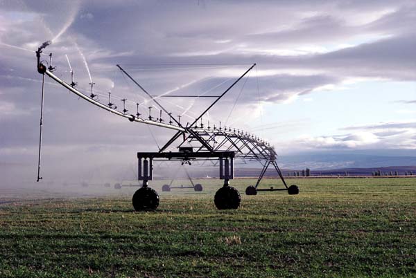
Figure 1. Water cycle
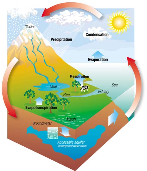
Provided by Ramsar Convention on Wetlands

NETWORK SUPPORT
Three major networks and global databases have been established that contribute to understanding hydrology and hydrological processes: The Global Runoff Data Centre (GRDC); the Global Precipitation Climatology Centre (GPCC); and the Global Environment Monitoring Centre on Water Quality (GEMS). Efforts are under way to increase the availability of and access to near-real-time hydrological information to provide timely data and information products for use in modelling, forecasting, research and applications, such as disaster reduction.
Access to global hydrological data and information is a prerequisite in addressing these issues. To facilitate data access, a Global Terrestrial Network for Hydrology (GTN-H) has been developed jointly by the Hydrology and Water Resources (HWR) Department of the World Meteorological Organization (WMO), the Global Climate Observing System (GCOS) and the Global Terrestrial Observing System (GTOS). GTN-H is a global hydrological "network of networks" for climate, that builds on existing networks and data centres and produces value-added products through enhanced communications and shared development.
CURRENT ACTIVITIES
During 2002 - 2003, GTN-H entered its implementation stage. The first meeting of the Coordination Panel for GTN-H was held from 21 to 22 November 2002 in Toronto, Canada, following an expert meeting on Hydrological Data for Global Studies.
Key issues GTN-H should address in improving current systems include:
generation of research- and applications-oriented products.
The meeting noted that most of the information generated from global observation networks is used by developed countries, and is barely used by research and user communities in the developing world. Sharing information across regions is valuable, especially for smaller countries, to complement their spatially or technologically restricted national observation networks. This is in particular important for forecasting purposes using hydrometeorological variables and hydrological data and information from shared river basins.
The Coordination Panel agreed that GTN-H must foster the sharing of information across regions. GTN-H will begin this process by inviting regional representatives, on an ad hoc basis, to solicit input and to also promote awareness of GTN-H as it develops.
The core function of GTN-H is to act as a portal, thereby improving access to data and information in the context of a global hydrological observing system, and demonstrating the use of standardized metadata formats with selected GTN-H data types to enable users to discover and access data and related information. The data and information will be supplemented by the generation of global-scale data products covering various fields, including products that:
improve the awareness of what data is available and how it can be accessed (e.g. metadata and maps);
enhance baseline or core hydrological data and improve our knowledge of hydrology (e.g. gridded runoff datasets, mapped statistics);
result from the integration of existing data sets (e.g. bio-geochemical fluxes); and
are designed to address specific scientific questions (e.g. reference hydrological data sets for use in detecting climate change).
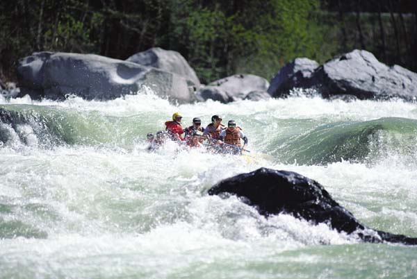
Figure 2. Water availability
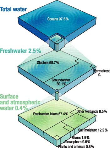
Provided by Ramsar Convention on Wetlands
FUTURE TASKS
Project briefs and an action plan have been developed as a step toward enabling GTN-H to meet expectations in achieving its objectives. This, however, will only be feasible through the active support of member countries and their national meteorological and hydrological services. GTN-H is currently maintained on a voluntary basis by a number of dedicated individuals, but additional resources will be required to further implement this important initiative.
![]()
![]()
![]()