Previous PageTable Of ContentsNext Page

3. Concept and strategy

3.1 Approach and principles of the FAO Ecological Zoning

The underlying strategy for FRA’s ecological zoning reflects both the thematic and technical needs of the map as well as the many operational constraints expected in its development. In terms of ecosystem principles, the map requirements are such that zones or classes are defined and mapped using a holistic approach. That is, both biotic and abiotic components of ecosystems are considered in the zoning scheme. Beyond the thematic content and zoning, practical aspects of digital cartographic production, such as data availability, currency, scale and associated reliability of the map inputs were taken into account.

To identify specific alternatives and constraints in the development of a global EZ map appropriate for FRA2000 purposes, FAO conducted two preliminary studies (Zhu, 1997 and Preto, 1998). Findings from these studies, experience in the development of the tropical EZ map for FRA 1990, and recommendations from other parties consulted in the process indicated that the development of an entirely new global ecological zoning map by FAO could not be completed by the year 2000, due to time constraints and the large amount of scientific, organisational and financial resources required. With this in mind, follow-up investigation focused on identifying an existing scheme that might be used or adapted to FAO’s needs.

Due to the enormity of conducting the work on a global scale, the most appropriate classification scheme had to meet FAO’s thematic requirements, be practical to construct with available resource and meet the scrutiny of a diverse group of users from all parts of the world. A survey of existing schemes revealed several possibilities. Each of the existing schemes were developed for specific purposes according to various environmental criteria, with macroclimate as an element being used by most (Preto 1998 and WCMC 1992). This is logical, as the macroclimate, that is temperature and precipitation, correlates well with the potential vegetation associated with a particular locale. In this respect, macroclimate was considered a logical basis for the FRA ecological zoning as well.

For the choice of climatic parameters to be used in the FRA 2000 map a number of global systems were surveyed including Köppen modified by Trewartha (Köppen, 1931, Trewartha, 1968), Thorntwaite (1933), and Holdridge (1947). Out of these possibilities, initial work indicated Köppen was a good candidate for the FRA 2000 work due to the number of classes that corresponded well to FRA 2000 needs. Moreover, further study showed that while Köppen is based on climate there is a demonstrated good correspondence between its subzones or climatic types and the natural climax vegetation types and soils within them (Bailey 1996)3 . These factors were seen as major advantages in favor of using the Köppen system for the backbone of the FRA 2000 zoning.

One good precedent for using Köppen in global ecological zoning was carried out by Robert Bailey, who used the Köppen system in toto for development of his ecoregion scheme for North America and the rest of the world (1989, 1995, 1998). He noted that although ecological zones can be mapped by reference to a single feature (such as climate), they must always be checked to ensure that the boundaries have ecological significance. At the same time, a climatic map showing such key features as temperature and precipitation is not necessarily an ecological map until the boundaries are shown to correspond to significant biological boundaries. Likewise maps of landform types (derived from digital elevation data) are not necessary ecological maps until it has been shown that the types co-vary with other components of the ecosystem, such as vegetation (Bailey, personal communication 1998).

To further the development of the work, FAO in cooperation with EDC and WCMC developed a prototype zoning scheme for FRA 2000 based on Köppen. The zoning was made hierarchical using Köppen’s climatic groups and - types as FAO Ecological zone levels 1 and 2 (Table 1). A third level was also tested during the pilot project and represents the differentiation within the first two levels according to landform. Mountains with altitudinal zonation were distinguished from lowland plains. Further expansion of the scheme is also possible for regional and local purposes. However, given the inherit heterogeneity of vegetation compositions beyond the third level, successive levels are excluded from the global classification.

In practical terms, delineation of EZ level 2 adapting Köppen’s climatic types is proposed as the working level for definition and mapping of Global classes. This will be accomplished by using both macroclimatic data4 and existing climax or potential vegetation maps. Use of vegetation maps will assure a more precise delineation of the ecological zones5. Using generalised climate maps alone might result in a final product where the zones actually mapped could probably correspond poorly to boundaries of homogenous vegetation transitions.

FAO considers the development of a global, geographically registered, spatial database roughly following Köppen’s climatic types as sufficient, and perhaps the best practical alternative for FRA 2000 reporting by ecological zones at the global level. At the same time, we acknowledge this as a first step toward the development of a more detailed ecological zoning map that must include elevation as a parameter (and perhaps others), due to the irregular distribution of landforms within Köppen’s broad climatic zones. During the course of the development of the EZ map, FAO will consult with the world’s experts on how to incorporate elevation into the Köppen framework, along with other factors such as floristic content. Beyond FRA 2000, FAO will continue the work on the global ecological zoning to provide increased detail in future efforts.


3.2. Köppen Climatic Groups and Types as the Basis for a FAO Global

Ecological Zone System

FAO’s global ecological zoning relies on a combination of climate and vegetation. The following summarizes the details and principles of the system:

The Köppen climatic groups and climatic types will be adopted as the first two levels of a hierarchical FAO global ecological zone classification system (Table 1, Figure 1). At the broadest level, five domains are distinguished based on temperature: Tropical, Sub-tropical, Temperate, Boreal and Polar. At the second level, following Köppen’s Climatic types, 14 classes are distinguished using precipitation as additional criterion. A third level of the FAO system may include additional criteria, for instance altitude variations within climate types (i.e., lowland versus mountain regions). This level may be optional depending upon data availability and amount of effort.

The second level, of 14 classes can be regarded as the reference or working level for the Global ecological zone mapping. They can be easily grouped into the broader level6.

A main principle in delineating the global ecological zones involves aggregating or matching regional ecological or potential vegetation maps into the global framework. The following steps can be distinguished (the practical implementation is described in the next section):

Table 1. Proposed FAO Global Ecological zoning (based on Köppen, adapted by Threwartha)

Level 1

(Equivalent Köppen Climate Groups)

Level 2

(Equivalent Köppen Climate Types)

Level 2 Zonalb vegetation types

Name

Characteristics

Name and symbol

Characteristics

Tropical

All months

without frost: in marine areas over 18°C

Wet Ar

Winter dry Aw

Semiarid BSh Arid BWh

0-2 months drya

Over 2 month dry

(in winter)

Evaporation > Precipitation

All months dry

Evergreen & Semi-evergreen Tropical rainforest

Deciduous Forests, woodlands and savanna

Shrub/Steppe

Desert

Sub-tropical

Eight months

or more over 10°C

Humid Cf

Summer dry Cs

Semiarid BSh

Arid BWh

No dry season

Summer dry

Evaporation > Precipitation

All months dry

Broadleaved-coniferous evergreen forest, semi- deciduous Forests

Sclerophyllous forests, open woodlands

Shrub/Steppe

Desert

Temperate

Four to eight months

over 10°C

Oceanic Do

Continental Dc

Semiarid BSk

Arid BWk

Coldest month over 0° C

Coldest month under 0° C

Evaporation > Precipitation

All months dry

Mixed forests; Coniferous evergreen, broadleaved deciduous forest

Mixed Deciduous – coniferous Forests

Steppe/Prairie

Desert

Boreal

Up to 3 months

over 10°C

Boreal E

Forest-tundra’s and open woodlands; taiga

Polar

all months below 10°C

Polar F

Shrubs/Arctic desert

Notes:

aA dry month is defined as the month in which the total of precipitation P expressed in millimeters is equal to or less than twice the mean Temperature in degrees Centigrade.

b Zonal vegetation: resulting from the variation in environmental, i.e. climatic, conditions in a north south direction.

Figure 1. Global distribution of Koppen climat types

Source: from Trewartha (1968) in Bailey (1996)


3.3 Regional Implementation of the FAO Global Ecological Zone System

A preparatory survey indicated that most regions have recent and dependable potential vegetation maps which are amenable to matching with Köppen climatic types. In some cases, such as the USA, vegetation classes are a sub-class of Köppen Climatic types. Here the translation is direct. In other cases, a study of mapping criteria, including physiognomy, phenology, floristics and dynamics of vegetation types, will be needed (FAO 1989).

There are other benefits of using the existing country/regional maps. They could form the basis or provide supporting information for further sub-division of global types. This may be done either now for the current FRA2000 or later. One such sub-division is lowland and hill/mountain forests, which can be implemented with the help of existing digital terrain data validated by vegetation maps. It may be noted that climate determines the zonal or climax vegetation types. The physiography acts as a modifier of the zonal vegetation and gives rise to azonal forms, for instance wetlands or heath.

The country/regional vegetation maps will also help in harmonisation of type boundaries across countries or regions which will be a problem in the global mapping. The ecological zones are expected to associate in adjoining regions/maps. This fact will provide an important basis for edge matching of EZ polygons in two maps. It is expected that experts attending the FAO/ WCMC/ EDC Consultation will contribute in a major way to define ecological zones of their respective regions as well as in edge matching of the same in adjoining geographic region.

The following is an outline of general steps for defining and mapping the Global FAO ecological zones region by region. They are divided in conceptual, thematic steps and technical production steps.


3.3.1 Conceptual and Thematic Issues

Collection and study of relevant maps and information : Locate and study suitable regional/national existing maps of climate, potential vegetation or ecoregions. Include all available maps for the concerned region. For example, in the North America case study, maps of Canada and USA were studied together. Those that are suitable should have detailed vegetation information and topographic effects on vegetation distribution. Depending on regions, the scale of such maps should be smaller than 1 million. Be sure to have access to both paper and digital versions of the maps. First, identify Köppen climate types occurring in the country or region (see Table 1), which are the approximate boundaries of FAO EZ Level 2. Then, make an in-depth study of the ecological – and /or vegetation maps, focusing on classification principles and - criteria used. Consult with regional experts, i.e. authors of maps and publications, to fully comprehend the information. Make a reference list of all source data used.

Matching or aggregating national/regional classes into the Global Ecological zones. Based on the in-depth study, establish the relation between national/regional vegetation types or ecoregions and the Global Level 2 Ecological zones. (Aggregation to FAO Level 1 is then straightforward). This usually involves aggregation of a number of regional classes into one Ecological zone. Then produce an "equivalence " table for the region, showing the correspondence between the regional classes and the Global Ecological zones Level 1 and 2. A documentation and explanation of the matching has to be made for review and evaluation purposes. This should include the description and definition of the regional vegetation types or – ecosystems.


3.3.2 Map production and Technical Issues

Both the existing FRA90 EZ and several existing regional maps have been produced using ESRI Arc/Info GIS software system. Thus, it is convenient for the rest of the work to be conducted on Arc/Info, or at least Arc/Info importable. Study the digital map in the Arc/Info coverage environment and make sure the digital version has appropriate attributes for the polygons. Edit the coverage and add attributes for each FAO EZ levels (at least 1 and 2). Produce graphics of FAO EZ at each level for the entire region.

For polygon edge-matching problems along country/regional boundaries, there could be two related causes. One is due to mismatch of polygon definition translations between polygons of both sides, as stated earlier. This problem is easy to solve -- simply go back to the original maps and make sure the translation is correct. The other cause is due to offset of lines of the polygons on both sides, even though they may have the same labels. For this problem, we would have to manually edit the coverage and change locations of the lines. It would help this step by underlying any of the following with the digital EZ map: composite of NOAA AVHRR spectral bands, classified continental-scale land cover (such as the USGS global land cover database), and digital elevation model (DEM) data. For North America (Canada and USA), the edge-matching problem was fortunately minimal.

To summarize, the resulting output from a regional EZ production should include the following: Arc/Info coverage of EZ map with attributes of each EZ levels, graphics (e.g., GIF images) of the two (or three) levels of EZ, a table containing the levels of EZ and corresponding labels or codes of the input regional maps. For these output materials, see the North America study (Annex A) as an example.


3.3.3 Potential Production Problems

From the perspective of EZ production, there are still some issues that potentially can affect the progress of producing regional and ultimately global EZ.

Availability of suitable regional/national maps. For some regions o r countries, maps may not exist that have suitable scale, information content, or quality. It is also possible that some regions have paper maps but not their digital version. One solution is to use as an alternative the few available global-scale maps (e.g., the WWF world ecoregions map in combination with a climate map based on Köppen).

Edge matching of cross-boundary polygons. Two sticking points here: 1) it can become complicated when different classification principles have been used for the two bordering maps, and 2) manual editing is not elegant.


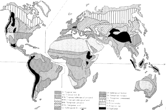
3This is largely because Köppen derived his climate classes from observations on the distribution of natural vegetation types on various continents (Köppen 1931).

4Among the existing climate classification systems, the one by Köppen is found to be the least demanding on data, which is primarily based on precipitation and temperature ? an important consideration from the production standpoint and may account for its wide use. As meteorological stations around the world routinely collect values for these attributes and the information is generally available in existing maps, this was seen as an additional advantage from the perspective of producing the map and database, which would require a relatively consistent global distribution of input data. Other global climate classification systems, for example, Thornwaite (1931) and Holdridge (1966), call for evapo-transpiration data, which is not uniformly available at the global level.

5The FAO ecological zone maps developed during Forest Resources Assessment 1990 for the tropics used a similar approach. A hierarchal system was adopted, using climatic and physiographic factors for identifying the regional classes or ecological zones. These zones were defined by aggregation of more detailed ecofloristic zones (EFZ). The classification criteria for EFZ included physiognomy, phenology, floristics and vegetation dynamics of vegetation (FAO, 1989). The dominant or characteristic species of the natural flora were used as indicators. Boundaries of ecofloristc zones were delineated with the help of existing potential, mostly national, vegetation maps, and brought to a common classification and scale. Class boundaries were delineated using standardised vegetation maps of the tropical regions.

6A more detailed regional classification system similar to that carried out for FRA90 may be conducted for regions. Concept and principles for more detailed schemes that use elevation and other parameters will be discussed during the Cambridge Expert meeting, July 1999.

7For this part of the work, FAO will rely heavily on the advice of regional experts specialising in ecological zoning and mapping.


Previous PageTop Of PageNext Page