![]()
![]()
![]()
Jean-Paul Lanly
JEAN-PAUL LANLY is Forest Resources Surveys Officer in the FAO Forestry Department
Knowledge of forest resources, in the widest meaning of the term, is a prerequisite for their appropriate development. Forest inventory, therefore, may be considered the first step of forest management. Different types of forest inventory reflect the numerous combinations possible related to the level and scope of planning, stages in decision-making, sizes of management units and the form of development. Accordingly, there is no single type of inventory for a given forest area; quite apart from technical problems, many types are possible.
This study is mainly concerned with one special type of forest resource - the tropical moist forest and, more particularly, with the industrial conversion of the primary wood material. Of course, there are other products and benefits this type of forest can provide, such as soil conservation and other environmental functions, recreation, and minor forest products for industrial conversion.
In fact, industrial investment decisions in the regions of tropical moist forests may be taken at all levels and intensities of planning, in different stages and may be concerned with basic management units of any size. It is an error to limit investigation to the exclusive problem of installing an industrial plant and consider only the so-called pre-investment surveys. An industrial investment, whatever its range, should be seen in the wider context of a forest industrialization policy extending beyond the limit of a particular zone. This policy needs information from the different forest management levels of district, region or province, state or nation. Many developing countries have not yet established an essential structure for a national forest inventory, but they cannot, in the meantime, ignore the local possibilities for development available. A policy of forest industrialization should be a coherent whole, in equilibrium at all levels.
The aims of a forest inventory should reflect the level and scope of planning under consideration, the nature and size of the unit of management and the stage reached in decision-making - whether for example it concerns a pre-investment study, or the investment itself. These should be defined in terms of the parameters to be investigated and their degree of precision at a given level of accepted risk.
A thorny problem is the possible evolution or progressive changing of objectives, often brought about by the later addition or new parameters to those originally indicated at the beginning of the inventory. It frequently happens, either because of a change in the local or international socio-economic context, or because of a change in forest policy, that new plans are established after the survey of resources has started, thus rendering incomplete the information so far collected. Because of the common belief held by man that one type of forest inventory can by itself provide all the required information, it is often hard to convince people that a complementary inventory may be indispensable in an area already inventoried. It has thus happened that an inventory, giving information on only a limited number of species and diameter classes, has proved to be very insufficient when it came to elaborating measures for securing a sustained yield of the forest resources. It is always possible to adapt an inventory operation to new requirements, particularly in an operation of a permanent nature, but the user should be fully aware that this will inevitably result in increased costs. The change of objectives can equally be expressed by a change in the extent and limits of management units, in the units of reference in the inventory ("populations" in the statistical sense). This difficulty may be overcome by considering a unique and uniform inventory design for the whole area under investigation, for example a one-stage systematic design that can provide, without difficulty, separate results for different divisions of the area (forest inventory experts often discard systematic designs on the ground that it is difficult to estimate errors in this type of design, even though they are the general rule in other types of natural resources surveys, such as mineral prospecting). One thing is certain: a large-scale survey of forest resources should not be undertaken without prior definition of a minimal standard list of information to be collected and of results to be obtained. The period should now be over when forest inventories were carried out in tropical moist forests purely to estimate volumes of exploitable dimensions of a restricted number of commercial species, in zones to be opened up for exploitation. Not only such inventories cannot provide in any way for the establishment of harvesting regulations or working plans, but also the opportunity is lost of getting an information useful for a better development based on more species and more diameter classes
To avoid the risk of too narrow a definition of objectives one may bring together, before starting the inventory, users of the inventory results and specialists of the various disciplines, including, of course, the inventory officer himself, so that they may all agree on the objectives and the appropriate inventory design. To leave the detailed definition of objectives entirely to the discretion of the inventory expert is to do him a disservice since his will be the first disappointment when the uselessness or reduced usefulness of his work becomes apparent. Unfortunately there have been all too many examples where the absence of team work has duly resulted in expensive operations.
Great expenses - and above all, much effort and difficulty - could have been avoived if the decision to undertake forest inventory operations had not been confined to dialogue solely between a forest service with imprecise intentions and the good "sellers" of inventory operations. In some cases more useful information could have been provided from the start for exactly the same-or even less-money; in others an operation could have been delayed or limited to a simple reconnaissance.
Indeed, the conclusion might easily have been reached of the uselessness, purely and simply, of an inventory operation.
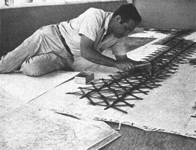
LARGE-SCALE CARTOGRAPHY: PART OF THE MEXICAN NATIONAL FOREST INVENTORY step one in forest management
Another important point concerning the objectives of an inventory operation is that of priorities between objectives, of priorities between the different parameters to be determined (each parameter being considered along with the accepted margin of error). Here too, past experience of tropical forest inventories has not always been exemplary.
There are many inventory designs which have been characteristically based on precise knowledge of one parameter of no interest to development far from possible sites for paper pulp mills, (at a time when the use of mixed tropical hardwoods for pulping was not even envisaged), inventory documents reported proudly on the small error intervals obtained in the gross volume of all species above 10 cm diameter, leaving in the dark the unacceptable error intervals on the volumes of exploitable dimensions of species or groups of species for sawnwood or veneer. This is an example of badly established priorities. Information for assessing the accessibility of forest resources has so far rarely been assembled and interpreted. This priority objective has not often been taken into consideration. In defense of the inventory expert it must be understood that he is in the almost impossible position of having to design an inventory operation that has to take full account of the range of priorities of the different parameters to be appraised. An inventory operation can be so designed as to be optimized with regard to the most important parameter, but an operation so conceived would not be equally effective for the dozens of other important parameters. It is only by successive approximations while adhering only roughly to the hierarchy among the most important parameters, that the inventory officer can hope to arrive at solutions having the least disadvantages.
At this point, some general remarks on forest inventory operations in tropical moist forest compared with similar operations in the temperate zone are in order. First to come to mind are the constraints of the tropical forest environment. The inhospitality of the surroundings (humidity, insects of all sorts, density of the undergrowth and frequency of swamp land hindering the progress of the work), the absence, in many cases, of areas of pleasant vegetation to break the unfriendly vastness of the forest and the generally difficult access, are many of the constraints and obstacles impeding effective and sound forest resource surveys. Some negative consequences are well known: the escape into desk studies (leading, for example, to an exaggerated refinement and distortion by subjectivity of the work on photo-interpretation and cartography), too few supervisory visits to the field by responsible personnel and, for the teams in the field who are left physically and psychologically to themselves, the desire to hurry through as fast as possible those tiring jobs which should, on the contrary, be carried out with deliberation and thoroughness. To infuse the ground teams with enthusiasm and set an example by frequent visits are among the most important actions which can be taken by forest inventory officers in the tropics and so ensuring the reliability of the basic data collected.
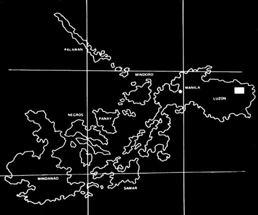
Outline map of the Philippines.
Perhaps even worse than inhospitality and inaccessibility is the effect of low-density human habitation and the lack of a traditional forest economy. Certainly, some indigenous social groups have always evolved in harmony with the forest environment in an economic equilibrium based on shifting cultivation with long fallows. But most of the populations at present living in tropical moist forest areas and who have to develop-and profit from-a forest economy based on industrialization come from other areas and have yet to find those terms of equilibrium and the tradition of forest development. Two important consequences follow in the evaluation of forest resources: firstly, the lack of intensive and intimate knowledge of the forest environment; the low density of population living in the forest areas and their limited interest in forestry matters means that the forest is not frequently traversed. Secondly, the absence of sufficient knowledge of dendrology or forest mensuration which would be of help in the evaluation of the forest resource. The best enumerators remain the inhabitants of traditional indigenous groups, although taxonomic differences exist between their terminology and the species and genera of systematic botany. Unfortunately, in many countries, their recruitment is still too uncertain to place some reliance on botanical identification in future forest inventory operations. The picture is not much brighter in the sphere of mensuration. Quantitative volumetric relations have been determined in large numbers in recent years and studies of the internal and external qualities of standing timber have also been developed; but more remains to be done, for instance in tree growth-rings and the study of increment. Finally, some concepts and methods established for temperate forests cannot be directly applied to tropical forests. It is necessary to develop new methods to clarify specific problems: for example, how should the useful stem wood within the buttresses of a tropical tree be assessed? For many trees, what should be the height of the stump or the equivalent of diameter at breast height? The inadequacy of concepts of temperate countries when applied to tropical moist forests, the scarcity of research on the latter and the need to elaborate new concepts and techniques better adapted to the problems, are a third important constraint in the evaluation of forest resource surveys in the tropics.
N.E. Nilsson's standard definition of forest inventory is as good for tropical moist forests as it is for temperate zones: "How much industrial wood specified by species, dimensions and grades can be made available at certain periods and at tentative mill sites within alternative cost limits per volume unit?"
This definition has the merit of taking into consideration the time factor ("at certain periods") and the problem of accessibility, that is, the cost of production of wood delivered to the conversion industry-elements too often neglected in past tropical forest inventories-and though it does not include all the facets of the question, ignoring for example the element "evaluation of the forest site", it could constitute a good starting point in attempting an analysis of information to be supplied by a tropical forest inventory for investment decisions.
"How much industrial wood specified by species, dimensions and grades can be made available-at tentative mill sites...?" On a quick reading it might be thought that all tropical forest inventories have answered the question. This is not so. Setting aside errors of species identification, inaccuracies and biases in tree measurements and volume estimation, and subjective errors in quality assessment, many tropical forest inventories give gross or net volumes by species, dimensions and quality classes. But the "industrial" reality of these volumes is not generally demonstrated, and for two reasons. On the one hand, the assessment of wood quality is often done without detecting and measuring internal decay in trees whose age is, and therefore the probability of decay, unknown. We know that the proportion of internal decay, invisible from the outside, is high in some commercial species, especially in the Amazonian region and in Southeast Asia where the proportion of decayed standing trees of exploitable size can be more than 50 percent (of 676 Shorea felled in Sarawak, 413 or 61 percent showed internal decay and in more than two thirds of those the decay went right through the length of the bole). The evaluation of standing quality, possibly supplemented by boring at the base to detect butt-rot, is useful for classifying standing timber - "stratification", in the statistical sense of the term-giving greater precision in the calculation of the recovery factor. It is impossible to determine, during the course of an inventory, from measurements and description of the standing trees the actual volume that can be extracted from the forest and used by the mill. This is due to the fact that all the trees that might theoretically be felled are not. This selection of standing trees by the user is often due to reasons which are difficult to foresee or to quantify: "expectation" of heavy decay, a particular tree might prove dangerous to fell, felling damage by one tree on another and the risk of a tree falling into a position from which extraction would be impossible. A far from negligible part of the felled wood is left in the forest for reasons which, again, do not appear very "scientific" - wood split in felling, logs damaged on the ground by the fall of another tree, logs found impossible for extraction. All these reasons derive partly from the large freedom left to the felling teams and the incentive schemes offered to them sometimes in conflict with a more complete utilization of standing timber. For all these reasons, it is useless to assess from measurements and grading on standing trees, during the inventory work, volumes to be actually extracted from the forest and likely to be processed. In the absence, presently prevailing in most tropical moist forests, of management and intensive control, it is essential to carry out recovery studies in the framework of the inventory operation. Such recovery studies would allow estimates to be made from objectively determined gross volumes, possibly stratified in quality classes, of the proportion of the volumes which could be effectively extracted by commercial quality classes.
Another element which differentiates between volume estimates in inventories in temperate and in tropical zones is the presentation of results by species. The position here is at once more difficult and easier in tropical than in temperate forest. It is more difficult because of the greater number of species, the continuing development of botanical taxonomy and the ever more serious lack of competent enumerators making the identification of trees often doubtful and the need for control greater. It is easier since it is often possible to group species according to their technological quality and similarity in end-use. Whole botanical families present very close characteristics and corresponding species can be grouped without difficulty (e.g. the Irvingiaceae). In other cases grouping is possible within the same family: thus in the Ivory Coast., 8 out of 9 species of Meliaceae (mahoganies) could be divided into two groups, the "principal red woods" (5) and "secondary red woods" (3). The margins of error on the results corresponding to these groups are generally smaller than on the results for each species taken individually. This stems from the fact that there is less variability (smaller statistical error) and possibility for compensation of identification errors for species, of similar appearance (less bias).
It is perhaps the time factor that has so far been most neglected in tropical forest inventories. In most cases these operations consist of evaluating the present state of a forest. Because of the limited nature of the operation and the impossibility of such data collection as increment measurement, the development of the growing stock cannot be even summarily quantified in terms of volume (growth, mortality, recruitment and maturity age); moreover, there is a certain amount of confusion in this province. Here and there in the literature, attempts are made to give figures of increment per hectare with some general application in tropical moist forest. But it is usually forgotten that each forest or forest type is at a particular stage in its development towards the climax forest, which as a volume increment of approximately zero, because the volume of dead trees is compensated by that of the recruitement. Equally neglected is the importance of changes in the species composition of the growing stock (that is, in terms of dominant species) during the course of its development. There is a tendency to consider, usually wrongly, that with a given type of exploitation and with appropriate silvicultural treatment, the continuous production of the same useful species could be maintained. Finally, and above all, little is known about growth in volume by species or by groups of species according to various types of exploitation.
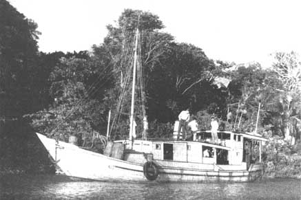
FOREST SURVEY TEAM TRAVELLING UP THE AMAZON learning about accessibility as well
It is only by growth measurements, from increment cores or by comparisons of results from repeated inventories (continuous forest inventory) combined with static inventory results, that it will be possible to establish harvesting regulations and management plans, which will allow for production and extraction in a time scale by calculation of the annual allowable cut. Measurements of growth made in the first inventory or during the period preceding exploitation can be shown to be sufficiently precise, providing exploitation is limited to the felling of one or two trees per hectare. However, a more intensive utilization of the forests tends to be the rule, and measurements of increment have to be done some years after exploitation to assess the reaction of the trees to the opening up of the forest.
The monitoring of forest resources is not only a question of estimating the increment of trees, the recruitment, the mortality and exploitation. In the tropics it involves above all a monitoring of forest areas often in demand for permanent or shifting cultivation and grazing. It may be thought that this is not a crucial problem when a forest area reserved for supplying an industrial complex is being dealt with, the protection of which can be easily assured (although a network of exploitation roads always encourages the immigration of farmers and it is often difficult and politically unrewarding to oppose their settlement). For forest planning to be valid for a whole country or for one of its regions, continuous monitoring of forest areas is at the least a necessity as it must take into account trends in, and/or decisions affecting, land utilization and ownership. When the annual rate of forest clearing rises, as in some countries, as high as 3 percent of the total forest cover, it is difficult to plan the forest economy if the changes brought about in the forest cover are not recognized. This information does not only consist of data concerning the extent and locality of the clearings but also requires study and evaluation of the areas of the different stages of forest degradation and forest reconstitution. The systematic gathering of this information is still not well developed and only rarely are official services able to indicate with sufficient precision even the extent of depletion of the forest area.
For the forest owner and for the logger, data on accessibility are indispensable at all levels of planning. Evaluation of accessibility enables the logger/investor to calculate the cost of wood material at the mill and equally enables the owner/government to determine the correct stumpage fee. These data can be classified in three categories:
- values of physical parameters describing the trees, growing stock, topography, soil, climate and the situation in relation to the existing infrastructure;- data on the types of logging and their efficiency depending upon methods of felling, skidding, transport and road construction;
- finally, values of socio-economic parameters relating to labour, materials used and the different laws, regulations and conventions fixing the standards of work in a country or region.
Because the personnel responsible for the inventory of the forest resources are often the only ones to go through the forest areas under study, and because they have the necessary logistic facilities, it is both logical and advisable that they should undertake the collection of data on the physical parameters of accessibility. In doing so they would go beyond the narrow concept of forest inventory limited to dendrological and mensurational data. Codification and/or quantification of the physical parameters of accessibility have been established by IUFRO as well as by the Joint Committee EEC/FAO/ILO on Forest Techniques and Training of Forest Workers. These attempts reflect chiefly conditions of work in temperate zones and similar trials have yet to be made better tailored to tropical conditions. For example, because of their relatively small part in the total cost of exploitation in tropical areas, parameters for the calculation of felling costs should be given less importance. By contrast, full account must be taken of the presence of, and distances to, quarries because of the relative importance of the cost of road construction per unit of volume extracted from tropical forest. Recent studies of accessibility have rendered possible the definition of parameters of accessibility which are particularly useful because of their direct correlation with the costs of logging. It has thus been possible to show the importance of parameters characterizing the "brokenness" of the terrain (in addition to the parameters of slope), such as the number of reverse slopes by unit of distance or the density of the drainage pattern. In conclusion, it can be said that some of the physical parameters of accessibility significant for tropical moist forest remain to be defined. This constitutes an important area for applied research.
Data on soils and topography are not useful solely for determining conditions of accessibility and the costs of exploitation. They are equally indispensable for determination of the index of site quality and its appropriate cartographic representation. In a wood supply scheme involving a partial or complete reforestation by artificial regeneration following a first exploitation of the natural forest, the determination of soil data and the distribution of soil types is fundamental for assessing the feasibility study of future plantations. The density and scope of a pedological sampling investigation depend on a compromise between the requirements of an intensive soil survey and the logistics and technical requirements of the forest inventory design envisaged. The cost of additional soil sampling should be examined in relation to the value and importance of the results to be expected.
This résumé of data necessary for investment decision-making would not be complete without some reference to the presentation of the inventory results. For instance, no one responsible for an inventory should conceive and initiate such an operation without a precise knowledge of the form of the tables of results and of the maps which will figure out the objectives of the operation. Pictorial information and tabulated figures are useful together and have complementary advantages. Moreoever electronic data processing is combining both types of information in the form of computer listings where each plot is indicated together with its corresponding values for the parameter studies. Maps prepared from conventional and new types of remote sensing imagery should have a scale corresponding to the precision of the interpretation as well as to the precision necessary for the pre-investment study carried out. While operational scales for exploitation vary between 1/5000 and 1/10000, a scale of 1/50000 is generally sufficient for a feasibility study of some extent. In any case, forestry maps produced by photo-interpretation should be linked to the other results. They should, in particular, reproduce the strata and other forestry divisions used in the tabulation of results and, if possible, the limits of the different classes of accessibility. Unfortunately, there are too many examples of forest inventories in which, following a division of work between two experts, two companies, two departments or two different institutes, the maps produced relate very superficially to the data and to the results of the field inventory. Accordingly, it is important to stress, for most inventories other than reconnaissances, the need to indicate on forest maps, or on the planimetric base map, the plots or points of the field sample as accurately as possible. If the sampling design used is systematic, it is possible to map at a small scale the value classes of a parameter measured on the ground (for example, the number of stems of exploitable diameter of a given group of commercial species). In photo-interpretation and in the estimation of areas there is often a choice between interpreting the remote sensing imagery at each point of a grid over the area under study, and complete mapping by: full photo-interpretation and the transfer of the limits of the different classes under consideration onto the map. The first solution is often more reliable. It does not indeed enable complete mapping to be done, but estimates can be obtained of the areas of the different classes, without bias or with less bias in the alternative case where the problem exists of the determination of the transition zones.
Forest inventory reports are often too difficult to use because inventory specialists familiar with forest inventory techniques and the use of figures do not always realize the need for a clear and simplified presentation of results. A confused and cumbersome exposition of over-abundant results can easily lead to a negative approach on the part of the decision-makers, regardless of the project's merits. Those responsible for forest inventory operations should be advised to make an effort towards more clarity and simplicity, and they should be encouraged to write, in addition to the actual report, a synthesis. This should set out briefly the main results in the form of clear tables and succinctly justify the principal conclusions to be drawn from the study of the figures obtained.
If the scientific and technical "tools" which foresters have at their disposal in 1976 are reviewed, one must inevitably admit that these have been far from fully used in the evaluation of tropical forest resources. The tools of mathematical statistics, operational research, theory of decision, etc. are still hardly used. In the field of statistics, for instance, some conventional techniques such as sampling techniques, analysis of variance and multivariable regression are certainly used, sometimes wrongly. However, more suitable and powerful statistical tools are practically neglected. Theories of stochastic processes or "regionalized variables" ("geostatistic") used in socioeconomic investigations and in mineralogical prospecting respectively, are practically unknown to forest inventory specialists working in the tropics. Yet the advantages offered by these techniques in the field of forest inventory are very useful: apart from the possibility for an estimation of statistical error in the systematic sampling designs - which the theory of sampling only approaches - the geostatic theory permits automatic mapping of the parameters under study (for example, the volume of a species of particular importance), from the analysis of the sampling results and distribution of the species (determination of the correlogrammes). Studies are in progress on the species Aucoumea klaineana, in the forests of Gabon, and it is to be hoped that it will prove possible, on the basis of these studies, to start using these techniques operationally in tropical forest inventory. Some forms of multivariable analysis such as principal components analysis, as well as automatic classification techniques, have a very varied field of application in forest inventory and mensuration. Examples which may be cited are the use of automatic classification for grouping a large number of species of a tropical forest for the purpose of establishing a restricted number of volume equations, or the identification and selection of two or three of the most important parameters of physical accessibility by principal components analysis as has recently been done in Gabon. But these examples should not obscure the fact that the use of these powerful statistical tools is still unfortunately too rare in the field of forest inventory.
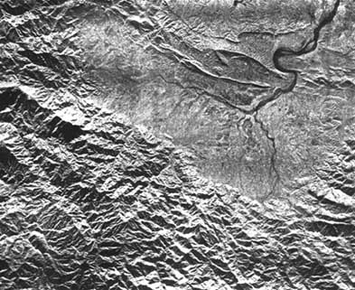
The new forms of remote sensing are better known to the forester and to the general public, and gain a favourable preconception which is not always justified by their actual applicability in the field of natural resources evaluation. Radar sensing (SLAR) is perhaps the recent tool most used in tropical forest inventory. It has rapidly made possible preliminary reconnaissance mapping of many tropical moist forest areas for which air photographs have not been available due to persistent cloud cover. Visible and near infrared photography taken by ERTS satellites (LANDSTAT) are as yet very little used in tropical forestry. It is true that much research is necessary before they can be intensively used in this field and their automated interpretation can be considered.
Electronic data processing is used much less than it could be. Computers are not always available for processing data from tropical forest inventories. The low capacity of most computers that could be available is not a serious disadvantage. It has been proved that a computer with a central unit capacity as small as 8 K-words could treat a collection of 50000 cards of forest inventory data. With the confidence and flexibility of electronic data processing it is possible to systematically detect errors in the data, to refine the volume models used, to combine and present a greater number of results, all of which are factors that would increase the value and usefulness of many tropical forest inventories in the eyes of the decision-makers.
It is also necessary to include tropical botany and forest mensuration among the basic tools of tropical forest inventory. Here it is not so much lack of application but the incomplete state of these two disciplines that are at stake. We have already said that some mensurational concepts are lacking because, for example, of the peculiarities of tropical trees, such as an abundance of overmature trees, buttresses and aerial roots - and efforts of conceptualization and standardization are necessary in tropical forest mensuration. As for forest botany, it advances daily and this in itself complicates, to a small extent, the task of tropical inventory workers as compared with their colleagues in the temperate zone.
So it is not at the level of basic tools and fundamental research that the causes of these inadequate inventories are to be sought. Rather, there appears to be a lack of coordination between inventory specialists and the users, and at times there is also a lack of applied research in tropical forestry. Examples of this state of affairs can be found in the three key sectors of preinvestment forest survey, that is, the estimation of volumes effectively extracted, the evaluation of accessibility and the estimation of changes in the forest resources in time.
There has been purely and simply a transposition of methods of net volume estimation and grading of standing wood from temperate to tropical countries without taking into account their totally different conditions. It is very easy to understand why the estimation of net volume or the grading of the standing trees in relation to anticipated production - and even the direct estimation on standing trees of the volume of expected end-products - has been characteristic of forest inventories in temperate zones. These were the traditional methods used in managed stands having only a few species and administered by communities who had managed, exploited or converted the same forest resource for several generations. It follows that their knowledge of the recovery factors in logging and processing by species and diameter categories was more than adequate to enable them to manipulate the concepts of net volume and end-product qualities. Nothing comparable is found in the tropical forest zone afflicted as it is with a recently developed forest economy, an absence of management (which causes the presence of many overmature and decayed trees), large fluctuations on the international market for tropical woods, progressive changes in accessibility and an abundance of species.
All these factors prevent a satisfactory estimation by commercial grades of volumes likely to be extracted. For example, whenever the market for tropical woods improves - and the events of recent years show that circumstances can be very changeable - or whenever a public access route is opened, then the selection of trees and grades becomes less intensive and the volume estimates given by the inventory lose their value. It is, then, essential to proceed from a base as objective as possible - for example, gross stem volumes defined at the outset by objective criteria and subsequently classified by standing tree quality classes (and not according to the expected form of utilization). A recovery study should be made from neighbouring logging units reflecting the present forest regulations, logging practices, conditions of accessibility, markets, etc. The result of this study would determine the recovery factors to be applied, by species or groups of species, to gross volumes, so as to provide a realistic estimate of volumes that are likely to be extracted. If one or more of these conditions should change significantly, another similar study should be made to determine the new coefficients to be applied to the same gross volumes. This procedure has many advantages:
- For the owner and manager, who can thus find out the probable utilization level of the forest and can draw conclusions for harvesting regulations and management prescriptions.- For the logger and the industrialist, who can determine the output which they can effectively extract from the forest.
- For the two groups together, who can determine, partly from these volume estimates, the logging costs and the possible profit for the one group and the level of tax that the other group can impose.
The recovery studies do not call for any particularly advanced technique and demand only objectivity, common sense and accuracy in measurements. Unfortunately, though they provide an adequate answer to one of the basic questions regarding investment, they are rarely undertaken. Inventory reports continue to be encumbered with figures for net-volumes, volumes of "sawnwood" or "veneer," quality classes frequently established with great care but not reflecting the reality of exploitation, since they are not based on a direct comparison with reality. In one recovery study carried out, admittedly in a period of stagnation of the tropical wood market, it was found that for the species most in demand, the volume extracted and sold was only 56 percent of the standing timber classified as "net industrial stemwood volume". What purpose can be served by calculating a net volume within 10 percent to 0.95 probability level and handing it to the economists when it is not known that the volume extracted can, in practice, be reduced by 44 percent
Inventory personnel and timber utilizers often fail to collaborate on the evaluation of accessibility and on the costs of exploitation. But it must also be recognized that there is a need for applied research which would permit determination of the best indication of physical accessibility, their quantification and that of their relations to the various logging costs. Very rough relationships have been established for tropical moist forest between the costs of felling, skidding, transport, road construction and indications expressed in figures or codes for the terrain and environment factors. But a considerable effort remains in order to refine the concepts and the relationship between cost and the environment factors, before the inventory specialist can be given the parameters which he should try to record in the field and from air photographs. However, this state of affairs should not be a justification for inaction by forest inventory officers and by logging specialists. On the contrary, they should try to quantify together accessibility.
A third key is the estimation of changes in time. It seems that on the question of increment in tropical forests, the foresters' approach has been characterized by ultra-conservatism. For too long it has been accepted as an inescapable fact that "one could not read the growth rings of tropical broadleaved trees". But recent research has shown that this is at least not the case for several important species, for example Okoumé and Limba (Terminalia superba). Furthermore the proportion of ring measurements on Okoumé, made without difficulty and without error from cores taken by a Pressler increment borer, is as high as 95 percent. Studies remain to be done on many other species but, a priori, there is no reason why it should not be so for several other species. Nor should there be any great difficulties in the general adoption of tree-measurement tapes fixed permanently to trees and read at regular intervals (were it not for the inconvenience caused by the pocketing of these metal collars for purposes other than forestry by insensitive borrowers), as well as the general establishment of permanent sample plots for growth studies. Figures are becoming more and more available on the growth of species in tropical moist forests, whether untouched forests or forests that have been subject to different regimes of exploitation and/or silvicultural treatment (Peninsular Malaysia and Sarawak, for example). These scattered results reflect concern for a study of the development of the growing stock of tropical moist forest and should lead, it is to be hoped, to the general use in the tropics of the concept of continuous forest inventory at all levels of planning. The proven methods of sampling applied in temperate zones, such as sampling with partial replacement (SPR), can be adapted with some care to tropical forests and should enable investigators to determine the growth and the expected potential 5 to 15 years after a first exploitation.
Concerning the changes in forest areas which on national and sub national levels are mainly of government interest, the tools of sampling techniques and photo-interpretation enable monitoring to be undertaken on a quantitative plane for the estimation of areas on which the vegetation cover has been modified, as well as on the qualitative plane of the nature of the changes. It is never sufficiently stressed how important this monitoring is on a national or sub-national level, and how negligible is the cost of new, complete or partial aerial photographic coverage in relation to the considerable losses indirectly caused by the lack of knowledge of deforestation and a "laissez-faire" policy in the use of the land.
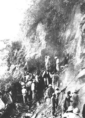
ROAD-BUILDING IN A REMOTE PART OF BOLIVIA put it in the survey from the start
To conclude, we have seen that tools and methods are available to answer key questions relating to forest inventory for investment purposes in the tropics, while studies remain to be done in certain spheres such as botany, use of satellite photographs, reading of growth rings and quantification of accessibility. On the whole, we can say that it is possible, during the course of forest inventory operations, to obtain the information necessary for industrial decision-making, and that the past shortcomings in this field can be largely attributed to a failure to get together at the proper time those responsible for inventory on the one hand, and the specialists in other disciplines, the users and the decision-makers on the other.
The possibility which tropical forest inventories thus have for providing the answers required by investment decision-makers, should lead to inventories being regarded as essential preparatory activities in the great majority of programmes of investment studies. It is to be regretted that the resources are so parsimoniously apportioned and that inventories are incomplete and hastly carried out.
The cost of a tropical forest inventory operation represents, per unit volume extracted, no more than a minute fraction of the cost of production and delivery to the factory (often about 1/1000). Even if the anticipated investment were not to take place immediately, the mass of information collected could serve, partly or wholly in the fairly near future when, among other factors, the conditions of accessibility have been improved. Unfortunately, so many governments and industrial companies fail to allocate the necessary funds. As a consequence, they are often led to risky decisions because of these attempts to save, really negligible when compared to the investment under consideration.
Finally, we must recall and stress again the importance, for all tropical forestry countries, of initiating permanent inventory operations at the national level. These would make it possible to assess, at any time, the situation regarding forest resources and could thus serve as a guide to all decision on forest policy.
![]()
![]()
![]()