![]()
![]()
![]()
S. Kolade Adeyoju
S. KOLADE ADEYOJU IS a Professor and Head of the Department of Forest Resources Management, Faculty of Agriculture and Forestry, university of Ibadan, Nigeria. This article is a shortened version of a paper entitled Critical aspects of forestry projects for rural development which was presented at the FAO/SIDA Consultation.
Land-use planning is not a new exercise. Discussions about land-use issues in both industrialized and developing countries over the last 20 or 30 years show a remarkable similarity to the present day in both the problems posed and the solutions considered.
In developing countries, however, two things are of interest: first, the actual implementation of land-use controls is moving steadily away from its traditional place in chiefdoms, families or ethnic groups into the purview of provincial and national authorities; second, planning practice is catching up, very slowly, with planning theory. Planners, long accustomed to preparing policy documents that they knew would never be implemented, are suddenly being taken seriously by decision makers.
The methods that have been used to assess forest land in relation to other competing land uses are nearly as diverse as the forest types or agricultural crops themselves. They include: national forest or agricultural surveys aimed at documenting native forest types and agricultural production; site index assessments of plantation agriculture and exotic forest trees; landscape zoning on the basis of geology, topography and soils; assessments of land suitability in terms of productive potential in cubic metres of biomass per hectare; evaluations of which indigenous forest should be reserved for scientific purposes; and many others.
These exercises are prompted by the fact that land is not always in surplus supply. Forestry is thus only one among numerous uses to which land can be put, and in many circumstances it should not even have top priority. It is for these reasons that land administrators often try to combine one use with another so as to minimize or eliminate conflict and competition between them. Indeed, it is often true that a given area can be used for timber production with some livestock grazing, while at the same time it can serve as a watershed and can have considerable recreational and wildlife value. Minerals in the same piece of land may also be developed with only moderate or even no conflict with surface uses.
The parameters for allocating land are neither entirely economic nor exclusively biological. Decisions must be guided by the factors of comparative economic advantage, availability of land for other uses and the political orientation of policy makers. However, since most forest products are important in the sense that they are commodities rather than prime necessities of life (such as major food items), forestry's case for land allocation is invariably of a lower priority than agriculture. It must therefore compete as an equal partner with other potential land uses.
ON THE OUTSKIRTS OF LIMA the rural exodus must he checked
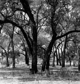
AN Acacia albida PLANTATION IN ZAMBIA
CALCULATING POTENTIAL TIMBER VOLUME FOR HARVESTING IN ECUADOR two options for land-use planning
The remedies that have been proposed to eliminate land-use conflicts generally range from the involvement of organized groups and advisory boards to the use of legislative powers. The effectiveness of any remedy depends to a very large extent on the personal feelings and community identity of the people concerned. When a government or any constituted authority tries to increase its control over an area that has so many meanings for people, the issues and conflicts that its efforts stir up tend to be important ones. Sometimes these issues appear in dramatic form, such as when angry property owners reject controls at public acquisition meetings. At other times, the conflicts are subtle and long-term; they pass by the decision makers without being noticed, only to appear later as future problems.
With regard to competition between agriculture and forestry for land, the problem is not simply the loss of forest land to agriculture but also the increasing area of agricultural land that is lost as a consequence of growing urbanization. Farmers in these urban transitional zones exert special pressure on the forest estate beyond that exerted by bush-fallow cultivators. Here farmers continually move into the forest estate, not necessarily because population is increasing rapidly or because their land is unproductive, but because they feel threatened by speculators and developers who buy them up and also because of the irresistible desire to change from wholly subsistence to plantation agriculture.
This group of pressures is often referred to as the "impermanence syndrome". Although in most developing countries the existing land supply would appear to be sufficient to meet the current or even the projected demand, there are nevertheless unknown factors such as weather vagaries, proneness to desertification, the supply of future energy-related inputs, uncertain prospects of agricultural output and the long-term negative effects of soil erosion on land productivity which can dramatically affect future land supply.
A choice between unpleasant alternatives has to be faced. To err on the side of under-protecting the forest lands could be disastrous. Yet being overly restrictive of forest land conversion could exacerbate already serious problems of food shortages and inadequacies of forest produce. While the results of further research into this difficult issue are awaited, it is believed that a prudent statement of forest policy should not attempt to outlaw forest land conversion outright, but should instead concentrate on reducing the amount of forest land affected by the impermanence syndrome. Agroforestry (in its variety of facets) has promising prospects for a balanced strategy in this regard.
Another approach may be to create "inviolate" agricultural districts. The goal of such zones would be to keep agricultural land under farming until it is really needed for other purposes. In so doing, agriculture would be more settled. It would help create regional production patterns and restore an element of sanity which is in actuality the sole purpose of land-use planning.
While such ideas involve a revision of existing laws, there is one area where planning authorities can, even now, show a greater awareness of the magnitude of the problems confronting them. This is in the collection, collating, analysis and dissemination of accurate data relating to land use.
It is true that a few planning authorities have undertaken surveys of various types in the past, but these have rarely been used as the bases of reports highlighting relevant problems and indicating the types of policy decisions that are called for. Undoubtedly, problems relating to the availability and qualification of relevant personnel are involved here, but this does not wholly explain why the relevant ministries and/or departments of provincial and national governments do not indicate the type of development and decision-making necessary to transform the traditional structure of land use into one which can more efficiently serve the needs of a developing society.
Land use is not a single problem to be solved by a single decision or a single piece of legislation. It is a developing chain of decisions, involving the conscious design of the future human environment. It requires decisions that cannot be made by any single level of government, but must involve all the participants in the land development process: landowners, developers, consumers and all levels of government. Therefore, the paramount goal should not be for one level of authority to dominate the other, but for each to have the liberty to bring into proper focus land-use and development interests that have long been neglected.
Land use is not a single problem to be solved by a single decision or a single piece of legislation, is a developing chain of decisions, involving the conscious design of the future human environment.
Critical areas. In special circumstances, certain classes of land may be designated as "critical areas of concern" requiring regional or national intervention to ensure their protection. These may be individual areas of great scenic value or historical significance. They may also be lands necessary for the survival of endangered plant and animal species. They might be particular coastlines, lakes or flood plains.
Other areas that may be considered critical are those having natural hazards, volcanic zones, high susceptibility to fire, or unstable or easily eroded soils. An area may also be considered critical because of its productive potential or its particular natural resources. Prime agricultural land can be given special protection from wanton development in the same way.
Urban growth. The State may wish to exert direct supervision over the use of land outside urban areas, either because the land is undeveloped or because it has not yet been zoned by local governments. Quite frequently such land is both undeveloped and unzoned. There is an urgent need to determine urban growth boundaries and to identify and separate urbanizable land from rural land so that development will be contained and systematic. This will require comprehensive land-use plans which would group land into zones. Such plans should encourage intensive development in existing areas, promote orderly growth in adjacent areas and allow well-planned development in other areas.
Regional planning. Beyond a certain limit, local governments may not have the capability, let alone the jurisdiction, to develop needed projects. The size of a scheme considered to have "regional impact" will vary, of course, from country to country. Hence, provincial or national governments may be required to provide leadership and also to bear the cumulative burden of such development projects. The various river and lake development authorities fall into this category.
Essential facilities. Closely related to the idea of regional planning is the concept of "essential facilities". Here emphasis should not be on the size of the project per se, but on its growth-inducing potential. Major highways, airports, university campuses, research institutes, reservoirs, reclamation schemes and irrigation projects normally generate growth in surrounding areas. It is not always easy to coordinate the investments and planning goals of these "growth centres" with those of the nation as a whole. Therefore, where special opportunities exist for the development of regional benefits, the provincial or national government should create specific land-use authorities to enhance meaningful coordination of public investment planning.
|
Techniques of land-use allocation Zoning. In practice, each zone in a given planning unit would be permitted to have certain uses which are presumed to be compatible with its character Unlike traditional laissez-faire practices, uses permitted under the constituted authority must comply with certain environmental criteria. In developing guidelines for zoning, care should be taken to ensure that areas neither too small nor too large are allocated to important sectors such as housing, forestry and livestock. Therefore, zoning legislation should have the general aim of achieving an orderly and balanced utilization of land resources. The double-veto system. There is a common land-use institution, which might be called the "double-veto" system, whereby a local government retains its power over such things as evaluation of building projects, issuance of approvals, and granting of permits for water and sewage connections but also whereby a developer may be obliged to secure a separate permit from the provincial government. This is true particularly if the project is of a special type, such as a processing plant, or if the total investment is large. Conversely, either of the two authorities can withhold approval or impose conditions on a project. However, local governments may find it difficult to impose conditions on projects which are to be built on land already set aside for a particular use and which do not require more than routine building and occupancy permits. Setting guidelines. The production of guidelines containing detailed information on suitability for development and broad policy goals can be attempted. State agencies such as housing and agricultural and transport corporations may also be required to prepare "functional maps" and submit them to the legislature. In these instances, a provincial government would rely on moral persuasion and wide publicity to induce local governments and planning authorities to bring their plans into conformity with state or provincial goals. Another approach is through "standard-setting" which, although limited in scope, is nevertheless regulatory and enforceable. Here, the provincial government sets standards for local planning and regulation. This is most frequently done through regional subdivision map laws covering conservation, natural reserves (or inviolate plots), scenic highways and so on. Collaborative planning. Another approach is collaborative planning between town planning authorities, property development corporations and ministries of land and housing. This is an increasingly popular procedure which combines some aspects of comprehensive planning with those of mandatory standards. Typically, the provincial government establishes broad planning goals or policies and then requests local governments and other land-use authorities to incorporate the specific goals in their own plans. |
![]()
![]()
![]()