![]()
![]()
![]()
The 1982 census showed that the population in Morocco was 22 million. Nearly 56 percent of this population, representing two million households, depends directly upon agriculture. The nation's agricultural income is generated from diverse sources and the livestock sector contributes 30 to 40 percent. The 12 million rural inhabitants derive their livelihood from 7.8 million ha of cropped land, 5 million ha of forest and more than 20 million ha of arid and semi-arid rangelands. Rainfed agriculture is very common in Morocco and covers 6.8 million ha representing about 87 percent of the cultivated land. This land is mainly cropped into grains or fallowed allowing annual weeds to grow and be grazed as a source of livestock feed. The extent of the different crop commodities is estimated as follows (FAO, 1986):
Grains: 4.7 million ha
Legumes: 0.4 million ha
Forages: 0.3 million ha
Other crops: 0.4 million ha
Fallow: 2.0 million ha.
Morocco has four distinct geographical areas: the coastal plains, the atlas and the Rif mountains, the plateau adjoining these mountains and the Sahara desert. The coastal belt is highly fertile and intensively cultivated into grains and various horticultural products. The topography in this region is gentle and the climatic conditions are favourable. Rainfall exceeds in general 500 mm and the temperature is usually mild all year around. An active dairy sector has been promoted in this region following the recent development of irrigation. Cattle and sheep are also commonly found in mixed herds in the rainfed area of this region where fallow, crop aftermath and residues are the main feed resources.
The continental plains of Tadla and Haouz (Figure 1.1) are to some extent comparable to the coastal plains in terms of agricultural commodities. However, the climatic conditions are harsher with less precipitation, a colder temperature during winter, and warmer temperatures during the summer season. Another feature of these plains is the greater economic importance of the sheep industry. Sheep performance in this area is dictated by the availability of grazing lands which are not cultivated due to low precipitation, shallow or rocky soil and a steep topography that discourage cropping.
The eastern limit of these plains consists of the middle Atlas mountains with an elevation ranging from 1200 to 2400 m. These mountains are subject to cold winters and to varying aridity. Annual precipitation varies from 300 mm in the southern part to over 1000 mm around Ifrane. Vegetation is diverse in these mountains and includes sagebrush rangeland, mountain grassland, and oak, juniper and cedar forests. Sheep are the main source of income in this area.
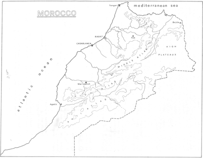
Figure 1.1 Map of Morocco
The high Atlas mountains divide the Haouz plain from the Moroccan desert and have an elevation which exceeds 4000 m. Annual precipitation and temperature are variable depending on exposure. Hence, the northern slopes are more humid and characterized by a freezing temperature ranging from -15o C to 0o C during four to nine months. Vegetation of this side of the high Atlas is dominated by Quercus, Juniperus, Tetraclinus and Pinus forests associated with an extremely diverse mattoral. The southern slopes are drier and dominated by steppic vegetation including Haloxylon scaparium, Aristida sp, and Helianthemum lipii. Agropastoralism is the main activity in this region where intensive crop production is practised on narrow terraces, while large numbers of small ruminants (mainly goats) rely for their feed on forestland and the summer rangeland existing beyond the timberline.
Further south of the high Atlas is the Moroccan desert. Aridity is severe in this area, where annual precipitation is below 150 mm and the low mean temperature is around 3 to 6o C. Agricultural activities are therefore limited to small oases, where irrigation allows subsistence cropping associated to the raising of a highly prolific sheep breed: the D'Man.
Finally, the high plateaux are an arid area bound in the north by the Mediterranean sea and in the south by the Moroccan Sahara. The degree of aridity obviously varies from north to south. The vegetation in this region is dominated by few low shrubs such as Artemisia herba alba and noaea mucronata and a perennial grass, Stipa tenacissima. Marginal cereal cropping is practised in this area, but the main source of income is generated from sheep raising in a declining nomadic system.
![]()
![]()
![]()