Author: Babaïev A.G. (ed.)
Title: Problïemy osvoïeniïa pustyn' (Problems of desert management)
Publisher: Akademiïa Naouk Turkmïenii. Institut Pustyn' (Academy of Sciences of Turkmenistan, Institute of Deserts), Ylym, Ashkhabad.
| Date: | Language: Russian |
| Available: | BiL Moscow, IG RAN Moscow, KR FAK Alma Ata, WGiSR UW Warsaw, UAM Poznan |
| Classification: | 1-5 |
| Region: | Mainly the arid and semi-arid zones of the ex-Soviet Union; also other arid and semi-arid areas. |
| Summary: | A bimonthly publication
concerned exclusively with deserts, containing the
following types of entry: articles (5 to 12 per issue),
brief notes (up to 10), "Our contribution to the
national economy" (also in the form of brief notes
which, however, have not appeared in these issues),
columns, reviews and discussions. In the years 1971-1978,
one issue in five contained a bibliography of
publications on the deserts of the Soviet Union published
the previous year. The texts are written primarily by
employees of the Institute of Deserts and by other
scientists in the ex-Soviet Union, rarely by Western
specialists. Most of the entries concern ex-Soviet
Central Asia (particularly Turkmenistan) and Kazakhstan. In 1970, few articles appeared on regions outside of the Soviet Union. These articles became more numerous toward the end of the 1980's and dealt mainly with arid and semi-arid territories of Africa, but included Asia as well. Information on projects of international organizations was also presented. In the 1970's, the magazine published almost exclusively articles on the natural environment and the economic development of deserts, whereas environmental degradation and desertification were only touched on in brief notes, then later in sporadic articles. Since the end of the 1980's, these problems take up 1/4 - 1/3 of the content of this publication. |
Remark: The title page presents the title in Turkoman and occasionally in English, the summary is written in Russian, Turkoman and occasionally English, some articles are summarized in English, some in Turkoman, and others in the two languages.
Author: Babaïev A.G. (ed.)
Title: Problïemy osvoïeniïa pustyn', Special N°: Naouchnomu Jurnalu "Problïemy osvoïeniïa pustyn"' 25 lïet (25 years of the scientific journal "Problems of desert management"
Publisher: Turkmïenistan Ylymlaz Akadïemiïasy (Academy of Sciences of Turkmenistan) Ylym, Ashkhabad, N° 3, 88 pp.
| Date: 1992 | Language: Russian |
| Available: | BiL Moscow, IG RAN Moscow |
| Classification: | 1C, 1D, 2-5 (general information) |
| Region: | Africa, Latin America, Uzbekistan |
| Summary: | This special issue is almost exclusively concerned with problems of desertification at a global level. Articles include information on United Nations programs in combating desertification (pp. 16-22), a text by H.E. Dregne on the restoration of arid lands (pp. 22-27), drought and development in Africa (by M.G. Glantz, pp. 27-33), the future of the Sahara (L. Cloudsley-Thompson, pp. 33-39), "The desert and desertification" (B.G. Rozanov, pp. 45-47, very general information), comparative study of research methods on desertification in the CIS and in Argentina (pp. 47-54, N.G. Kharin, E.M. Abraham de Vásquez), soil salinization in conjunction with arid climates (pp. 54 61, I.I. Pankova), combating desertification in Mali (pp. 66-70) and the stability of arid geosystems in Uzbekistan under human pressure (pp. 70-77) (cf. bibl. entry 125 - Rafikov A.A., 1992). The articles by L. Cloudsley-Thompson and B.G. Rozanov cite a number of definitions for desertification, given in English or French, without commentary. |
Authors: Babaïev A.G., Frïeïkin Z.G.
Title: Pustyni SSSR vchïera, sïegodnïa, zavtra (Deserts of the USSR, yesterday, today, and tomorrow)
Publisher: Mysl', Moskva, 352 pp.
| Date: 1977 | Language: Russian |
| Available: | BiL Moscow, IG RAN Moscow, WGiSR UW Warsaw |
| Classification: | 0, 5A1-2, 5D2a |
| Region: | Central Asia (Turkmenistan, Tajikistan, Uzbekistan, Kyrgyzstan) |
| Summary: | This monograph concerning the environment of the deserts of Soviet Asia and their economic development demonstrates the considerable success of man in dominating nature. The history of the deserts of the Soviet Union is discussed at length (beginning with the time of Ancient Greece and including Arab travellers). In the chapter entitled "Deserts and man" there is an emphasis on the harmony of traditional agricultural methods in the Central Asian deserts and the local population's profound knowledge of the environment. Subsequent chapters describe in detail the development of the deserts under the Soviet government: development of the mining industry, of irrigation (for cereal cultivation and animal production), of road networks and of railways. A rational approach to the economy of natural resources under socialism improves the use of these resources (p. 286). Technical progress allows the control of individual, exceptional cases of degradation (for example, wind deflation after the laying of pipes - pp. 290-291). Economic development of Central Asian deserts could be accelerated by the diversion of water from Siberian rivers towards this region (a canal 3000 km long from the Ob River to the Caspian Sea, supplying 25 km3 of water per year; a detailed map of planned changes is presented pp. 252-253), which would also save the Aral Sea. As for the size and cost of the investment project, extensive studies would be necessary, using the Karakumy Canal as a model. The bibliography contains exclusively Russian publications. |
Authors: Babaïev A., Kharin N.
Title: Combating Desertification in the USSR
Publisher: Unasylva, vol. 43, N° 168, pp. 48-51, FAO, Rome
| Date: 1992 | Language: English |
| Available: | BiL Moscow, FAO Rome |
| Classification: | 5 |
| Region: | Central Asia (Kazakhstan, Uzbekistan, Turkmenistan) |
| Summary: | A general publication on combating desertification in three Central Asian countries. It includes charts showing the percentage of lands affected by desertification (58% of the area of Kazakhstan, 59% of Uzbekistan and 66% of Turkmenistan). General information on work since the early 1980's on the afforestation of sand deserts and the restoration of pasturelands in desert foothills. The drying up of the Aral Sea is mentioned. By the year 2000, the area of the lake may have decreased to 2,689 km. Names of plants are given which are used in revegetalization. |
Plants used in vegetalization:
Protective strips: Haloxylon, Salsola, Aellenia, Calligonum, Ephedra;
Shrubs: Haloxylon persicum, Calligonum rubens, C. caput-medusue, C. microcarpum, C. setosum, Ephedra strobilacea, Salsola paletzkiana, S. richteri, Aellenia subaphylla;
Semi-shrubs: Kochia prostrata, Salsola orientalis, Artemisia badhysi, A. kemrudica, A. turanica, Astragalus unifoliatus, Eurotia ceratoides;
Perennial plants: Astragalus agameticus, Dorema aichisonii, Ferula assafoetida, F., badrakema, Poa bulbosa;
Annual plants: Salsola paulsenii, Eremopirum orientalis, Catandia memphitica, Eromus tectorum, Agriophyllum latifolium, Malcolmia grandiflora.
Authors: Babaïev A.G., Kharin N.G.
Title: Karta opustynivaniïa aridnykh tïerritorii Azii (Desertification map of Asian drylands [conception])
Publisher: Problïemy osvoïeniïa pustyn', N° 5, pp. 37-39, Ashkhabad
| Date: 1991 | Language: Russian |
| Available: | BiL Moscow, IG RAN Moscow, KR FAK Alma Ata |
| Classification: | 1C1, 1C4 (cartography) |
| Region: | Central Asia, Mongolia, Afghanistan |
| Summary: | The following maps have been
completely finished:
All these maps are to be used in subsequent projects. The main criteria in preparing these maps were vegetation degradation, wind and fluvial erosion, and salinization. Preparation of maps to the scales of 1:5,000,000 and 1:10,000,000 is proposed: current state of deserts, aridity indicators, population density, lithoecological desert types, land use. |
Maps available:
- IP Ashkhabad;
- Institut Gïeografii Akadïemiï Naouk Kazakhstana (Institute of Geography, Kazakhstan Academy of Sciences) - exclusively manuscripts dealing with part of Central Asia and Kazakhstan.
Authors: Babaïev A.G., Orlovskiï N.S.
Title: Osnovnyïe rïezultaty vypoliïeniïa plane dïeïstviï po borbïe s opustyni-vaniïem za 19771985 (Principal results of the programme in combating desertification)
Edition: Problïemy osvoïeniïa pustyn', N° 3, pp. 3-10, Ashkhabad
| Date: 1985 | Language: Russian |
| Available: | BiL Moscow, IG RAN Moscow, KR FAK Alma Ata, WGiSR UW Warsaw, UAM Poznan' |
| Classification: | 1D, 2B1-2, 5 |
| Region: | Global |
| Summary: | In 1977, during the United
Nations Conference on Desertification a world-wide plan
was prepared up to the year 2000. The measures taken to combat desertification in the years 1977-1984 and their effectiveness are analyzed here. In addition, the obstacles which prevent the implementation of this programme are identified. The current state of projects and desertification trends for the years to come are discussed. General estimations of the extent of desertification are that 3.475 billion ha, or 75 %, of arable lands in arid regions are affected (out of 4.5 billion ha) and 3.1 billion ha of pasturelands. Each year 21 million hectares are affected by degradation and 6 million ha are added to deserts; at the same time, local populations have increased from 650 million in 1977 to 850 million in 1983. During the United Nations Conference, global desertification trends and a forecast for the year 2000 were presented for particular regions of the world and for specific types of land use. A graph was presented showing four trends of the desertification process: ° acceleration of desertification, ° continuation of the process, ° unchanged state of desertification, ° success in combating desertification. |
Regional desertification trends
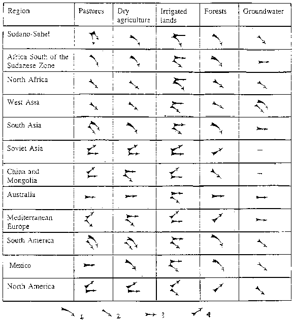
Regional desertification trends: 1- Acceleration of desertification; 2 - Continuation of desertification; 3 - Unchanged desertification; 4 - Success in combating desertification.
Authors: Babaïev A.G., Zonn I.S.
Title: Mïezhdunarodnoïe sotrudnichïestvo SSSR v oblasti bor'by s opustyni-vaniïem (International cooperation by the Soviet Union in combating desertification)
Publisher: Akademiïa Naouk Turkmïenskoï SSR. Institut Pustyn' (Academy of Sciences of Turkmenistan. Instute of Deserts), Ylym, Ashkhabad, 48 pp.
| Date: 1989 | Language: Russian |
| Available: | BiL Moscow |
| Classification: | 1D |
| Region: | Central Asia |
| Summary: | The Soviet Union participated in a number of international programmes in combating desertification. This involvement dates from the 1977 Nairobi Conference where the Soviet delegation participated "constructively". This text presents documents prepared for the conference and often republished subsequently (cf. bibl. entries 46, 70, 115, 139). Other official documents on Soviet experiences are included (cf. bibl. entries 12, 22, 60, 67). The USSR participated in UNEP programmes (with the United States, Kenya, and other countries; FAO is also mentioned), in particular in organizing conferences and courses for specialists from developing countries (rangeland management, sand dune fixation, combating desertification as part of integrated development plans (cf. bibl. entries 20, 49, 71, 100, 144). It also participated in ESCAP/UNEP/UNESCO programmes. |
Authors: Babaïev A.G., Zonn I.S., Orlovsky N.S.
Title: The USSR Experience in Desert Reclamation and Desertification Control. The USSR National Report.
Publisher: USSR State Committee for Science and Technology. The USSR Commission for UNEP. Academy of Sciences of Turkmenian SSR. Institute of Deserts, Moscow, 104 pp. + 4 maps.
| Date: 1984 | Language: English |
| Available: | BiL Moscow |
| Classification: | 1-5 |
| Region: | Central Asia, primarily Turkmenistan |
| Summary: | This report covers 1) the natural conditions of Central Asian deserts (notably climatic conditions); 2) historical aspects of natural desertification and that which is caused by human activities (discussion of the causes of the decline of ancient civilizations in Central Asia, particularly socio-economic and historical aspects, but the importance of climate change is also mentioned); 3) the process of desertification and its dynamics (examples of rangeland degradation, revegetalization; planned projects; 4) forecast of the process of desertification in Turkmenistan with an optimistic view of the limitation of deflation and salinization and the continuous development of irrigated lands to the year 2000; 5) technologies for controlling desertification (the text is primarily concerned with rangeland revegetalization and the development of irrigation). In 1982, in Turkmenistan, the total length of principal canals was 4,323 km, the length of secondary canals totalled 20,723 km, and collective drainage canals were 20,237. |
Supplements:
1. List of publications on the problems of desertification for the period 1977-1983 (177 titles which deal with deserts, not desertification);
2. Physical and geographic regionalism of arid and semi-arid Soviet lands (although the word "regionalism" should be replaced by "region" or "regionalization";
3. Social and economic development of drylands (statistical charts of population, industrial and agricultural production, the number of scientists, etc.);
4. Integrated programme of assessing, monitoring, preventing and combating desertification in drylands of the USSR - this supplement only presents very general preliminary conditions.
Maps:
1. Simplified maps of Central Asian deserts;
2. Schematic map illustrating the state of desertification in Turkmenistan (categories, types and causes of desertification);
3. Schematic map of the danger of desertification in Turkmenistan for the next 20 years;
4. Agricultural methods of desert management in Central Asia.
Author: Babaïeva T.Z.
Title: Primïenieniïe distantsionnykh mïetodov dlïa izuchïniïa protsïessov opustynivaniïa v Turkmïenistanïe (The use of remote sensing in studying desertification in Turkmenistan)
Publisher: Ministierstvo Vyshïego i Srïednïego Spïetsial'nogo Obrazovaniïa Uzbïetskoï SSR (Ministry of Higher Education of Uzbekistan), Tashkent, 18 pp.
| Date: 1984 | Language: Russian |
| Available: | BiL Moscow |
| Classification: | 1C1, 2A3, 2B2c, 3C4 |
| Region: | Turkmenistan |
| Summary: | Doctoral thesis presented in
Tashkent. The document describes work on desertification
outside the USSR, including the "Provisional
Methodology for Desertification Assessment and
Mapping," FAO 1981. To this classification of
processes should be added desertification as a result of
modernization leading to the degradation of soil and
vegetation. An interesting chart "Areas of Turkmenistan affected by different desertification processes" is presented (pp. 15-16). Information is given on patches of desertification near water points as identified on "Meteor" satellite imagery: in the land between the Murgab and Tedzhen rivers there are 66 patches of an average diameter of 2.21 km, in southeast Karakumy 94 patches of an average diameter of 2.16 km, in central Karakumy 200 patches with and average diameter of 1.32 km. The largest patches exceed 6 km in diameter. According to Landsat imagery (1972) in southeast Turkmenistan patches have a diameter of 1.58 km, roughly the same as was determined on the base Soyuz-22 (1976): 1.72 km. By comparing imagery the rate of degradation can be estimated. |
Author: Bakhiïev A.
Title: Problïemy sokhranïeniïa i vosstanovlïeniïa rastitïel'nosti iuzhnogo Priaral'ïa i prognozirovaniïa ikh razvitiïa v svïazi s protsïessom opustynianiïa (The protection and succession of vegetation south of the Aral Sea, and forecast for the desertification process)
Publisher: Izvïestiïa Rossiïskoï Akadïemii Naouk, series: Gïeografichïeskaïa (Geographic), N° 1, pp. 51-60, Moscow
| Date: 1993 | Language: Russian |
| Available: | BiL Moscow, IG RAN Moscow, KR FAK Alma Ata, WGiSR UW Warsaw |
| Classification: | 2A3, 2B2f, 3C2, 4A4, 5C4, 5D2b |
| Region: | Aral Sea (Uzbekistan) |
| Summary: | The current state of nature
reserves, created to safeguard the environment, is
catastrophic. There is degradation due to negative
changes in nature as well as to irrational human
behaviour (e.g., roads crossing the reserves). Forests
bordering on the reserves are being continuously
devastated (e.g., in the Shabbaz, Kovïanchik, Akhamysh,
Iumalak and Samanbaï regions). Revegetalization has not
been sufficient to achieve the goals of the programme to
restore vegetation. Suitable conditions must be created
so that vegetation can survive, while protecting it from
salt winds. This goal can be achieved by planting the
Aral Sea shore with halophytes and by planting vegetation
in sheltered spots, e.g., in depressions. In the end, any attempt to combat desertification will be in vain if the area of irrigated land does not decrease and if the dried up seabed is not planted with vegetation. After desertification is controlled, the region of the Aral Sea should be predominantly agropastoral bush. The author postulates the reinstatement of animal production, recently in a state of ruin in this region. |
Author: Bananova V.A.
Title: Antropogïennoïe opustynivaniïe aridnykh tïerritoriï Kalmykii (Desertification of arid zones of Kalmyk due to human activity)
Publisher: Akadïemiïa Naouk Turkmïenistana. Institut Pustyn' (Academy of Sciences of Turkmenistan. Institute of Deserts), Ashkhabad, 44 pp.
| Date: 1992 | Language: Russian |
| Available: | IP Ashkhabad |
| Classification: | 2A, 2B2h |
| Region: | Russia, Kalmyk |
| Summary: | Summary of a doctoral thesis. The arid zone of Russia is located in Kalmyk (80%), in Astrakhan oblast' (district) and southern Volgograd oblast' (20%). The Kalmyk region is the most vulnerable to the danger of desertification given its light rainfall. The level of precipitation can be as little as 120-200 mm, the potential evaporation is more than 1000 mm. There are 14-15 days of dust-storm per year. Six types of desertification exist: degradation of the vegetation, fluvial and wind erosion, salinization, marsh and wetlands formation, and desertification due to human action. The degradation of the vegetation is the dominant type. 47% of the area is in very poor condition. The author presents indicators of four degrees of desertification: light, moderate, strong, and extreme. Five charts have been prepared with numerical indicators of these degrees. The map illustrates types, stages and causes of desertification according to different types of vegetation in rangelands. The author predicts a reduction in the diversity of the flora and of the types of steppe. The map "Methods of combating desertification" illustrates pastoral norms for rangelands and methods of restoring vegetation and soil. |
Example of chart: Criteria of desertification due to modernization (simplified - charts for other types of desertification are more complex).
Criteria |
Degrees of desertification |
||||
Light |
Moderate |
Strong |
Extreme |
||
| 1. | Degradation of the vegetation cover: a) degradation of the herbaceous cover (% of the surface) b) average cover (%) | 5-10 | 10-50 | 50-70 | 70-100 |
| 23-35 | 25-20 | 20-5 | 5-0 | ||
| 1-2 | 2-6 | 6-9 | more than 9 | ||
| 2. | Percentage of area affected by erosion due to off-road motor vehicle traffic and the mechanization of the construction of irrigation systems | ||||
| 3. | Percentage of area covered by sand as a result of modernization | 0.2-1 | 1-4 | 4-5 | more than 5 |
| Average annual percentage of area affected by desertification in the periods: | |||||
| a) 1957-1960 | - | - | - | less than 0.01 | |
| b) 1978-1988 | 0.1 | 0.1-0.6 | 0.6-0.9 | 0.9 | |
| Mechanical comparison of soils | clay, sandy clay | sandy clay | sand with small amount of clay | sand | |
Authors: Borovskiï V.M., Jamalbïekov I. Y.
Title: Pustyni Mangyshlaka i problïemy ikh asvoïeniïa (The deserts of Mangyshlak and their management)
Publisher: Kazakhstan, Alma Ata, 62 pp.
| Date: 1982 | Language: Russian |
| Available: | BiL Moscow, KR FAK Alma Ata |
| Classification: | 3C5, 5A1 |
| Region: | Kazakhstan (Mangyshlak) |
| Summary: | The author describes the natural environment, and discusses hydraulic equipment. There is information on afforestation, gardens and lawns. Homeowners water their gardens regularly, thus avoiding salinization. Public lands are watered irregularly and soil salinity increases. General information is given on the management of pasturage. There is a description of the intense degradation of the natural environment due to public works and trucking (pp. 55-56). |
Author: Chïernïenko I.M.
Title: Pïerïebroska chasti stoke sibirskikh rïek na fug i optimal'noïe usloviïa sokhranieniïa Aral'a (Optimal conditions for the protection of the level of the Aral Sea by diverting Siberian rivers)
Publisher: Problïemy osvoïeniïa pustyn', N° 6, pp. 29-34, Ashkhabad
| Date: 1972 | Language: Russian (summary in English) |
| Available: | BiL Moscow, IG RAN Moscow, KR FAK Alma Ata, WGiSR UW Warsaw, UAM Poznan |
| Classification: | 2B2f, 5A2, 5D2a |
| Region: | Aral Sea and southern Siberia |
| Summary: | A text presenting large-scale environmental projects. As a result of the excessive use of the waters of the Amu-Darya and the Syr-Darya rivers, the level of the Aral Sea has decreased by 2 m "during recent years". The total drying up of the lake would cause an ecological catastrophe (lowering of the water table and salinization of groundwater in the region). The cost of transferring water from the Yenissey-Ob (19 million roubles) and from the Yenissey-Ob (33 million roubles) is considered to be very high. For this reason the project was not begun (at the time of publication), as work could not have been completed rapidly. The author recommends lowering the level of the Aral Sea by 10-15 m, which would require the diversion of 21 km3 of river water per year. During the decrease to the first 10 meters, the flow from the Amu-Darya would have to be strictly controlled, and, at the next stage, the supply of water to the Aral Sea should be supplemented by water from Siberian rivers. Compared to previous projects of large-scale water transfer, this author proposes relatively small changes. |
Map and 11 bibliographic titles.
Authors: Dïanpïeisov R., Dïamalïekov I. U.
Title: Voprosy okhrany poch v Kazakhstanïe (The protection of soils in Kazakhstan)
Publisher: Problïemy osvoïeniïa pustyn', N° 4, pp. 63-69, Ashkhabad
| Date: 1978 | Language: Russian (summary in English) |
| Available: | BiL Moscow, IG RAN Moscow, KR FAK Alma Ata, WGiSR UW Warsaw, UAM Poznan' |
| Classification: | 2A1-2, 2B2b, 3C1, 3C4-5, 5Dlb, 5D1e (windbreaks) |
| Region: | Kazakhstan |
| Summary: | 60% of the area of
Kazakhstan is located in the arid zone. There are also
fertile lands which have been systematically developed. Towards the end of the 1940's and during the 1950's, cultivation and/or pastoral use was begun on previously unused lands. This caused a sudden increase in water erosion and deflation (e.g., in the brown soil zone, seed destruction caused by deflation and erosion varies between 40% and 90%). The most intense deflation was observed in the years 1955-1958. This phenomenon threatened approximately 1/4 of the territory of Kazakhstan. Wind erosion has been studied in detail in southern Kazakhstan where animal production has been developed. To combat desertification in southern Kazakhstan, strips of trees and bushes were used as early as the 1940's, with good results. These strips decrease the spring water deficit by preserving snow longer In Kazakhstan, 90,000 ha (minimum) of lands destroyed by erosion and deflation require redevelopment. |
Authors: Dukhovnyï V.A., Razakov R.M., Ruziïev I.B., Kosnazarov K.A.
Title: Problïema Aral'skogo Morïa i prirodookhrannyïe mïeropriïatiïa (The problem ot the Aral Sea and natural methods of its preservation)
Publisher: Problïemy osvoieniïa pustyn', N° 6, pp. 3-15, Ashkhabad
| Date: 1984 | Language: Russian |
| Available: | BiL Moscow, IG RAN Moscow, KR FAK Alma Ata, WGiSR UW Warsaw, UAM Poznan |
| Classification: | 2A1-4, 2B2f, 3C3, 4A1-4, 4B, 5B1, 5D2b |
| Region: | Aral Sea (Uzbekistan, Kazakhstan) |
| Summary: | For some years the level of
the Aral Sea has lowered by 0.6-0.9 m per year, with
serious ecological consequences. During the years 1975
1981, 29 heavy dust-storms occurred, covering a distance
of 200 450 km around the lake, particularly towards the
west and southwest. Moving sands cover approximately
10,000 km2 of the former seabed, including
islands. The moderating influence of the mass of water on
the climate has decreased (the humidity of the air has
diminished by 2 points). Several estimations of salt
migration are quoted. The water table lowered from 3-5m
to 15-20m over a period of 18-20 years in the southwest
basin of the Aral Sea. In the Amu-Darya basin, 70 km3
of water (87.6%) have been used for irrigation, and in
the Syr-Darya basin, water consumption exceeds by 24%
available resources (due to the recycling of water). In
the 1960's, the Amu-Darya supplied 55 km3 of
water to the sea, in the late 1970's 9-10 km3,
and in 1982 nothing at all. More than 50 lakes with a
total area of 100,000 ha have dried up in the Amu-Darya
delta. The salinity of groundwater below the dried seabed
is 50-100 grams/litre. Economic losses in the years 1974, 1975, 1977 and 1982 are estimated to be 1.7 thousand million roubles, due to a decrease in cereal harvests. There is a project to create polders for the cultivation of sorghum, maize and Sudan grass, and for the economic development of selected parts of the seabed. The cost of revegetalizing 120,000 ha of the seabed will come to 56 million roubles. |