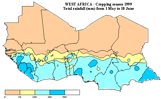
The first map indicates the total rainfall amount from 1st May
to 10th June. Data is extracted from FAO field reports and the RainFall Estimate
(RFE) Satellite Imagery as produced by NOAA/USGS/FEWS/USAID project. The RFE
images are obtained by interpolating various parameters recorded on the ground
and obtained through remote sensing measurements such as: rainfall, relative
humidity, wind speed, elevation, cold cloud temperatures.
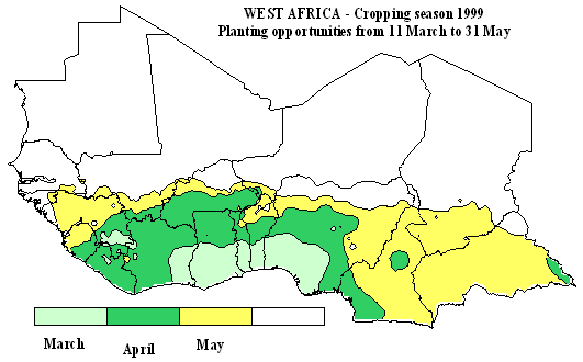
The map below shows the estimated planting time (opportunity)
as defined by the dekad (10-day) satisfying the following requisites: during
the first dekad, 25 mm of rainfall should be measured and a total rainfall
of at least 20 mm should be recorded during the two next dekads. Data used
for this analysis are from FAO field reports and RFE imagery.
Data source: NOAA - Prepared by: FAO, SDRN, Agrometeorology Group