![]()
![]()
During the summer of 1951 FAO organized a Land Utilization Conference in Ceylon for countries of the Asia and Far East Region which many foresters attended.
Summarizing its discussions, the Conference declared that the catchment area of a stream, large or small, was the natural unit for land development because of the importance to such development of the utilization and control of the flow of waters. It called attention to the need for international co-operation in developing the resources of catchment areas that served more than one country, thus echoing the plea of FAO's Mysore Forestry Conference of 1949.
The Conference affirmed that the basic facts about land, water and other resources - their inherent characteristics, potentialities and economic uses - should be sought and compiled in a comprehensive resource-inventory before decisions concerning their development were made. Such inventories should be the basis for planning the integrated development of a region and its varied resources.
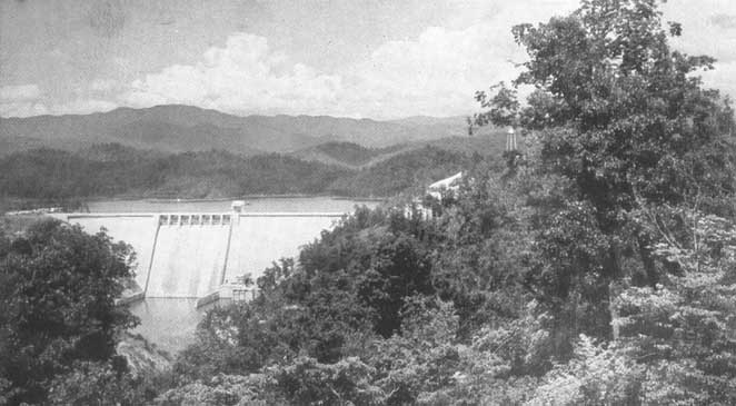
In this issue of Unasylva an article deals with what is, perhaps, the best known example of systematic integrated land development, that of the Tennessee Valley in the United States of America. Two years ago at the United Nations Scientific Conference on the Conservation and Utilization of Resources, Mr. H.L. Keenleyside (now Director of the United Nations Technical Assistance Administration) spoke of that project as follows:
"Conceived in something approaching desperation, authorized as a result of political courage and imagination of the highest order, executed by the people of the valley itself under the guidance of engineers and technicians and social scientists of unusual competence and conscience, guided from the beginning by an administration that was able to combine sound executive practices with adherence to democratic practices, the Tennessee Valley project is today a steadily increasing proof that political, social and scientific techniques can be successfully integrated for the permanent advantage of depressed humanity and the benefit of the nation."
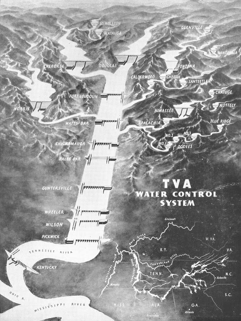
Schematic drawing of the TVA water control system. Topographical lay-out is shown bottom right.
![]()
![]()