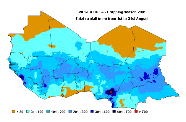
The first map indicates the total rainfall amount for the whole month of August. Data are extracted from the RainFall Estimate (RFE) Satellite Imagery as produced by NOAA/USGS/FEWS/USAID project. The RFE images are obtained by interpolating various parameters recorded at ground and obtained through remote sensing measurements as: rainfall, relative humidity, wind speed, elevation, cold cloud temperatures.
The map below shows the forecasted yield of millet for the Sahelian countries for the 2001 cropping season, as percent of the average yield of the last five years (1996-2000). The map is obtained by applying to each country a yield function which relates, in a statistical way for the period 1982 to 2000, the output parameters from the FAO crop specific water balance model to the crop yield. For 2001, the water balance model is using average rainfall from 1st September to the end of the crop cycle.
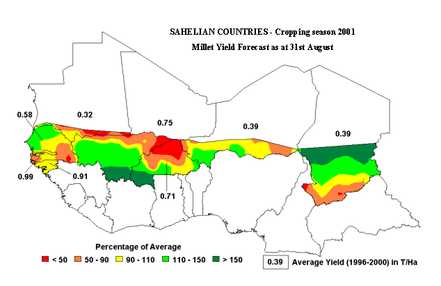
Data source: NOAA - Prepared by: FAO, SDRN, Agrometeorology Group