![]()
![]()
![]()
Till now we used polygon shapefiles, i.e. shapefiles that enclose a certain geographical area on a map. Another type of shapefile, often used, is a point shapefile. We explain the differences between the two with the following exercise.
1. Start ArcView, Open a New Project, and Open a New View. Add the Themes ‘Dist_catch_point.shp’ and ‘Dist_catch.shp’ from the folder: ‘08_Point_vs_Polygon’ in the CD.
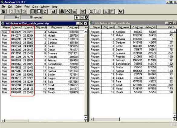
2. Open the two attribute tables of the Themes. You can see that exactly the same data are attached in these two separate tables (Figure 10.1). Still the characteristics of the two Themes are quite distinct.
3. Make a ‘Graduated Colour’ distribution of the ‘CPUE’ for both Themes. What do you see? (If you forgot how to do this, have a look at: Displaying two parameters in one Theme, page 19).
4. Make a multiple pie chart with ‘Migratory’, ‘Prawns’, ‘Brackishwater species’, and ‘Others’ with the pie size related to CPUE for both Themes. What do you see?
From the exercises we can conclude that the main characteristic of a Point is that it is related to an exact location on a map. The exact location of each data point is indicated by the X and Y coordinates in the attribute table of Catch_dist_point.shp (Figure 10.1).
FIGURE 10.1
Two Attribute Tables
Further we have seen that most types of displaying data of these different Themes are similar.
![]()
![]()
![]()