7 June 2024, Lagos - The Food and Agriculture Organization of the United Nations (FAO) organized a regional remote sensing survey workshop in Lagos, Nigeria, this week to support data collection for the Remote Sensing Survey (RSS) of FAO’s 2025 Global Forest Resources Assessment (FRA).
FRA provides essential information for understanding the extent of forest resources, their condition, management and uses across the globe.
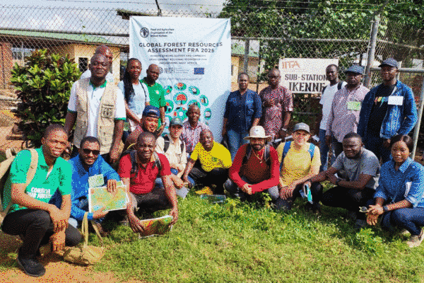
Experts from Nigeria, Ghana, Liberia and Sierra Leone attended the workshop from 3 to 7 June, which was organized for experts from anglophone West Africa with the assistance of the European Union and Norway’s International Climate and Forest Initiative.
"Anglophone West Africa has a major contribution to make to the global Remote Sensing Survey 2025," said Xavier De Lamo, FAO Forestry Officer. Building upon this, Pedro Vivar, Remote Sensing and Geographic Information System Specialist with FAO’s FRA, continued that “the contribution from the region’s experts, with their extensive field knowledge, is essential for better capturing complex land use change patterns occurring in the region, such as shifting cultivation.”
Setting the groundwork for regional data collection
Workshop facilitators provided an overview of the FRA 2025 methodology and implementation and provided lessons on the physics of remote sensing, theory of photointerpretation and FRA RSS methodology, terms and definitions.
The participants received guidance on setting up and configuring Collect Earth Online (CEO), a platform developed in collaboration with the National Aeronautics and Space Administration (NASA) and Google. Discussions focused on ensuring that the FRA RSS terms were correctly applied in the region with examples of typical land uses and land use transition patterns from each country. Approximately 250 RSS samples were collected by each participant within their country and region of expertise.
A field trip to the Institute of Agricultural Research Training (IAR&T) station in Ikene (Ogun State) involved a ground-truthing exercise in several locations that have undergone different forms of land-use change. The participants compared satellite images from the FRA 2025 RSS with the actual conditions on the ground for further practical instruction in image interpretation.
FAO’s global Remote Sensing Survey
Since 1948, FAO has conducted assessments of the condition, extent, management and uses of global forest resources. The assessments compile comprehensive country reports every five years from officially nominated national correspondents using a standardized methodology. The findings of these assessments provide evidence to inform the decisions and recommendations of civil society, the private sector, governments and international conventions.
First developed in 1990, the Remote Sensing Survey is used by FRA to assess the status and changes in forest area and other key land uses with satellite imagery. Using advanced remote sensing tools and satellite imagery has allowed FAO to produce independent and thorough analyses of forest area and how it changes over time at global, regional and biome levels.
Building on the success of the FRA 2020 RSS, which was presented at the World Forestry Congress in 2022, FAO is now conducting a new global survey which will provide up-to-date, reliable and consistent estimates of forest area and forest area change at regional, global and global ecological zones up to the year 2024. The FRA 2025 RSS will update data on variables from the previous cycle and collect new information on agroforestry systems, pastoral systems, types of crops, burned forests, mangroves and trees outside of forests.
Learn more
- Platform: Collect Earth Online
- Platform: FRA 2020 data
- Publication: FRA 2020 Remote Sensing Survey
- Website: FRA Remote Sensing Survey
- Website: Global Forest Resources Assessment
- Video: Insight into the Global Forest Resources Assessment process
- Video game: Forest Kids (available in six languages)