New manual aims to improve accuracy of mangrove monitoring

Rome - A new manual, produced by the Food and Agriculture Organization of the United Nations (FAO) and The Nature Conservancy (TNC), aims to help governments to gather far more accurate information on mangroves to better inform decisions on coastal land use and restoration.
Over 20 percent of mangroves are estimated to have been lost globally over the past 40 years, mainly due to both human activities and natural retraction, although the rate of loss is slowing.
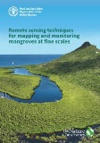
The new manual, Remote sensing techniques for mapping and monitoring mangroves at fine scales, was launched at the Greening with Mangroves side event during World Forest Week in Rome on the International Day for the Conservation of the Mangrove Ecosystem.
“Mangrove ecosystems play a unique and critical role for nature and people,” said Zhimin Wu, Director of FAO’s Forestry Division. “But because they grow at the fringes of land and sea, often in narrow stretches around small islands, they can be hard to measure. It is vital that better techniques for monitoring mangroves are developed so that we can conserve, restore and sustainable manage this precious natural resource.”
Mangroves around the world
There are 14.8 million hectares of mangrove around the world, scattered across 123 countries, according to FAO’s recent publication The World’s Mangroves, 2000-2020.
They provide food and livelihoods for coastal communities, protect coastlines against natural disasters and harbour biodiversity. They can store four to ten times more carbon per hectare as terrestrial forests.
But due to the risks they face, the need for robust information on the status and changes to mangroves is increasingly recognized. Most datasets on mangroves are based on medium-resolution satellite imagery, which fails to detect many narrow and fringing mangroves common on small islands. In addition, in many countries, there is a lack of local resources and technical capacity to map and monitor mangroves at a local scale.
Guidance for mangrove resource managers
The new manual aims to overcome these challenges, providing guidance for mangrove resource managers on building capacity and using the latest mapping and monitoring technology.
Unmanned aerial systems are becoming a popular tool for local scale monitoring and the manual provides a current inventory of available platforms and sensors as well as mission planning applications and postprocessing solutions.
There is guidance on assessing mangrove condition and change and options for online data resources and open-source software for low budget projects. And there are case studies on estimating mangrove extent, structure, condition and change using a range of remote sensing-derived sources focused on <5m spatial resolution.
“This manual should help resource managers make the best decisions on methods for mapping and monitoring mangroves based on project needs and available budget,” said FAO Forestry Officer Kenichi Shono, who coordinated the publication. “It will enable the collection of data that informs conservation decision-making, guiding the planning of mangrove restoration and protection. Ultimately it should lead to enhanced management and conservation of mangroves.”

