Agriculture provides direct livelihoods for 2.5 billion people globally and feeds the entire planet. By 2050, as populations grow and diets change, the sector must produce 49 percent more food than in 2012. Yet climate change, biodiversity loss, land degradation, water scarcity, pollution and many other challenges are hampering efforts to feed the planet.
The 2030 Agenda for Sustainable Development calls upon everyone to address these issues. Sound and timely data is key to inform and guide decision makers as we take meaningful and effective action. Geospatial data (simply defined as information with a geographical component), methods and tools are essential in providing this key data for agriculture.
The Food and Agriculture Organization of the United Nations (FAO) has more than 50 years of experience in the development and use of geospatial data, methods and tools, which are applied to local, national, regional, and global sustainable development planning and implementation. FAO helps countries implement appropriate geospatial solutions, assisting their efforts to create sustainable agrifood systems, organizing and delivering this work to Member Nations through projects and programmes carried out at FAO headquarters and regional, subregional and national offices. In this way, FAO ensures the adoption and implementation of best practices and standards.
Focus areas
Main data and tools
Recent publications
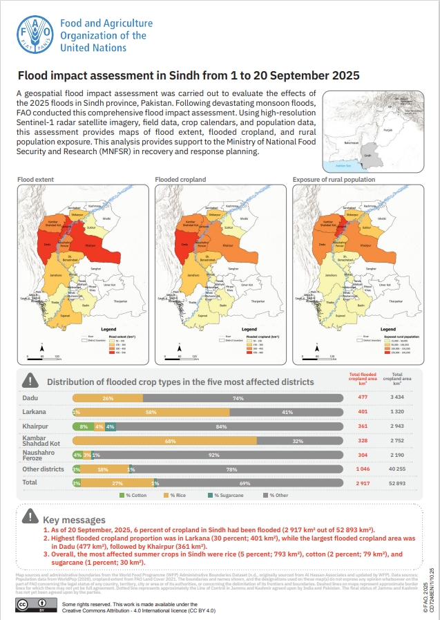
Flood impact assessment in Sindh from 1 to 20 September 2025
06/11/2025
This one-pager presents a geospatial assessment of the 2025 monsoon floods in Sindh, Pakistan (1–20 September). Using Sentinel-1 SAR observations, FAO Land Cover 2021 cropland extent, crop calendars and WorldPop 2020, it maps flood extent and quantifies flooded cropland overall and by rice, cotton, sugarcane and other crop types, with district-level statistics and rural population exposure.
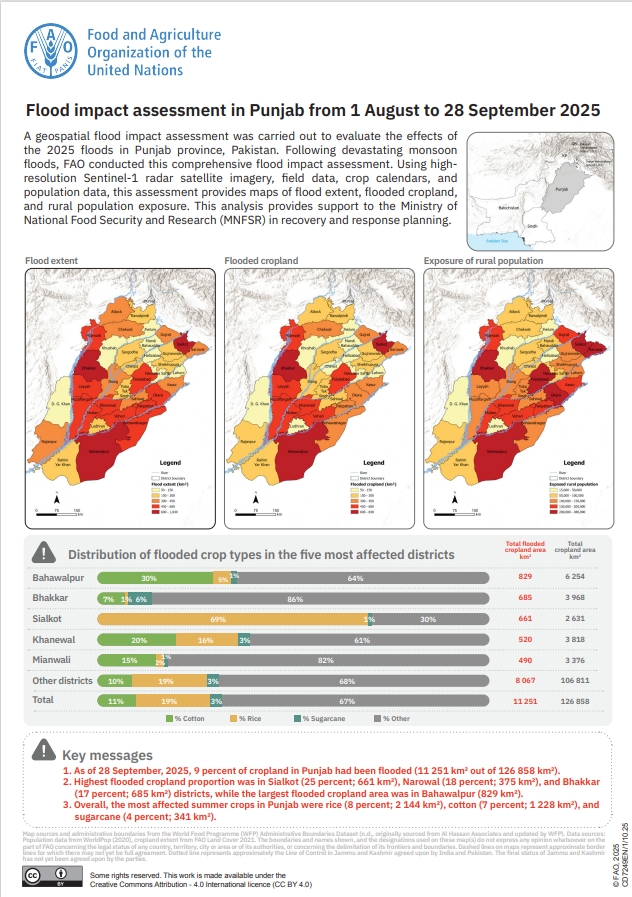
Flood impact assessment in Punjab from 1 August to 28 September 2025
06/11/2025
This one-pager presents a geospatial assessment of the 2025 monsoon floods in Punjab, Pakistan (1 August–28 September). Using Sentinel-1 SAR observations, FAO Land Cover 2021 cropland extent, crop calendars and WorldPop 2020, it maps flood extent and quantifies flooded cropland overall and by rice, cotton, sugarcane and other crop types, with district-level statistics and rural population exposure.
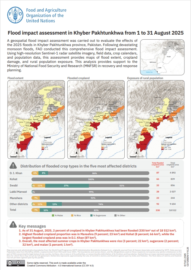
Flood impact assessment in Khyber Pakhtunkhwa from 1 to 31 August 2025
06/11/2025
This one-pager presents a geospatial assessment of the 2025 monsoon floods in Khyber Pakhtunkhwa, Pakistan (1-31 August). Using Sentinel-1 SAR observations, FAO Land Cover 2021 cropland extent, crop calendars and WorldPop 2020, it maps flood extent and quantifies flooded cropland overall and by rice, cotton, sugarcane and other crop types, with district-level statistics and rural population exposure.

Damage to agricultural wells due to the conflict in the Gaza Strip as of 26 September 2025
31/10/2025
Utilising a baseline agricultural wells layer and very high-resolution satellite imagery, FAO conducted an assessment of the number of agricultural wells damaged in the Gaza Strip as a result of the recent conflict escalation. The number of damaged agricultural wells was calculated based on their location within a 15-metre radius area around a damaged site.
Events
Related links
- FAO Land and Water
- Land Resources Databases/Information Systems
- Aquamaps
- WaPOR
- GLOSIS
- Earth Observation
- National Forest Monitoring Systems
- Fisheries and Resources
- Food and Agriculture Microdata Catalogue (FAM)
- Global Livestock Environmental Assessment Model (GLEAM)
- United Nations Office for Outer Space Affairs (UNOOSA)
- The International Charter Space and Major Disasters


