Events
From 24 February 2023 to 27 February 2023

The Food and Agriculture Organization of the United Nations (FAO) with the Indonesian Ministry of Agriculture (MoA), organized terminal workshop on the project “Strengthening Digital Agricultural Monitoring Capacities Using E-agriculture (TCP/INS/3805)” during 24 to 27 February 2023 in...
From 22 February 2023 to 22 February 2023
To make the benefits of a national LiDAR dataset a reality in Bangladesh, multiple users and donors will need to come forward for financial and technical support. Data and knowledge sharing among national institutions...
From 16 February 2023 to 16 February 2023
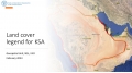
A technical meeting has been held on 16 February 2023 in Saudi Arabia. The objective of this meeting is to discuss the need of harmonized land cover representation system...
From 06 February 2023 to 09 February 2023

The FAO Geospatial Unit is providing technical assistance to the project “Gums for Adaptation and Mitigation in Sudan (GAMS): Enhancing adaptive capacity of local communities and restoring carbon sink potential of the Gum Arabic belt, expanding Africa’s Great Green Wall...
From 30 January 2023 to 30 January 2023

Registration link available here
Interested in digital platforms and tools for more effective forest and land monitoring?
Learn how to use SEPAL.
To support knowledge and skills development to operationally apply high-resolution satellite imagery to critical forest and land monitoring in tropical...