Events
From 21 November 2023 to 22 November 2023

The National Consultative Workshop on the Soil-Land-Water Digital Information System (SoLaWISe) project was conducted in Maputo by the Food and Agriculture Organization of the United Nations from November 21st to 22nd, 2023. Mozambique serves as a pilot country for the...
From 20 November 2023 to 22 November 2023

Following the first consultation on land cover mapping in October 2023, the Food and Agriculture Organization of the United Nations is organizing a three-days technical workshop on the use of land cover classification system from 21-23 November 2023. This workshop...
From 24 October 2023 to 27 October 2023
The National Consultative Workshop on implementation of the Soil Land and Water Information System (SoLaWISe) initiative was organized by the Food and Agriculture Organization of the United Nations in Tunis from October 24th to 27th, 2023. Tunisia serves as a...
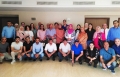
From 24 October 2023 to 24 October 2023

The National Consultative Workshop on the Use of Geospatial Solutions for Agricultural Development in The Gambia, organized by the Food and Agriculture Organization of the United Nations took place in Banjul on the 24th October, 2023.
The workshop aimed to facilitate...
From 18 October 2023 to 19 October 2023

Join us for an exciting interactive experience and demo of AgroAdapt: Cultivate the Future! This simulation game, developed in collaboration with FAO Office Climate Change Biodiversity, FAO Land and Water Geospatial Unit, FAO Office of Innovation and FAO Regional Office...