Actos
Aquí encontrará información sobre los próximos actos, seminarios, reuniones y conferencias sobre cuestiones geoespaciales organizados por la FAO o en los que la FAO toma parte activa.
From 06 April 2022 to 06 April 2022
The complex task of plantation activities ranging from location identification, participatory mapping, coordination among the implementing agencies and final roll out of the field intervention passes through a rigorous process under the direct supervision of the Energy and Environmental Technical...
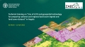
From 05 April 2022 to 05 April 2022
From 24 March 2022 to 24 March 2022
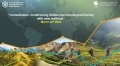
A virtual consultation on the update of the methodology for the new Global Agro-Ecological Zoning is organized by the Food and Agriculture Organization of the United Nations (FAO) and the International Institute for Applied Systems Analysis (IIASA), in collaboration with...
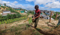
From 02 March 2022 to 11 April 2022
The project Sustainable Land Management in target landscapes of Central Angola (GCP/ANG/055/GFF) aims at strengthening technical capacities and revert land degradation trends in agriculture. Under this project, a one-month training programme from March 2nd to April 11th 2022 on land...
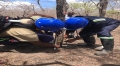
From 24 January 2022 to 03 March 2022
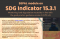
FAO in collaboration with Guyana Lands and Surveys Commission (GLSC) organizes two four-day long online trainings on January 24-27th and February 28-March 3d, 2022 on “Use of SEPAL platform for assessment and monitoring of land degradation and restoration activities”.