Activités
Vous trouverez ici des informations sur les manifestations, séminaires, réunions et conférences qui seront prochainement organisés par la FAO ou auxquels la FAO participe activement.
From 02 December 2022 to 02 December 2022
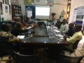
A national consultation to establish the technical working group for the establishment of the national early warning system of Central-Africa is organised on December 4th in Bangui. With national representatives from the Direction Générale de la Météorologie, Direction Générale...
From 29 November 2022 to 02 December 2022

The Food and Agriculture Organization of the United Nations (FAO) with the Asian Institute of Technology (AIT), and in collaboration with the International Institute for Applied Systems Analysis (IIASA) is organizing a virtual training on the updated version of the...
From 28 November 2022 to 28 November 2022

The Food and Agriculture Organization of the United Nations (FAO) with the Asian Institute of Technology (AIT), and in collaboration with the International Institute for Applied Systems Analysis (IIASA) will launch the updated version of the PyAEZ Python package (PyAEZ...
From 28 November 2022 to 30 November 2022
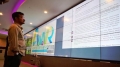
The Food and Agriculture Organization of the United Nations (FAO) with the Indonesian Ministry of Agriculture (MoA), is organizing a training on Operationalization Mobile Application and Dashboard from 28 to...
From 24 November 2022 to 24 November 2022

A technical training on using geospatial technologies, mapping and delineating intervention areas for the Forest and Farm Facility (FFF) in Kenya was organized on 24 November 2022. A total of twelve participants, ten from six forest and farm producer...