Мероприятия
В настоящем разделе представлена информация о предстоящих мероприятиях, совещаниях и конференциях, посвященных применению геопространственных технологий, организатором или активным участником которых является ФАО.
From 29 September 2021 to 29 September 2021

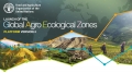
Making informed decisions with new data on agro-ecological zones
Where do which crops grow best? What potential yields are possible in a future warmer climate?
Geospatial data from the new Global Agro-Ecological Zoning version 4 (GAEZ v4) can help IFAD-projects make informed...
From 17 June 2021 to 17 June 2021
As the world population is expected to reach 8.6 billion in 2030, 9.8 billion in 2050, more efforts and innovations are needed in order to sustainably increase agricultural production, improve the global supply chain, decrease food losses and waste, and...
From 28 December 2020 to 29 December 2020
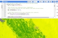
Land cover, or land use information, plays an important role for many environmental and monitoring tasks and challenges. These include climate change, ecosystem dynamics analysis, food security among others. Accurate information about land cover affects the accuracy of...
From 15 October 2020 to 30 November 2020
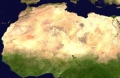
Recognizing the role of land use change in combatting climate change, many African countries are implementing strategies to halt deforestation and manage their land resources sustainably. National land monitoring systems are essential for these countries, as they provide...
From 01 September 2020 to 30 September 2020
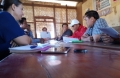
While the Covid-19 pandemic radically changed our approach to support and implement capacity development activities, FAO has reacted to the new challenges and needs by continuously adapting and developing innovative approaches.
Within the Ministry of Agriculture in...