活动
在此可了解粮农组织即将举办或即将积极参加的地理空间领域活动、研讨会、会议的相关信息。
From 26 July 2022 to 26 July 2022
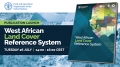
The Food and Agriculture Organization of the United Nations (FAO) in close collaboration with the Agrometeorology, Hydrology and Meteorology Regional Center (AGRHYMET), the Economic Community of West African States (ECOWAS), the Observatoire du Sahara et du Sahel (OSS) and SERVIR...
From 25 July 2022 to 25 July 2022

A stakeholder consultation on the identification and prioritization of geospatial indicators for monitoring the progress of the Forest and Farm Facility (FFF) in Nepal was organized on 25 July 2022. This consultation brought together stakeholders from the Ministry of Forests...
From 14 July 2022 to 14 July 2022
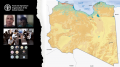
FAO Geospatial Unit and the Libyan Center for Remote Sensing and Space Science also known as LCRSSS organize a natoinal consultation on land cover and crop-type mapping in Libya on 14 July 2022. The consultation is dedicated to national experts from...
From 11 July 2022 to 13 July 2022
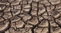
From July 11 to 13, a technical training on Assessment and Monitoring of Land Degradation using the cloud computing platform SEPAL was organised. The SEPAL module for analyzing SDG indicator 15.3.1, the proportion of land that is degraded draws on three...
From 09 June 2022 to 09 June 2022

A virtual training on the use of the open source application PyAEZ for Agro-Ecological Zoning is organized on 9 June 2022. The training is dedicated to national experts from the Department of Agricultural Land Management of the Ministry of Agriculture...