活动
在此可了解粮农组织即将举办或即将积极参加的地理空间领域活动、研讨会、会议的相关信息。
From 09 November 2021 to 09 November 2021
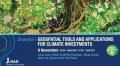
As changing climates affect farming conditions across the world, how can geospatial and remote sensing tools
help IFAD and others decide on where adaptation investments are best needed and what impact these
interventions will have? You can register to the sharefair here.
From 01 November 2021 to 04 November 2021
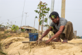
Trees and forests in Bangladesh provide a wealth of resources in the form of nutrition, energy, medicine and materials which local communities heavily depend on. They are also valued for their contribution to soil and water protection, carbon sequestration and...
From 25 October 2021 to 29 October 2021

The second training focus on the use of a cloud-platform (Google Colab) on running the Python code to generate AEZ outputs. It covers the various modules implemented in AEZ on agro-climatic analysis, crop-modelling, limiting factors on climate, soil and terrain...
From 18 October 2021 to 22 October 2021
FAO has developed a module in the SEPAL platform based on the UNCCD’s GPG to make calculate the SDG indicator 15.3.1 at local and national scale. The interface is simple and intuitive, however to properly interpret the result an understanding...
From 11 October 2021 to 15 October 2021

This training aims to explain the conditions, limitations and steps to implementing a national AEZ. It explores the basic concepts and definitions found when working with agro-ecological zoning, and the relationship with land evaluation and land use planning. It also...