المشاريع
يمكن الاطلاع هنا على المشاريع الجارية المتعلقة بالرصد الزراعي وتقييم الغطاء الأرضي والتي أعدّتها المنظمة باستخدام المنهجيات والأدوات الجغرافية المكانية.
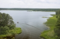
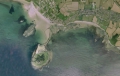
The Lao People’s Democratic Republic (PDR) is a landlocked country with a total area of 236,800 square kilometers and an estimated population of 6,803,699 in 2014, up from 4,574,848 in 1995. Its 2013 Human Development Index ranked 139th worldwide, and...
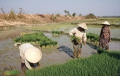
The main objective of the project Strengthening agro-climatic monitoring and information systems (SAMIS) to improve adaptation to climate change and food security in Lao PDR is to en-hance monitoring, analysis, communi-cation and use of agro-meteorological data and...
15 November 2014
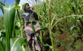
The project aimed to increase the resilience of Lesotho’s food and nutrition security through the upscaling of climate smart agriculture and a functional Land Resources Database (LRD).
A functional LRD and evidence-based decision-making tools are essential...
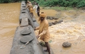
DECCMA is a 5-year, CAD$13.5 million program of applied research on the adaptation options, limits and potential in deltaic environments to weather varia-bility and extremes, funded by the International Development Research Centre. The project runs from February...
01 November 2013
SIGMA is part of Europe’s contribution to GEOGLAM (Group on Earth Observations Global Agricultural Monitoring Initiative) in a common effort to enhance current remote sensing based agricultural moni-toring techniques. SIGMA is financed through FP7 – the European...