Publications
Atlas of Malawi Land Cover and Land Cover Change 1990-2010
10 October 2013
10 October 2013
The Atlas of Malawi, land cover and land cover change (1990s-2010s) provides information on land cover resources, their distribution and changes over time, at national, regional and district levels. The administrative unit layer,...
Land cover atlas of Fouta Djallon Highlands
07 November 2012
07 November 2012
The Fouta Djallon Highlands (FDH) has a rich natural environment and important ecosystems. Over the last decades, a number of growing threats have been contributing to the decline of its natural values. Land cover assessment...
Land Cover Atlas of Sudan
27 March 2012
27 March 2012
The Sudan Institutional Capacity Program: Food Security Information for Action (SIFSIA) aims at strengthening human, physical and institutional capacity in analysing, designing, monitoring and evaluating food security policies and programs.
The production...
Land Cover Atlas of the Republic of South Sudan
14 February 2012
14 February 2012
In the framework of the FAO-SIFISIA program, the land cover database of South Sudan, already created under the GLCN East Africa Module (Africover, circa 2000), was targeted for update. The new dataset provides...
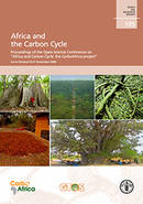
Africa and the Carbon Cycle
15 June 2011
15 June 2011
This publication contains a peer-reviewed selection of articles derived from presentations and posters shown at the Open Science Conference Africa and Carbon Cycle, Accra, Ghana (25-27 November 2008). The conference brought together about...


