Water accounting
Water use and productivity assessment in agriculture through remote sensing
Water accounting is the systematic study of the current status and trends in water supply, demand, accessibility and use. Water accounting provides the foundation of sound water management decisions: “You can’t manage what you don’t know." Given the fugitive nature of water, water accounting is a great challenge. Particularly, quantifying the use of water in agriculture is challenging, but of major importance, as agriculture globally represents 70 percent of water withdrawals.
Given the scarcity of land and water resources, global strategies to increase food production need to focus efforts on increasing production per unit resources, i.e. the combined increase of production per unit land surface (yield expressed in kg/ha) and the increase of production per unit water used (water productivity expressed in kg/m³). Closing land and water productivity gaps is a complex task which requires: (i) monitoring of current levels of productivity in various crop production systems; (ii) assessment of observed productivity relative to potential; (iii) identification and analysis of the underlying causes of the productivity gaps; and (iv) evaluation of options and identification of viable solutions to close the productivity gaps in the local context.
FAO’s open-access database WaPOR uses into a wealth of satellite data to help farmers optimize irrigation systems and achieve more reliable agricultural yields. WaPOR produces maps that show how much biomass and yield is produced per cubic meter of water consumed. The portal also allows for direct data queries, time series analyses, area statistics and data download of key variables associated to water and land productivity assessments, from a catalogue of more than 6 000 data layers, with direct access through application programming interfaces (APIs). Maps are available at resolutions of as high as 30 to 250 meters and updated every one to ten days.
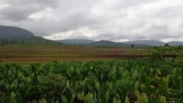
The KnoWat project helps develop the WaPOR portal in pilot areas of Rwanda, Senegal and Sri Lanka where data is not yet available. KnoWat will also build capacities at national, basin, scheme and farm levels to use and manage geospatial data with a view to improving water management and water productivity.
- At national and basin levels, government agencies involved in water resources planning and management can use the information provided by WaPOR to improve water balances, monitor resource use and promote efficient use of their natural resources.
- At scheme and farm level, irrigation authorities and water user groups can make use of WaPOR information to modernize their irrigation schemes and improve water productivity. WaPOR opens the door for extension agencies, water user groups and service-providers to assist farmers in obtaining more reliable yields and improving their livelihoods.