 Mali
Mali
Latest news related to Mali

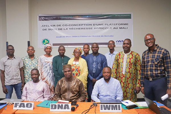
Workshop to co-design an agricultural drought monitoring platform in Mali
21/03/2024
The International Water Management Institute (IWMI), in collaboration with the Direction Nationale de l'Agriculture (DNA) and with the support of FAO, have organized a workshop to co-develop an agricultural drought monitoring and management platform using WaPOR remote sensing data.
...

Regional training workshop "QGIS for water productivity analysis" from 26 to 29 February 2024 in Algiers
26/02/2024
Within the framework of the implementation of the activities of the project "Monitoring land and water productivity by remote sensing WaPOR phase 2" financed by the government of the Netherlands, a regional QGIS training for water productivity analysis is organized by the Food and Ag...

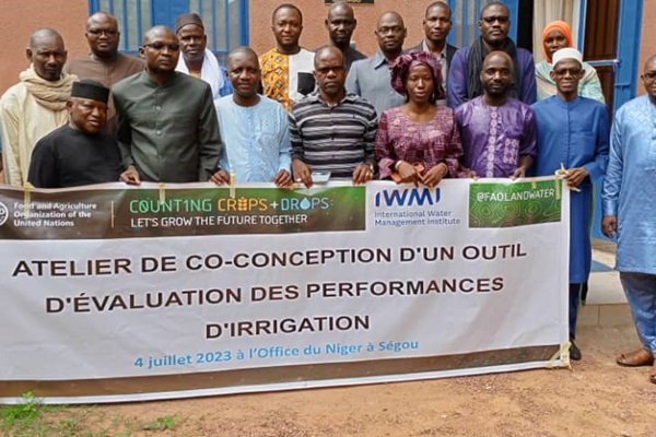
Irrigation performance tool co-creation workshop in Ségou, Mali
04/07/2023
On Tuesday, 4 July 2023, the WaPOR project organized a workshop in Ségou, Mali, to design a performance evaluation tool for the Office of Niger. Office water management officers, GIS specialists, as well as representatives from FAO, IWMI and the WaPOR project, participated in the workshop/
...
Resources and links
About Mali
Mali, with an area of 1,241,238 km², is a landlocked country of 20.9 million inhabitants, almost half of whom are under 15 years old, located in the central Sahel region. It is classified as a least developed country by the United Nations Development Programme (UNDP), with a GDP per capita of US$891 (source: World Bank). Women represent 52 per cent of the rural population and 64.2 per cent of them live below the poverty line (source UNDP Mali, Gender Strategy and Action Plan 2018-2020).
According to the latest available studies, the availability of water resources in Mali is not a problem in itself. Indeed, Mali is crossed by two of the main rivers of the sub-region, the Niger and the Senegal. However, this resource is very unevenly distributed, and some regions (notably Kayes) offer sometimes dismal success rates for drilling campaigns.
Mali's economy is heavily dependent on the primary sector, which is the engine of development, with agriculture accounting for 45% of GDP, employing 80% of the total population and providing more than 75% of export earnings. However, it is constantly subject to climatic hazards, the degradation of natural resources (degradation of soil, water, air, vegetation, biodiversity, climate, etc.) and the deterioration of the terms of trade (continuous fall in the price of agricultural exports), thus limiting the increase in the income of the rural population and exposing the population, particularly young people, to immigration.
Project milestones:
October 2021: project inception workshop
June 2022: WaPOR training in Bamako
11 October 2022: WaPOR data validation workshop
July 2022, March 2023: workshops on the use of WaPOR data for pastoralism
Pilot Zones :
The pilot site for the WaPOR project in Mali is the Office du Niger. It was established on January 5, 1932, and occupies the western part of the central delta of the Niger River. It received a mandate from the State to manage land and infrastructure within the perimeter. The project was initially set up for the development of 960,000 hectares. It has a potential area of 1,907,406 hectares that can be developed for gravity irrigation. The combined effect of low development rates and high land demand limits the possibility of increasing the size of plots allocated to farmers.
During the 2021-2022 agricultural season, the Office du Niger comprised 90,036 family farms spread across 420 villages, with a total population of 634,977 inhabitants, including 331,010 women (52.13% of the total population) and 303,967 men (47.87% of the total population).
This population is predominantly young, with an average age of 20 years.
WaPOR partnerships in Mali
The WaPOR project partners are:
- the Ministry of Rural Development which formulates and implements the national agricultural policy in Mali. A WaPOR focal point has been designated to facilitate collaboration between WaPOR and its decentralised services.
- the Ministry of Environment, Sanitation and Rural Development which is in charge of environmental management, especially the management of river basins and major infrastructures.
- the National Directorate of Agriculture which is responsible for developing the different elements of the national agricultural policy and ensuring the coordination and control of its implementation. To this end, it is responsible for designing and monitoring the implementation of measures and actions to increase production and improve the quality of agricultural, food and non-food goods;
- the Office du Niger which is the largest irrigated area in Mali. This area is administered by a state service which is also called Office du Niger. Its mission is to
- manage the water of the scheme,
- manage and operate the maintenance of the facilities and infrastructures,
- manage the land among its users,
- provide advice and assistance to the farmers in terms of supplies, inputs and agricultural equipment.

© S. Maines

