Key documents

The dimensions of water productivity
10/2022
This document presents the different dimension of water productivity, and shows how remote-sensing data, including WaPOR data, can be helpful in monitoring it at different scales. The document illustrates these different dimensions through on a series of case studies.

Water productivity analyses using WaPOR: the case of sugarcane
04/2022
This document explores the use of WaPOR data in the context of sugarcane production. Two different case studies of sugarcane estates are explored: the case of Wonji, in Ethiopia, and the case of Xinavane, in Mozambique.

Map story: WaPOR data for groundwater monitoring
03/2022
This map story explores the potential of the use of WaPOR data to assist in the monitoring of groundwater abstraction in the Azraq basin, a basin that is the second most exploited in Jordan. Also, it goes to show the potential of pyWaPOR as a tool to extend the coverage of higher resolution WaPOR data to new areas of high relevance.

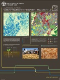
Map story: the use of WaPOR data in the cultivation of sugarcane
08/2021
This map story shows the way that productivity analysis can be carried with WaPOR data in order to understand the spatially explicit attainable water and land productivities of an area of interest, identify the zones where these productivities are met and derive from that analysis best practices to increase the productivity of the area as a whole with the goal of producing more while using less water.

WaPOR 2: using remote sensing in support of solutions to reduce agricultural water productivity gaps
07/2021
This flyer introduces WaPOR to potential users and to stakeholders involved in WaPOR projects. It sheds light both on the project itself and the portal that contains the data. It is also available in French, Portuguese, Spanish and Arabic.

WaPOR and ICT
04/2021
This leaflet deals with the use of ICT (information and communication technologies) in agriculture as extension and advisory services using concrete examples of applications that use WaPOR data.

WaPOR for water accounting
11/2020
Water accounting is one tool that can assist with facing the challenges related to the sustainable use of our finite freshwater resources and it can be supported by easily-available open-access data. This case study aims to show how WaPOR (FAO’s portal to monitor Water productivity through open access of remotely sensed derived data) data can be used to support water auditing processes at different scales: the basin, the national scale and the subnational/scheme scale.


