土地资源规划工具箱
该类工具在土地评估过程中突出了生物自然属性(气候、土壤、地形、水等)及其相互作用。大多数情况下,主要基于生物自然属性的输出结果会引导用户选择合适的土地利用方案。土地适宜性和相似性分析是典型的例子。包括描述土地评价的原理、方法和准则的文件,以及基于特定用途、能力或潜力、肥力限制和管理、产量、生产力、物理和化学性质的不同的土壤分类工具。复杂或简化的作物生长和产量预测模型也属于这一类。
该类工具利用生物自然特征和社会经济条件作为输入信息,并通常包括参与式土地利用规划的原理、方式和方法,其总体目标是实现所有利益相关者互利共赢。
该类工具突出了土地利用规划所需要的社会和经济环境特征,包括参与决策的方式和方法。这些工具也可以考虑生物自然条件,但不作深度考虑。

该类包括可促进土地评价和土地利用规划的数据库,通过为这些过程提供输入信息而实现。这些数据库提供了多种地图和数据,包括土壤和地形特征、土地退化、土地覆盖、土地利用、气候数据(包括未来的预测)、作物和产量、粮食、农业、水资源、植物物种对特定环境的适应性/适宜性、关于贫穷、人口、职位和性别的社会经济数据和统计数据

该类工具并不产生直接用于土地评估和土地利用规划的结果。但它提供了各种类型的数据,可用于土地评价研究和作为土地利用规划的输入数据集。
Number of records: 171

The global map of urban extent has a spatial resolution of 15 arc-seconds (about 500 m) and was obtained from MODIS imagery through a supervised decision tree classification algorithm using region-specific parameters. It provides a consistent and seamless map of urban, built-up and settled areas for...
Type: Maps/GIS
Scale: Global, Regional
Thematic areas: Land use/cover
User Category: 技术专家

The TerrAfrica partnership between FAO, the World Bank, NEPAD and other implementing agencies offers a knowledge platform for sharing lessons and developing tools and learning materials for scaling up and mainstreaming sustainable land management (SLM) into development planning and relevant sectoral and investment plans, portfolios and...
Type: Documentation/Manuals,Framework/Guidelines
Scale: National, Sub-national/Province/District, Watershed/Basin/Landscape
Thematic areas: Land management/planning
User Category: 技术专家, 科学顾问, 政策制定者
The Spatial Planning and Monitoring of Landscape Interventions (SPMLI) publication is one of the training manuals developed as part of the TerrAfrica program. It is designed to stimulate the use of maps in cross-sectoral collaborations to locate, design and monitor interventions in rural landscapes. The manual provides guidance on...
Type: Documentation/Manuals,Framework/Guidelines
Scale: Locality/Farm/Site, Watershed/Basin/Landscape
Thematic areas: Land management/planning
User Category: 技术专家, 协助人员, 利益相关者

The Self-evaluation and Holistic Assessment of Climate Resilience of Farmers and Pastoralists (SHARP) is a tool developed by FAO, available as a tablet or smartphone app, that enables smallholder farmers and pastoralists to assess their own climate resilience. The SHARP tool is implemented in three phases:
(1)...
Type: Questionnaire/Survey
Scale: Locality/Farm/Site
Thematic areas: Climate, Farming systems
User Category: 协助人员, 利益相关者
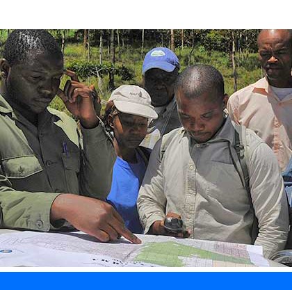
Rapid Rural Appraisal (RRA) is generally described as a systematic but semi-structured activity carried out in the field by a multidisciplinary team, designed to obtain new information and to formulate new hypotheses about rural life. The RRA methodology was developed to overcome the disadvantages of formal survey methods in rural...
Type: Framework/Guidelines
Scale: Locality/Farm/Site, Watershed/Basin/Landscape
Thematic areas: Farming systems
User Category: 技术专家, 协助人员
Participatory video (PVIDEO) is a process in which a group or community creates their own film. PVIDEO differs from conventional documentary making in that the subjects themselves shape issues according to their own sense of what is important, and that they control how they will be represented. The idea behind...
Type: Educational materials
Scale: Locality/Farm/Site
Thematic areas: Social - participatory approaches
User Category: 利益相关者
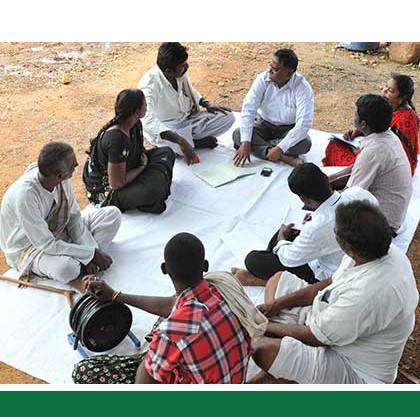
Participatory and Negotiated Territorial Development (PNTD) is an approach that aims to promote a systemic territorial development by improving trust among social actors and strengthening social cohesion. PNTD fits within the array of participatory, bottoms-up approaches that have emerged over the last 30 years in response to the failure...
Type: Framework/Guidelines
Scale: Sub-national/Province/District, Locality/Farm/Site, Watershed/Basin/Landscape
Thematic areas: Social - participatory approaches
User Category: 技术专家, 协助人员, 利益相关者
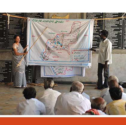
This FAO Working Paper is the synthesis of a workshop on Participatory Land Use Planning (PLUP) and provides guidelines for facilitators of similar workshops on the PLUP theme. PLUP is defined as the systematic assessment of physical, social and economic factors in such a way as to encourage and assist...
Type: Framework/Guidelines
Scale: Sub-national/Province/District, Locality/Farm/Site, Watershed/Basin/Landscape
Thematic areas: Land management/planning, Social - participatory approaches
User Category: 协助人员
This FAO publication explains concepts relevant to integrated planning, important elements to consider in such approach, issues to be resolved, objectives and implementation, and institutional aspects .Key concepts for Integrated planning are defined: land, land resources and other environmental resources to be considered in land use planning, zoning and links...
Type: Framework/Guidelines
Scale: National, Sub-national/Province/District, Locality/Farm/Site, Watershed/Basin/Landscape
Thematic areas: Land management/planning
User Category: 政策制定者
Land and Water Division Working Paper 6 explains the rationale for the four key principles of participatory planning of natural resource management through the Participatory and Negotiated Territorial Development (PNTD) approach: (1) integrated approach; (2) decentralization; (3) participation; (4) negotiation. 1) Need for integration The need for an integrated approach...
Type: Framework/Guidelines
Scale: National, Sub-national/Province/District, Locality/Farm/Site, Watershed/Basin/Landscape
Thematic areas: Social - participatory approaches
User Category: 政策制定者