Easy-to-use tools empowering communities to record tenure rights
Who needs Open Tenure?
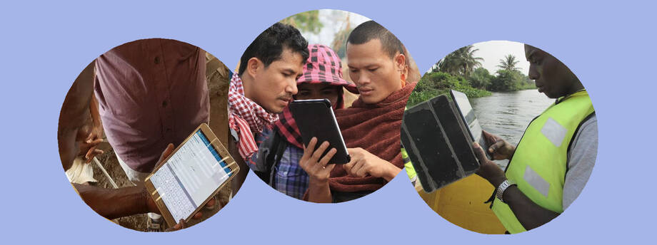
Open Tenure supports in-the-field collection of tenure related details as performed by communities. Once the community has discussed and agreed to the means of data collection, claims of tenure rights will be gathered, moderated and displayed on the Community Server, which can be established as a local or cloud-based server. Before proceeding with data collection, community members with specific roles will be trained and instructed.
Open Tenure as a data collection and processing tool can be used at different levels and for different purposes. It can be used by local communities to establish land registries or other types of tenure (e.g. forestry). It can also be used by NGOs to assist and facilitate different communities in securing tenure rights. Because of similarities with systematic registration processes, land tenure institutions can use this tool. Compared to SOLA applications, Open Tenure was designed to have minimum or zero customization efforts, focusing more on configuration tasks. This simplifies implementation, avoiding the hiring of software development experts. If a country is looking for Open Tenure implementation, it can use Open Tenure deployment checklist, prepared by FAO to assess country/community readiness and provide further recommendations.
Online resources
For developers:
Open Tenure
- Date: December 2020
- Source code version: version 1.15
- Source code repository: https://github.com/OpenTenure/ot-android-studio/
- Changes from previous version: source code quality improvement, libraries updates, improved technical documentation
Community Server
- Date: December 2020
- Source code version: version 1.4
- Source code repository: https://github.com/OpenTenure/
- Changes from previous version: simplified installation (available at https://github.com/OpenTenure/Docker/), source code quality improvement, libraries updates, improved technical documentation
- License
Source Code Repositories
- Open Tenure and Community Server source codes (https://github.com/OpenTenure)
- SOLA Web Admin source codes (https://github.com/SOLA-WA-FAO)
- Open Tenure mobile application (Search Google Play on your device)
Technical Documentation
- SOLA Community Server & Open Tenure Administration Guide
- CS Installation Docker Quick Reference Guide
For users:
- Open Tenure mobile application (Search Google Play on your device)
Click to view recording stages of tenure rights
Click to view recording stages of tenure rights
Typically the recording of tenure rights will include the following stages:
- Community information dissemination;
- Community Recorders download details of existing tenure rights and fit-for-purpose map imagery;
- In-the-field recording of claim details including mapping of claims and the collection of document images and photos;
- Upload claims to Community Server;
- Display of claims and the potential submission of challenges to claims on the Community Server;
- Review of claims (and associated challenges);
- Moderation of claims (community endorsed) including modification of claims based on community based consensus;
- Publishing of community endorsed tenure rights on Community Server.
- Key features of Open Tenure mobile application:
- Fully open source, based on best practices and well-known platforms and tools;
- Multilingual – currently supports 10 languages (English, Arabic, French, Italian, Spanish, Khmer, Russian, Portuguese, Albanian, Vietnamese);
- Works online and offline;
- Uses Google maps and WMTS layers (including offline mode);
- Supports local database encryption;
- Works even with slow and unreliable Internet connections;
- Supports dynamic forms handling – additional fields configured by the user;
- Has a tutorial component to guide users on the application;
- Allows capturing land-related claims and submitting them for further processing;
- Features capturing disputing claims, challenging existing ones;
- Supports capturing additional land features (e.g. big tree, building, rock, etc.);
- Implements import and export of collected claims in the form of archive, password-protected;
- Allows capturing community area boundaries (e.g. village boundary) to use this information later, when recording a claim;
- Auto-saves claim details, preventing information loss;
- Supports capturing evidence in form of documents, attached to claim;
- Allows adding and submitting additional documents for claims already submitted;
- Implements reliable and convenient mapping tools, allowing administrative or parcel boundary capturing and accurate editing;
- Supports boundary points snapping and automatic geometry validation; and
- Allows download of claims, captured by other recorders.
Click to view key features of Community Server (back-office):
Click to view key features of Community Server (back-office):
Key features of Community Server:
- Fully open source, based on best practices and common platforms and tools;
- Based on LADM (ISO19152);
- Multilingual – currently supports 10 languages (English, Arabic, French, Italian, Spanish, Khmer, Russian, Portuguese, Albanian, Vietnamese);
- Can be hosted in local environment or cloud;
- Supports Google Maps and custom layers, sourced from map servers (e.g. GeoServer);
- Implements robust security model with clearly defined user roles;
- Bundles Web Admin module, allowing convenient management of various system settings;
- Integrates with JasperReports Server, allowing adding new reports without source code modifications;
- Contains number of predefined reports for claims collection analysis;
- Implements workflows for claims processing and issuing ownership certificates, including printing of public display lists and map;
- Implements simple post-registration transactions (e.g. ownership transfer), allowing records maintenance after the first registration processes;
- Maintains full history of previous ownerships;
- Allows configuration of dynamic forms – adding new data collection fields by the user;
- Allows capturing and editing land-related claims in the office;
- Allows claims uploading from the file;
- Allows capturing community area boundaries in the office, through review, print-out and approval;
- Provides public access to community map and collected records;
- Implements automatic email notifications of claim reorders and claimants if any change or action is made on claims.