![]()
![]()
![]()
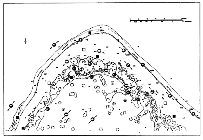
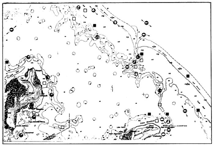
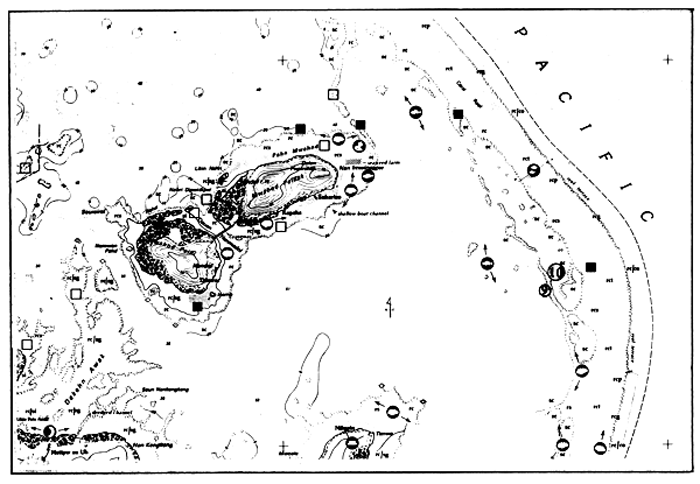
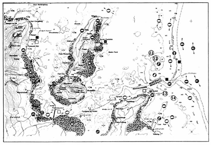
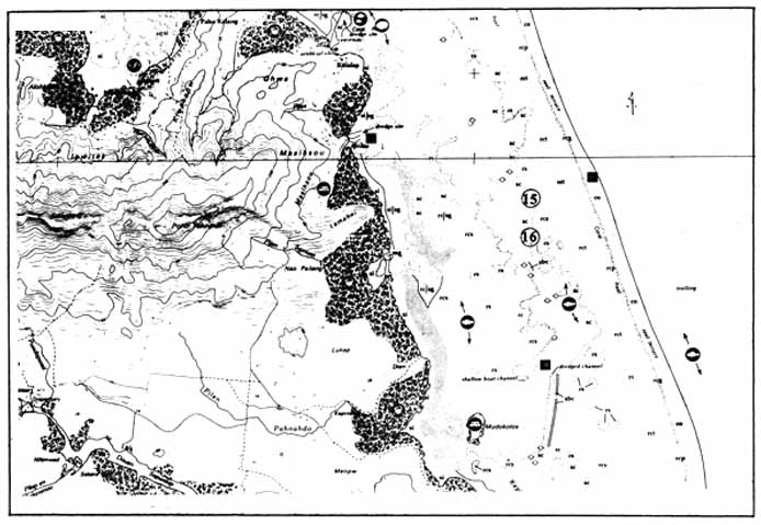
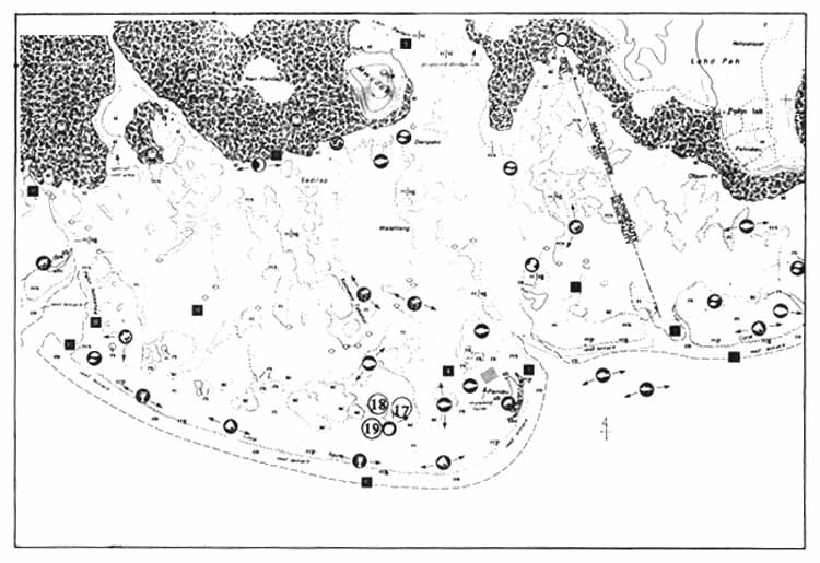
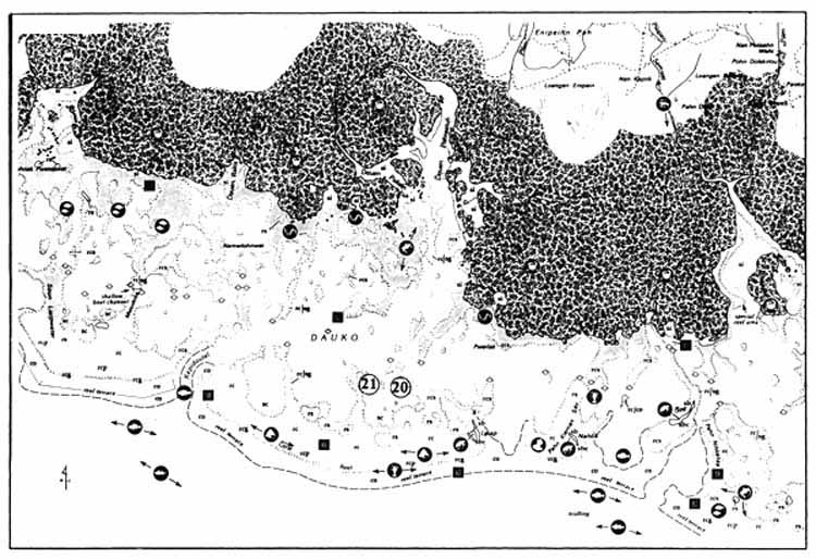
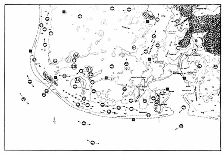
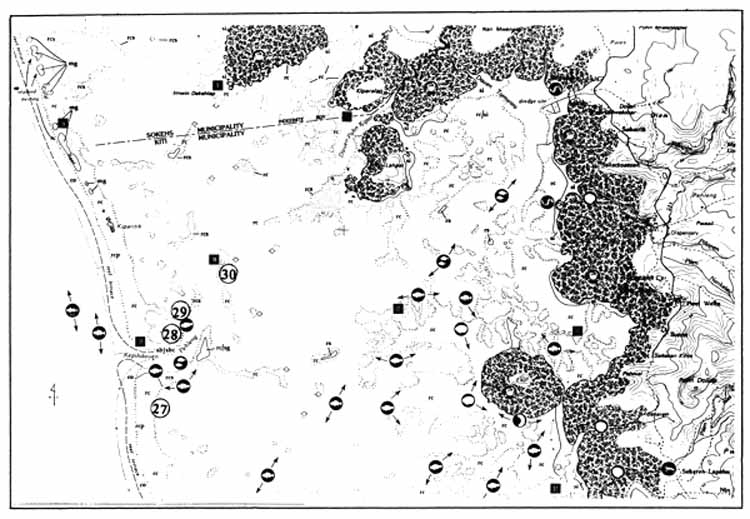
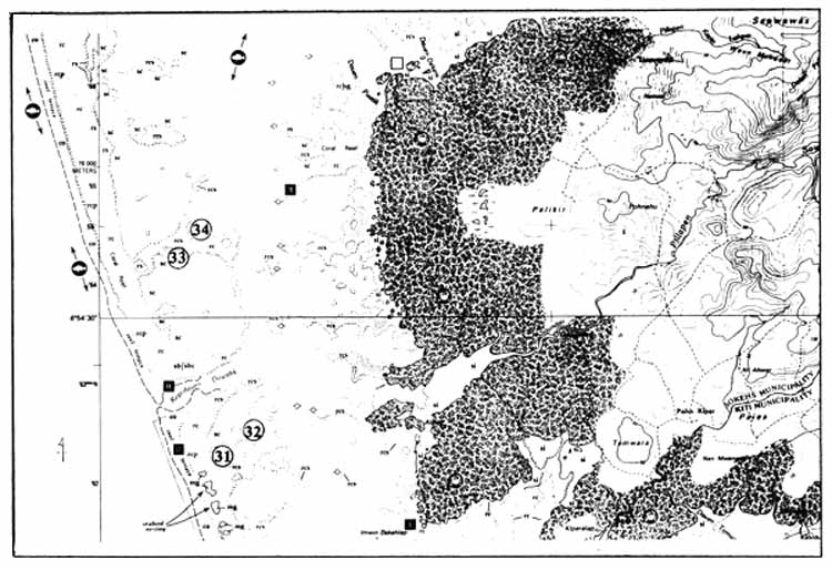
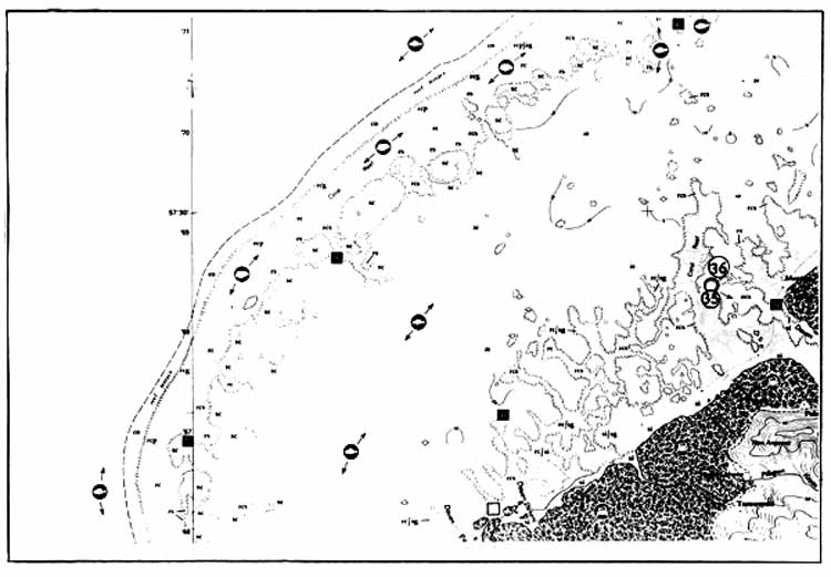
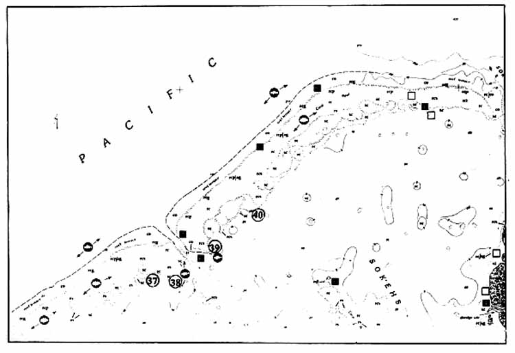
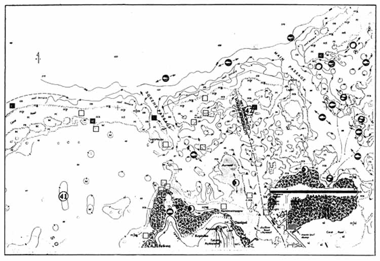
| Resource Use | ||
| Aerial Photograph | RELATED TO BIOTA | |
| Based Classification System | ||
 | Deep water handlining (primarily for yellowfin tuna). | |
| OFFSHORE |  | Bottom fishing (primarily for groupers and snappers). |
| s — Sediment. |  | Reef fishery (very productive and/or heavily fished areas). |
| sc — Sand bottom, in water depths less than 10 meters |  | Stone fishtrap. |
| sd — Sand bottom, in water depths greater than 10 meters. |  | Seasonal fish aggregation area. |
| si — Silt. |  | Baitfish (ikatek). |
| rc — Reef complex. |  | Sea turtle nesting area (historical). |
| rc — Mixed bottom types consisting of reef rock (lime stone) associated with shallow reef formations. |  | Sea turtle feeding area. |
| rcl — Consolidated limestone, lacking sediment. |  | Mangrove crab. |
| rcp — Consolidated limestone with a smooth pavement-like surface. |  | Lobster. |
| rcg — Consolidated reef with well defined groove-and-spur system. |  | Freshwater shrimp. |
| rcs — Mostly consolidated limestone with some (25–50%) sediment bottom. |  | Giant clams (Hippopus and/or Tridacna). |
| rct — Complex reef bottom type (rc, rcs, or rs) with loose materials formed into tracts by waves or currents. |  | Lipwei clam (Anadara antiquata). |
| rs — Complex reef bottom type consisting mostly of sand, but with some limestone outcrops or boulders. |  | Other clams (primarily kopil clams). |
| co — Areas of greater than 50 percent live coral cover. |  | Top shell (Trochus niloticus). outside of preserves. |
 | Octopus. | |
| SHORELINE |  | Sea cucumbers. |
| ba — Volcanic rock shoreline (basalt). |  | Sponge collecting (historical). |
| bb — Man-made boulder shoreline. |  | Recreational diving. |
| bc — Concrete/cement masonry seawall and shoreline. | RELATED TO BIOTA | |
| sb — White sand beach of predominately calcareous material. |  | Sand mining. |
| sbc — Calcareous rubble and/or shingle beach. |  | Manual sand removal. |
| VEGETATION COVER |  | Archaeological site. |
| mg — Mangrove forest (where not otherwise indicated on basemap). | ||
| sg — Seagrass bed. | ||
| ag — Algae bed. | ||
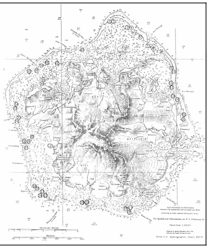
| Note: All patch reef surfaces are substrate type rc unless otherwise designated. | ||
| Field Stations | ||
| Trochus preserve |  Channel buoy. Channel buoy. |  PCRI Stations. PCRI Stations. |
| Fish migration path |  Channel marker. Channel marker. | |
| Seagrass bed |  Reef marker. Reef marker. | □ Other stations. |
![]()
![]()
![]()