Indonesia: Computerized land evaluation
Qualitative land evaluation may be adequate in the early stages of planning but a need often arises later to compare the relative suitability of alternative land uses on a precise numerical basis. Indeed, without quantitative economic assessment, it is scarcely possible to make meaningful comparisons between land uses that yield different products - grain crops and livestock, for example - or which differ greatly in their requirement for inputs. Only a monetary base can make a comparison between such different factors possible.
Quantitative suitability is measured by comparing output (crop yield, for example) with the sum of the inputs, all in monetary terms, for each class of land for each alternative use. Predicting yield is the first step. In principle, the problem is no different from that faced in qualitative evaluation and is approached in the same way. The method involves recording actual yields in comparable situations or calculating yield with arithmetic models that simulate the way in which yield is determined by the interaction of environmental factors.
Modern statistics provide refined means of extrapolating actual yield data and of verifying the reliability of the output. No comprehensive model yet exists that can manipulate raw environmental data and provide practical assessments at farm level but progress is being made and existing models can already address limited problems, such as the availability of moisture or the risk of soil erosion. Furthermore, summary models, notably the FAO approach to the evaluation of 'agro-ecological zones', that consider only selected environmental variables can provide reasonable assessments of productive capability.
Verification of results, by comparison with actual field experience, is important because it is easy to be misled by the apparent precision of numerical values. The conversion of yields into economic returns, of course, is also subject to uncertainties such as changes in future market prices and rates of inflation. Similar problems and assumptions are encountered in assessing the present and future costs of capital and recurrent inputs.
Nevertheless, quantification adds several new dimensions to land evaluation beyond the ability to compare unlike uses and products. For example, developments in modelling are soon likely to provide a systematic way of using available data more efficiently, by minimizing the effects of some of the inevitable shortcomings and gaps in raw data and thus economizing on survey resources. Most significantly, by expressing all input and output variables numerically, the way is opened for the application of computers.
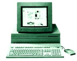
Computers can assist land evaluation in the storage and retrieval of data, in the manipulation of data and in graphic representation. The use of computers in this field has progressed rapidly. In developing countries, for example, FAO teams have recently helped to develop computerized land evaluation systems based on the FAO framework in a number of countries (see box). This work is so recent that the systems have yet to be extensively tested but, in the context of data collection and retrieval alone, such systems can serve as, or make a major contribution to, a national geographical information system which is of great value in development planning.
Approaches differ by the extent to which mathematical modelling within the computer is used to derive and combine environmental data. The extent of modelling is not important if the approach itself is systematic and logical, and the findings are adequately validated by field observation. The computer allows stored data to be reproduced at will as maps, diagrams or tables. Imagery from satellites, aircraft or other sources can also be stored in digital form, and processed mathematically to enhance contrast and aid interpretation.
Computer science itself is developing fast. A negative aspect of this development is the temptation to abandon one system in favour of a more powerful one before the first has had a chance to fulfill its design purpose. There are few clearer examples of the better being the enemy of the merely good. This risk can be minimized by designing the computer system in a way that allows individual modules, serving separate purposes, to be updated periodically without discarding the system as a whole.
Indonesia: Computerized land evaluation
In 1983 an FAO team working with the Centre for Soil Research at Bogor in Indonesia developed and published the methodology of a land evaluation computer system (LECS) based upon the FAO Framework. In developing LECS a pragmatic approach was adopted with an eye to the kinds of data already available or readily obtainable for a regional study in Indonesia. The overall model is simple in relation to the complex land systems that it represents or, indeed, in relation to computer systems that are now being developed elsewhere, but it well illustrates the basic possibilities of computerized evaluation.
Using LECS, a standardized selection of basic physical and economic data relating to each land unit and to the requirements of each land utilization type is stored in the computer and then analysed in two stages. First, the potential productivity of each land unit is evaluated for each of 22 crops and 10 timber species, each at 3 levels of technology and management input. In parallel, the computer runs a soil degradation model, based on an adaptation of the Universal Soil Loss Equation, which estimates soil loss under each land use and compares this with a level of loss regarded as tolerable; this indicates the level of conservation measures required.
The second stage assesses potential productivity on an economic basis by predicting the effects of improved management at the three management levels. These are defined in terms of input resources, allowable cropping patterns and available management resources for conservation and land improvement. The conservation model selects options for conservation management and estimates their cost. The final output provides individual crop recommendations for each land unit on an economic basis.
LECS uses a simplified procedure to predict local crop yield, and thus land suitability, by assessing the local values of just 8 land qualities derived from 14 land characteristics. These qualities are chosen because they are the major environmental variables which affect crop yield.
A computerized system can be expected to be versatile in the way in which it presents findings. Thus, the first stage output of LECS, in addition to indicating the suitability of each crop on each land unit, can provide summaries of land units and their areas within each class and of areas affected by each crop constraint. The sensitivity of the classification to different constaints can even be assessed by deliberately changing a parameter and re-running the analysis. By changing the boundary values assigned to salinity, for example, the effect of introducing a salt-tolerant crop variety can be simulated.
LECS, as originally developed, did not consider irrigation or livestock, but there is no reason, in principle, why the requirements of these land uses should not be added to the data store. The data is arranged in modules that can be updated separately as need arises.
Basic physical data used in LECS
Land qualities
1. Temperature regime
2. Water regime
3. Nutrient retention
4. Nutrient availability
5. Salinity
6. Toxicity
7. Rooting conditionsLand characteristics
1. Average monthly temperature in growing season
2. Length of growing period (days)
3. Annual rainfall (mm/year)
4. Cation exchange capacity (me/100g)
5. pH*
6. Nitrogen (kg/ha)
7. Phosphorus (kg/ha)
8. Potassium (kg/ha)
9. Salinity (mmhos/cm)
10. pH *
11. pH *
12. Rooting depth (cm)
13. Drainage class (USDA, 1951)
14. Texture class (Sys and Riquier, 1979)* different ranges of pH are established for different qualities
The increasing power of the micro-computer is highly significant. Machines and programmes are already available that promise an effective, easy to use, land evaluation capability on small, personal computers. These will allow great flexibility and speed in resolving land evaluation queries, even in remote field offices.
Computers will revolutionize land evaluation and land use planning - but will be for the better only if their output is geared closely to practical objectives and is continuously validated.