Database of South African Surface Water Bodies, source, content and data structure
by
Gayle Johnson
GIS and Database Assistant, ALCOM
and
Lieven Verheust
Fisheries and Data Management Officer, ALCOM
ALCOM Working Paper No. 18
| ALCOM | GCP/RAF/277/BEL |
| Aquatic Resource Management for Local Community Development Programme | |
| Database of South African Surface Water Bodies, source, content and data structure by Gayle Johnson GIS and Database Assistant, ALCOM and Lieven Verheust Fisheries and Data Management Officer, ALCOM |
Funding Agency:
BELGIAN ADMINISTRATION FOR DEVELOPMENT CO-OPERATION
Executing Agency;
FOOD AND AGRICULTURE ORGANIZATION OF THE UNITED NATIONS
Harare, 1998
The designations employed and the presentation of material in this publication do not imply the expression of any opinion whatsoever on the part of the Food and Agriculture Organization of the United Nations concerning the legal status of any country, territory, city or area or of its authorities, or concerning the delimitation of its frontiers or boundaries.
| Johnson, G.; Verheust, L Database of South African surface water bodies, source, content and data structure. ALCOM Working Paper No 18. Harare, ALCOM/FAO. 1998. 15p. |
| ABSTRACT |
| ALCOM has been gathering information on Surface Water Bodies from all mainland countries in the SADC region since 1992. Despite several efforts to get more information, little surface water body data were obtained for South Africa until a mission was undertaken in 1997 to contact different organisations and departments involved in surface water. Several databases on surface water resources were collected and merged into one comprehensive database. This paper describes the procedure for merging, eventual correction of the data and the data structure of the complete South African SWB database, including the metadatabase. |
This paper accompanies the digital data on South African surface water bodies as compiled by ALCOM from a set of different databases. It describes the source of the data, compilation procedure, eventual modifications to original data and structure of the database components.
ALCOM is a regional water resource management programme of the FAO (Food and Agriculture Organization of the United Nations). Based in Harare, Zimbabwe, it covers all the mainland member-countries of SADC (Angola, Botswana, Lesotho, Malawi, Mozambique, Namibia, South Africa, Swaziland, Tanzania, Zambia and Zimbabwe).
The aim of ALCOM is to assist member-countries improve the living standards of rural populations through the practice of improved water resource management. Toward this end, pilot activities are conducted in member-countries to demonstrate new techniques, technologies or methodologies.
The information service plays a very important role in ALCOM to disseminate information and to make information available to all those interested in water resource management for local communities. It is in this framework that the following paper was realised.
| For more information contact ALCOM at: | |
| Mailing address: | P.O. Box 3730 Harare, Zimbabwe |
| Physical address: | National Parks Complex, Sandringham Drive Harare, Zimbabwe |
| Telephone: | 263-4-724985/734797 |
| FAX: | 263-4-792782 |
| E-Mail: | [email protected] |
| Homepage: | http://www.zamnet.zm/zamnet/alcom/alcom.htm |
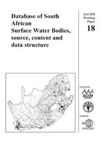
Cover graphic: point locations of surface water bodies in South Africa
Hyperlinks to non-FAO Internet sites do not imply any official endorsement of or responsibility for the opinions, ideas, data or products presented at these locations, or guarantee the validity of the information provided. The sole purpose of links to non-FAO sites is to indicate further information available on related topics.
This electronic document has been scanned using optical character recognition (OCR) software. FAO declines all responsibility for any discrepancies that may exist between the present document and its original printed version.
LIST OF ACRONYMS AND ABBREVIATIONS
4. CORRECTIONS AND MODIFICATIONS
4.1.2. Location outside the South Africa
5.2. POINT DISTRIBUTION FILE IN ATLAS GIS FORMAT
5.4. LIST OF FILES COMPRISING THE COMPLETE SOUTH AFRICAN SWB DATASET
5.5. REFERENCE LISTS OF CORRECTIONS AND MODIFICATIONS
ANNEX I LIST OF SWBS WITH CO-ORDINATES INVERTED BY ALCOM
ANNEX II: LIST OF SWBS WITH POSSIBLE WRONG CO-ORDINATES
ANNEX III: CHARACTERISTICS AND SUMMARY STATISTICS ON THE MAIN DATABASE ZA_SWB.DBF
ANNEX IV: CHARACTERISTICS AND SUMMARY STATISTICS ON THE MAIN FIELDS IN THE SOURCE DATABASE ZA_SOURC.DBF
ANNEX V: CODING SCHEME FOR SOURCE DATABASE ZA_SOURC.DBF
LIST OF FIGURES
FIGURE 1: Linking of the database files
FIGURE 2: Distribution of surface water bodies in South Africa
LIST OF TABLES
TABLE 1: Number of entries from each information source for 3 important fields
TABLE 2: Number of SWBs within each drainage region,