![]()
![]()
![]()
by
T. STROMME
S. SUNDBY
G. SAETERSDAL
INSTITUTE OF MARINE RESEARCH BERGEN 1982
In the period May 1981 - April 1982 a programme of acoustic fish resource surveys was conducted in West African waters with the R/V “Dr. Fridtjof Nansen”. The programme included ten surveys covering areas between Agadir and Point Noir planned and carried out in close cooperation with the FAO/UNDP/Project: Development of Fisheries in the Eastern Central Atlantic through its headquarters in Dakar.
The work reported here was planned during a meeting in Praia in October 1981. The main objectives were:
An acoustic survey of the distribution and abundance of the pelagic and demersal resources.
Sampling of the distribution and size composition of the main species with pelagic and bottom trawl and with long lines where bottom conditions do not permit trawling.
A pilot acoustic study of the distribution and abundance of mesopelagic fish within the Cape Verde Archipelago.
Mapping of bottom conditions suitable for trawling, based on bottom traces from the acoustic system.
Investigations of main hydrographical conditions.
The participating scientific and technical staff is listed in Annex 1. All staff took part in sampling and gathering of data and carried out analysis and processing to the extent possible on board the vessel. The preliminary results were presented in a short cruise report.
The survey started from Dakar on 3 November and the vessel called on Praia on 5 November to pick up personnel from Cape Verde. After a calibration of the acoustic instruments in the bay of Praia, the vessel's propeller was seriously damaged, and the vessel had to return to Dakar for docking. After a ten days' delay the local participants were again embarked in Praia on 16 November.
The survey track together with fishing and hydrographical stations are shown in Figures 1 and 2. The islands were surveyed in a clockwise direction, beginning with Fogo in the west. The shelves of all the islands were covered, including also fishing banks within the archipelago. On the tracks between the islands and also on some broader sweeping tracks pelagic resources over deep water were investigated.
The vessel called on Praia on 27 November to exchange some of the Norwegian crew and the biologist from Cape Verde. The next day the vessel set out for a short trip of three days to resurvey the area around the islands Sal, Boavista and Maio, and this time also an attempt to evaluate the demersal resources by bottom trawling was made. The vessel made a last call on Praia on 1 December.
The Portugese navigational charts provided for the survey proved to be lacking in details for some of the islands with many shoals and breakers unmarked. For safety reasons this made parts of the shelves inaccessible to the vessel. As this mostly concerns the islands Santiago, Fogo, Brava and St. Nicolau where the shelf is extremely small, the lack of important acoustic and catch data seems negligible.
The traditional method of identifying and sampling the echo targets by midwater and bottom trawling could not be fully used as underwater peaks and heavily serrated shoals occurred frequently both on the shelf and close by. In such locations fishing with long lines was tried.
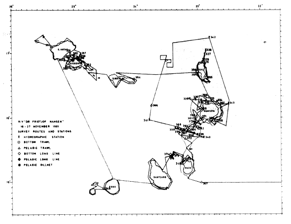
Fig. 1. Cruise trach and stations 16 – 27 November 1981.
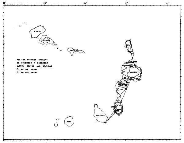
Fig. 2. Cruise track and stations 28 November -1 December 1981.
During the daily study of the echogrammes the bottom which seemed suitable for bottom trawling was marked off.
The survey comprised:
| 17 | bottom trawl stations |
| 17 | Pelagic trawl stations |
| 8 | long line stations |
| 27 | hydrographical stations |
The total cruise track within the Cape Verde archipelago was 2500 nm.
![]()
![]()
![]()