SUCCESSFUL ACTION AGAINST SOIL EROSION ON A LARGE SCALE WILL ONLY BE POSSIBLE BY IMPLEMENTING LAND MANAGEMENT PRACTICES WHICH CONVINCINGLY INCREASE PRODUCTION OR DECREASE COSTS OR LABOUR TO THE BENEFIT OF THE LAND USER, WHILST SIMULTANEOUSLY CONTROLLING SOIL EROSION. THIS IS SOMETIMES REFERRED TO AS ACHIEVING SOIL CONSERVATION BY STEALTH.
Land conservation approaches
A broad-scale assault on land degradation and desertification will only be successful if the actual land users are able to perceive direct benefits from the recommended conservation and management practices. Therefore, a new concept is the promotion of management practices capable of providing not only erosion control but also greater productivity, lower costs and higher profits. This is sometimes referred to as 'conservation by stealth'.
Another change of concept is the trend away from applying solely physical conservation structures and placing more reliance on the use of biological and agronomic conservation practices that provide a protective vegetative cover to the soils for as much of the year as possible. Typical examples of the biological and agronomic practices are denser plant populations, leaving crop residues on the soil surface, minimum tillage, sequential cropping, intercropping and agroforestry. The use of physical conservation structures then becomes complementary to biological and agronomic practices.
A further change of approach is to take advantage of traditional farming practices, many of which are conservation-oriented, but which have fallen into disuse because of growing population pressures on the land and changing economic and social life styles. Some of these traditional systems can be modified and adapted to make them more appropriate to current economic realities. Building on existing traditional practices to achieve soil conservation is much more likely to lead to successful adoption than attempting to introduce completely new techniques.
Focus on participation
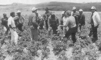
Numerous experiences confirm that a change in farming practice can be relatively easily achieved when a community of farmers, with some trusted technical advisers, design, prepare and implement their own plans and action programmes. Changes have been slow, difficult and at times impossible when plans have been made without farmer participation.
Thus an obvious change of approach is required from 'top-down' to 'bottom-up', whereby all land users are involved in the whole process of development from the identification of their problems to the selection and implementation of solutions.
Governments must promote and support land conservation and desertification control programmes, but only farmers can implement and maintain land conservation practices. It is the farmers who make decisions on how best to use and manage their lands, according to the needs of their families and considering soil, climatic, economic and market factors.
Participation and training Most of the FAO technical assistance projects engaged in land and water conservation in Latin America and the Caribbean are promoting active participation of the beneficiaries, whether they be families, communities or farmers' associations. In projects as diverse as 'the management and conservation of lands' (Costa Rica), 'sustainable agriculture on hillsides' (El Salvador), 'the management of waters, public irrigation plans and irrigation districts' (Brazil and Mexico) and 'the management of plant nutrition' (Bolivia and Nicaragua), training courses on the participatory approach are being funded that will enable farmers' organizations to manage crop or irrigation technologies in a truly participatory and independent manner. Farmer participation in meetings where results of surveys or field data are presented and visits to see successful land management, conservation and rehabilitation practices form part of the training courses. The provision of collective credit has a very positive effect as an incentive and catalyst in promoting the participatory approach. |
Thus NAP need to be participatory, not imposed; this can be greatly facilitated when farmers, farmer associations and other land users in the community are included as members of all decision-making groups that deal with land use and management. Decisions on the parties responsible for carrying out specific activities must be made according to the capabilities, resources, interests and willingness of the different members and sectors of the community.
Focus on gender
It is essential that not only the men but also women and the whole family participate in decision making about the management and conservation of natural resources. The participation of women has been recognized as essential for the successful implementation of land and water conservation programmes.
In recent years the role of women in agriculture has become increasingly recognized, not only in the execution but also in the planning and management of specific tasks. It is extremely important that women are urged to participate more effectively and fully in developing and implementing land conservation and desertification control programmes. To achieve this, mere incentives are not sufficient; definite opportunities must be systematically created for women to be involved in all livestock, crop and land management activities. An inventory and analysis of those activities assigned to women and to which the man's contribution is very limited would greatly facilitate the correction of these imbalances. A flagrant example is women's total involvement in domestic duties and field work and their almost complete exclusion from the predominantly male role of decision making, e.g., about which crops to grow or activities to initiate, what management practices to apply and when or where to sell the produce.
Recognition of the equitable role of women in the new strategies must be viewed as an integral part of the participatory approach and is essential for the success of the proposed actions in the longer term.
Sustainability
The aim of conservation-effective land management and desertification control is to achieve a sustainable system of agricultural production which is socially and economically acceptable to farmers and has a favourable cost/benefit ratio. Sustainability implies that land is used according to its suitability without causing land deterioration or environmental degradation, so that its productivity can be guaranteed for present and future generations.
Systems approach
To facilitate the formulation of appropriate conservation and rehabilitation programmes it is necessary to identify agro-ecologically and socio-economically similar areas, within which the conservation or rehabilitation programmes will be applied. These areas are often referred to as recommendation domains or resource management domains, having similar crop, livestock or forestry production systems, to which the same land use or management recommendation will be equally relevant and applicable.
The basic agricultural unit is the farming system which has at its centre the farmer and her or his family. This is a holistic concept that embraces the agro-ecological and environmental conditions of the farm, the farmer's enterprises, the systems of management for each of the production systems, the marketing and economic conditions in the community or region where the farmer lives; the socioeconomic circumstances and needs of the farm family.
Within a farming system there are invariably interactions between the production systems or management practices. These interactions may give rise to positive or negative effects on the productivity or sustainability of one or more of the production systems. An example is given in the box below, from El Salvador, where frequently there is a conflict between the use of crop residues as protection against soil erosion and as fodder for livestock. This conflict can best be solved by a farming systems approach in which alternative sources of fodder are produced to satisfy livestock requirements, thereby leaving more crop residues on the surface for better soil conservation.
The systems approach to soil conservation For farmers cultivating basic grains
on steep hillsides in El Salvador, crop residues are very important, being used as
livestock fodder and also for soil conservation when left on the soil surface as a
protective cover. In areas with more livestock or lower crop residue production due to a
drier climate or less fertile soils, there are often insufficient residues to satisfy the
requirements for both soil conservation and livestock fodder. When a conflict arises, the
priority use of residues is as fodder at the expense of soil conservation. To improve soil
conservation a farming systems approach is required, and in this situation the production
of additional fodder in the form of silage or hay from improved pastures, silage crops or
forage trees, should be promoted. This would allow more crop residues to be left on the
soil surface for soil conservation. |
The sustainability of land conservation and rehabilitation will be the end result of an efficient system of agricultural production, which in turn will depend on the adaptability and resilience of the conservation technologies employed.
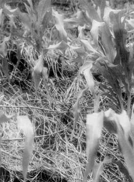
Soil cover from a prior cover crop of rye into which beans have been sown (Chapecó, Brazil)
Flexibility of recommended practices
Land conservation and rehabilitation practices thus become an integral part of farming systems. Therefore, the technologies should be adapted to the specific agro-ecological, socio-economic and cultural conditions where they are to be applied, to ensure that they are sufficiently flexible to accommodate future changes in economic, marketing, technological and political pressures.
General approach
Conservation-effective land management and desertification control programmes must become a part of national agricultural development plans, so that the proposed activities are truly integrated towards solving the main problems facing farmers. The variations in farming systems and the different socioeconomic and cultural circumstances of farmers need to be taken into account when planning activities in the different countries and regions of Latin America and the Caribbean. All aspects of the planning process must include the participation of land users, as well as other public and private sectors of the community.
Levels of planning
Land conservation, rehabilitation and desertification control programmes must be planned at the level of farms, communities and political-administrative regions. The socio-economic development plan must be preceded by a physical planning at the level of a clearly defined watershed or other physiographic unit in order to avoid situations where local solutions produce adverse impacts on the natural resources or inhabitants in other parts of the watershed.
For physical planning to be fully effective, all available information on natural resources, climate and socioeconomic conditions must be compiled using geographic information systems. The acquisition of additional, or more detailed, data may be necessary for some areas. Those who will be using the data may need to be trained and motivated, and the same people must also be involved in the planning of the work.
Monitoring of activities is very important so that adjustments in procedures can be carried out when necessary. Monitoring should be carried out using environmental, economic and social indicators based on both quantitative and qualitative indices identified by both technicians and land users.
Geographic Information Systems Geographic information systems are of great assistance in the classification of natural resource inventories and in the diagnosis of land potential and limitations. They permit the geographical integration of many different thematic variables and afford opportunities of diagnosis and prediction that would be very difficult to carry out manually. Inventories of natural resources are used to identify agro-ecological zones at both regional and national levels. In Latin America and the Caribbean agro-ecological zoning has been carried out on a very small scale. By agreements between FAO and member countries, i.e., Argentina, Brazil, Chile, Colombia, Mexico, Paraguay, Peru and Venezuela, more detailed agro-ecological zoning has been accomplished using soil, terrain and climatic maps elaborated at larger scales. The identification of areas that are homogenous in terms of their biophysical characteristics and the transfer of production systems that are compatible with the land and climatic conditions will contribute to the sustainable use of natural resources. At the same time it will permit the identification of those areas that are particularly sensitive to human intervention and those which require protection, conservation or rehabilitation to maintain biodiversity and a stable ecology. The agro-ecological zoning projects have generated various related initiatives. Among these is a regional project executed by FAO funded by the Netherlands Government for 'Assistance to the Pro-Tempore Secretariat of the Amazonian Cooperation Treaty' covering Bolivia, Brazil, Colombia, Ecuador, Guyana, Peru, Surinam and Venezuela. The aim of this project is to formulate projects on the establishment of ecological economic zones within the programme of the Special Commission of the Environment Treaty and a programme of land planning of the Commission for Science and Technology. Training courses on agro-ecological zoning and assistance to countries in the region have helped to develop land resource information systems with computerized databases that are used in land evaluation and land planning activities. |
Methods
The successful implementation of land conservation, rehabilitation and desertification control programmes depends to a large extent on having carried out a previous satisfactory diagnostic study. The study should be based on national or local information on land, water and climate, with the creation of inventories and data classification according to existing schemes. The diagnostic phase also permits land-use potentials and limitations to be identified which, in turn, serve as the basis for determining alternative systems of land use and land management. A complementary diagnosis of socio-economic factors is very important for assessing priority areas and problems and also for determining the most suitable land use and management solutions.
Proposed land use and management practices will need to consider both production and environmental aspects and be tailored to address the solution of problems in the short, medium or long term, depending on the particular local requirements.
The micro-catchment as a planning unit
Much emphasis has been placed on the micro-catchment as the most 'logical' and 'rational' unit for planning the utilization of natural resources. Working within a whole micro-catchment will avoid problems which can occur in a development programme when upstream areas are neglected. For example, upstream problems of water contamination and erosion can result in serious downstream problems of contaminated water supplies, sediment deposition and gully erosion.
When working in a micro-catchment, it is easier to plan and implement physical structures which extend across the properties of several or many farmers.
Representative portions of well managed micro-catchments can serve as useful demonstration areas for farmers in other catchments with similar biophysical and social conditions.
The micro-catchment concept can foster group identity and encourage group activities related to credit access, inputs, marketing and obtaining technical advice.
The advantages of micro-catchments as planning units The use of micro-catchments as physical and social planning units has various advantages:
The advantages of working in groups reinforce the argument for implementation at a micro-catchment scale:
|
WATER EROSION CAN BE EFFECTIVELY REDUCED BY INCREASING SURFACE COVER AND POROSITY IN THE SURFACE SOIL. IN THIS WAY SOIL RAINDROP IMPACT AND SURFACE RUNOFF, THE MAIN FACTORS RESPONSIBLE FOR EROSION, ARE GREATLY REDUCED.
Vegetative cover
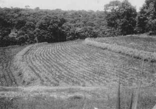
Recent experience has shown that in order to combat erosion, attention should be focused on increasing the quantity and continuity of soil cover and on improving the structure and porosity of the surface soil. In this way soil-raindrop impact and runoff, the two factors most responsible for soil erosion, are greatly reduced. Moreover, covering the soil with annual perennial crops and crop residues is the most economic and convenient approach for small-scale farmers to soil and water conservation.
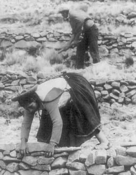
A vegetative cover not only protects the soil but also supplies nutrients and organic matter; it encourages the biological activity that helps to maintain the all-important porosity in the surface soil layer. In some cases the vegetative cover must be reinforced by physical soil conservation structures. In such cases, a vegetative cover of planted shrubs or grasses is also required to protect and stabilize the terrace banks.
Improving the retention and use of rainfall
Until recently very little attention has been paid to increasing soil cover and soil porosity to retain the rainfall where it falls, thereby increasing soil moisture availability and its subsequent use by crops. The neglect of these practices has often resulted in unnecessary and expensive irrigation schemes to supply additional water.
However. in many parts of Latin America and the Caribbean, the steep slopes and shallow, stony nature of soils limit their capacity to accept and retain water during the rainy season, resulting in runoff and the loss of water to crops.
In these situations, in addition to using agronomic and biological methods to control runoff, other complementary physical structures should be contemplated, e.g., ditches to control and discharge excess runoff, or modifications of slope length and gradient by means of terracing to reduce the accumulation of runoff. Terracing is usually only appropriate for the intensive production of high value crops.
In regions where the annual rainfall varies between 100 and 700 mm, low-cost practices of water harvesting represent a feasible option for sustainable development. The efficient collection of rainfall permits increased yields in irrigable areas, a reduction in the effects of drought, the halting of desertification through tree planting, increased supply of water to domestic animals, maintenance of pastures and the provision of drinking water for domestic use.
A large number of water harvesting practices are in existence, but their applicability depends on the annual rainfall and its distribution, the characteristics of the zone and the ultimate use of the water. Some of these practices are ancient and have formed the basis for settlements of past civilizations.
The harvesting of water continues to be an economic and worthwhile technology for dryland zones but, for it to be successful, a high degree of farmer participation is necessary, not only for the installation of the technology but, more importantly, for its maintenance.
It is essential that water harvesting programmes are supported by farmer training and by the selection of the most appropriate technologies.
Increasing soil cover and porosity not only reduces runoff but also increases the supply of plant - available water. |
Surface drainage
Rainfall raises the level of the water table downstream and carries away soil nutrients, which may reduce the productive capacity of the land. Surface drainage is an important practice but is seldom included within the typical range of land productivity improvement practices.
Rainfall and runoff in dryland zones with cropping potential When soil moisture limits crop growth, knowledge of the pattern of rainfall distribution and the frequency and duration of drought periods becomes important. Higher or more reliable yields can often be obtained by adjusting the sowing date, or by selecting varieties with a more compatible growing period. Additional information on topography, land use and soil characteristics in conjunction with rainfall probability data can be very useful in the selection of appropriate water storage techniques. An inventory of surface and subterranean water supplies is required to assess irrigation possibilities, but this information is lacking in many areas. |
The main problem for the introduction of drainage systems is payment for the maintenance costs once the drainage canals have been constructed by the public sector. A solution could be the establishment of farmers' associations that jointly share the responsibility for maintenance.
Integrated plant nutrition
FAO is promoting the establishment of integrated plant nutrition systems (IPNS) in Latin America and the Caribbean. The concept of IPNS is the rationalization of plant nutrient management, with the aims of increasing the efficiency of nutrient supplies to plants and increasing farmers' income through the supply of local and external nutrient sources.
IPNS promotes the use of all sources of plant nutrients (mineral, organic and biological); organic waste products, rock phosphates and guano can all be important sources of crop nutrients.
The integrated systems of plant nutrition have an evolutionary character, because profits from better plant nutrient management are reinvested into the nutrient cycle. The objective is to increase the quantity of available plant nutrient reserves gradually, then to use the increased profits for the purchase of additional plant nutrients.
Integrated systems of plant nutrition comprise an initial diagnosis of how plant nutrients are being managed, the formulation of a plan to improve nutrient management efficiency and decisions on the need to purchase external nutrient supplies.
Biomass, organic residues and fertilizers In 1990, the total biomass production of crops in the region contained 17 million tons of plant nutrients. Of this quantity, 9.8 million tons of nutrients were exported in the form of agricultural produce. The exported nutrients constituted 69 percent of the nitrogen, 73 percent of the phosphorus and 40 percent of the potassium that was present in the total biomass. The crop residues that remained contained more than 7.2 million tons of plant nutrients which, if they were recycled, would be an important source of plant nutrients. The regional annual consumption of plant nutrients derived from mineral fertilizers was approximately 7.7 million tons, of which 3.6 were N. 2.2 P2O5 and 1.9 K2O. Considering only the average values for the region, the fertilizer application rates in Latin America and the Caribbean exceed the amounts of N and P2O5 needed to compensate for nutrient losses caused, for example, by leaching and denitrification. Nevertheless, the distribution of fertilizer application in the cultivated areas is very variable and in 1990 varied from 3 kg/ha to more than 200 kg/ha. Also, in 16 of the 33 countries, soil nutrient reserves are being exhausted. |
Reducing plant nutrient losses is a fundamental issue, but the lower labour costs and improved productivity due to better nutrient management are also of great interest and are highly appreciated by farmers.
Farmer participation in the identification of suitable plant nutrient management technologies and in the formation of effective farmers' associations can facilitate the provision of nutrients at greatly reduced prices. Moreover, farmer participation ensures that the IPNS practices are adapted to their own social and economic conditions and to their particular production objectives.