![]()
![]()
![]()
Hydrography
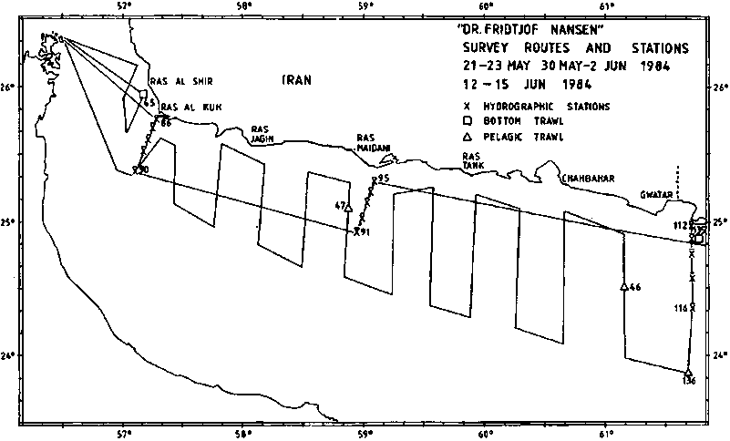
Two hydrographical sections were worked, together with one section, just over the border of Pakistan, (Figure 1), which also will be representative for the general hydrographical conditions on the eastern Iranian coast. (Figure 2 and 3).
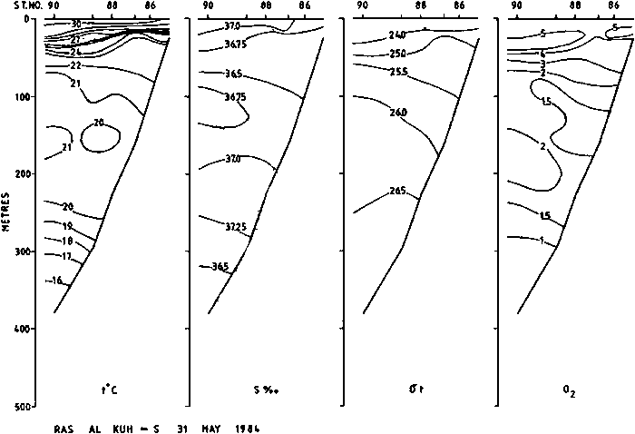
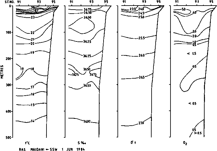
The temperature in the surface layers was measured to 30-31°C at the head of the Gulf, decreasing eastwards to 28-29°C. Surface salinity also show a similar decreasing trend from Ras al Kuh, - eastwards. A sharp thermocline was found at 30-40 m in the western section and at about 50 m off Ras Maidani. An intermediate layer, most prominent in the salinity profiles can be identified as Persian Gulf water. It’s depth increases eastwards to about 250 m in the Ras Maidani section. A tendency of a shallow rise of the isolines of temperature, density and oxygen, particularly in the Ras al Kuh-section, indicates a local upwelling. This was also seen in the western section of Pakistan.
Bottom fish
As the planned survey on the shelf area was terminated at the first trawl station, no distribution maps are presented. Trawl station no. 45 indicated a high diversity of demersal fishes, with 27 different species, fairsized Pomadasys hasta being the dominant. The catch rate was about 5 tonnes per hour trawling, but additional 5 tonnes of mud and clay inside the bag indicate that the area was unsuitable for trawling with heavy otter-boards and bobbins. The catch data is presented in ANNEX I.
Mesopelagic fish
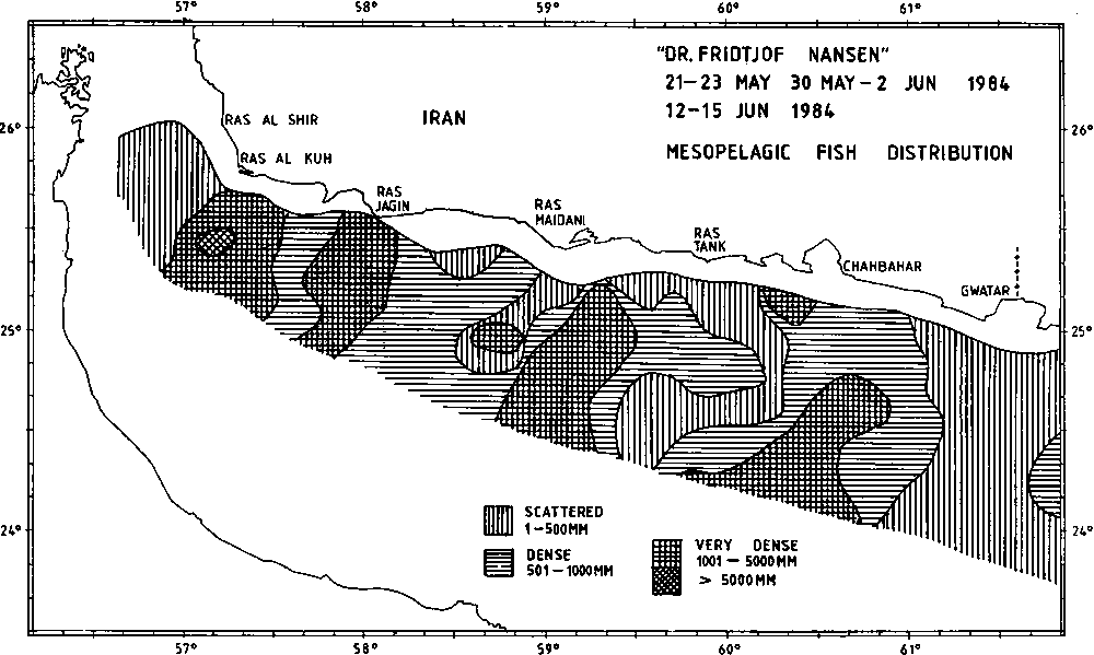
Recordings of mesopelagic fish were made at and off the edge of the continental shelf in the entire area covered. (Figure 4). The vertical migration pattern was as expected from previous cruises, with two separate scattering layers both at day and night. The vertical migrations were fast, the downward movement at sunrise often completed within 20 minutes.
The recordings were generally scattered to dense, but belts with higher densities, 30-60 nautical miles wide, were found all along the covered area. The DAY-11 scattering layer, below 200 meters depth, gave weak and blurred recordings, but very high integrator values. The recordings of mesopelagic fish were easily identified, and two pelagic trawl stations were worked to check the length frequency distribution of the predominant species; Benthosema pterotum. Estimates of total biomass of mesopelagic fish in the area will be made in the final reports.
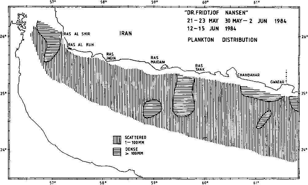
Plankton
The distribution of plankton in the covered area is shown in Figure 5. The recordings were mainly scattered with three limited areas of higher density. As jellyfish and small shrimps were found in the pelagic trawl stations, these were probably the main contributors to the integrated echo intensity in the plankton layer. No plankton net samples were collected.
![]()
![]()
![]()