开始使用“手拉手”地理空间信息平台
2022
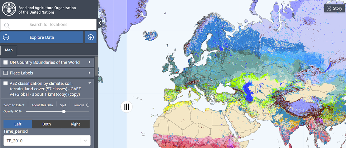
The Hand-in-Hand Geospatial Platform is a supporting tool for the Hand-in-Hand (HiH) Initiative, an evidence-based, country-led and country-owned initiative...

应用接口基本知识
2022
API stands for Application Programming Interface (API)– and the keyword here is interface. In other words, APIs allow two or more digital applications...

行政界限数据共享
2021
Hand-in-Hand (HiH) is an evidence-based initiative, using multi-sectorial geospatial data to address a wide-spectrum of problems with a system approach....
如何添加表格数据
2022
This document provides guidance on the entire tabular data workflow, including how to create datasets, update tables, and debug errors in the workflow...
CKAN元数据发布工作流程
2023
Hand-in-Hand is an evidence-based, country-led and country-owned initiative of the Food and Agriculture Organization of the United Nations (FAO) to...
地理网络元数据发布工作流程
2021
This guide provides instructions for data holders on how to publish metadata information associated with their geospatial resources through the FAO...
粮农组织GISMGR 2.0 API参考资料
2022
The goal of this document is to provide the reference of the ReST API exposed by the FAO GISMGR 2.0 System. It’s a concise reference manual containing...
粮农组织GISMGR 2.0 WEB UI用户手册
2022
This document, the FAO GISMGR 2.0 WEB UI User Manual, provides information for data owners and supporting officers on using the FAO GISMGR 2.0 Web application...

