土地资源规划工具箱
该类工具在土地评估过程中突出了生物自然属性(气候、土壤、地形、水等)及其相互作用。大多数情况下,主要基于生物自然属性的输出结果会引导用户选择合适的土地利用方案。土地适宜性和相似性分析是典型的例子。包括描述土地评价的原理、方法和准则的文件,以及基于特定用途、能力或潜力、肥力限制和管理、产量、生产力、物理和化学性质的不同的土壤分类工具。复杂或简化的作物生长和产量预测模型也属于这一类。
该类工具利用生物自然特征和社会经济条件作为输入信息,并通常包括参与式土地利用规划的原理、方式和方法,其总体目标是实现所有利益相关者互利共赢。
该类工具突出了土地利用规划所需要的社会和经济环境特征,包括参与决策的方式和方法。这些工具也可以考虑生物自然条件,但不作深度考虑。

该类包括可促进土地评价和土地利用规划的数据库,通过为这些过程提供输入信息而实现。这些数据库提供了多种地图和数据,包括土壤和地形特征、土地退化、土地覆盖、土地利用、气候数据(包括未来的预测)、作物和产量、粮食、农业、水资源、植物物种对特定环境的适应性/适宜性、关于贫穷、人口、职位和性别的社会经济数据和统计数据

该类工具并不产生直接用于土地评估和土地利用规划的结果。但它提供了各种类型的数据,可用于土地评价研究和作为土地利用规划的输入数据集。
Number of records: 34

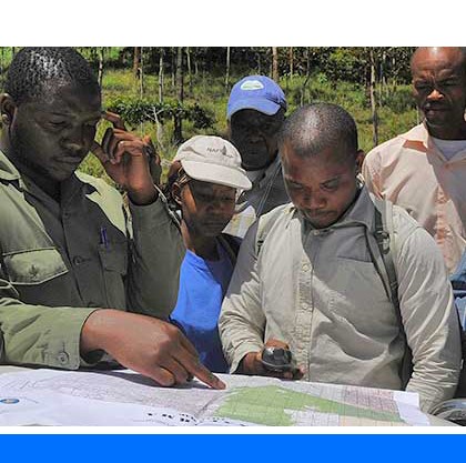
Village land use (VLU) planning in Tanzania has its basis in the Land Use Planning Act No. 6 of 2007 and the Village Land Act of 1999, both of which give village councils (VCs) the powers to plan, manage and administer the lands within their village. Sectoral legislation such as...
Type: Documentation/Manuals
Scale: National
Thematic areas: Land management/planning
User Category: 技术专家, 科学顾问, 政策制定者
The full name of this document is the SARD Project Toolkit: a resource guide for promoting SARD in projects and programmes. The SARD Project Toolkit summarizes frameworks, approaches and tools that can be used to promote sustainability in the management of agricultural and rural development projects and programmes. Frameworks provide...
Type: Framework/Guidelines
Scale: Locality/Farm/Site
Thematic areas: General
User Category: 技术专家, 科学顾问, 政策制定者
FAO upon recommendation of its members identified the need to initiate a comprehensive analysis, evaluation and documentation of relevant forestation and restoration programmes and projects in drylands, in collaboration with its member countries, local partner organizations and international institutions and organizations. This endeavour will...
Type: Questionnaire/Survey
Scale: Watershed/Basin/Landscape
Thematic areas: Climate
User Category: 技术专家, 政策制定者, 协助人员
The Guidelines for Soil Description (SOIL_DESC) provide users with a complete procedure for soil description and for collecting field data necessary for soil classification systems, such as the World Reference...
Type: Framework/Guidelines
Scale: Locality/Farm/Site
Thematic areas: Soils - distribution and properties
User Category: 技术专家
Soil classification is a tool for grouping soils with a similar range of properties (chemical, physical and biological), and potentially similar behaviour, into a limited number of units that can be geo-referenced and mapped. The need for soil classification arose out of the complexity and often transitional...
Type: Documentation/Manuals
Scale: Global, Regional, National, Sub-national/Province/District, Locality/Farm/Site, Watershed/Basin/Landscape
Thematic areas: Soils - distribution and properties
User Category: 技术专家
The FAO Soils Portal (FAO-SOILS) provides a gateway to various aspects of soils information. It explains, with links to a variety of publications, the concepts, diversity, degradation, and importance for agriculture, biodiversity, construction, as well as its role in mitigation of/adaptation to climate change.
Type: Documentation/Manuals,Educational materials,Framework/Guidelines,Maps/GIS
Scale: Global, Regional, National
Thematic areas: Soils - distribution and properties, Soils - management and conservation
User Category: 技术专家, 科学顾问, 利益相关者
The erosion model of the Water Erosion Prediction Project (WEPP) is a continuous simulation computer program which predicts soil loss...
Type: Model
Scale: Locality/Farm/Site
Thematic areas: Soils - management and conservation
User Category: 技术专家, 模型建立者
SDBm Plus is a software package designed to harmonize, store and use large amounts of geo-referenced soil profile data, elaborated in the field and the laboratory, in an efficient and systematic way. The soil profile database can be...
Type: Data
Scale: Global, Regional, National, Sub-national/Province/District, Watershed/Basin/Landscape
Thematic areas: Soils - distribution and properties
User Category: 技术专家
LRIMS is a GIS-based system to manage land resource information in Libya, developed by the project “Mapping of Natural Resources for Agriculture Use and Planning in Libya” (LIB/00/004), initiated by the Libyan Government in collaboration with UNDP and FAO.
Type: Maps/GIS
Scale: National
Thematic areas: Land evaluation
User Category: 技术专家, 科学顾问
The objective of the Sustainable Land Management Mainstreaming Tool (DS-SLM) is to provide elements for the design of operational strategies and action plans for mainstreaming and scaling up SLM to guide national teams and other SLM-related projects in establishing processes for mainstreaming information on desertification, land degradation and drought (DLDD)...
Type: Framework/Guidelines
Scale: National, Sub-national/Province/District, Locality/Farm/Site, Watershed/Basin/Landscape
Thematic areas: Land management/planning
User Category: 技术专家, 科学顾问, 政策制定者