![]()
![]()
![]()
Among the sovereign states of Europe, the Republic of Malta is the fourth smallest and next to Monaco the most densely populated. A small group of islands in the Mediterranean Sea, Malta lacks mountains, lakes, perennial streams and even reservoirs of any size. Furthermore, heavy demands upon its meagre water resources preclude serious attempts to support freshwater capture fisheries.
Despite its notable lack of inland fishery resources and their aquatic base, Malta is a member of the European Inland Fisheries Advisory Commission (EIFAC). Possibilities may be entertained of at least establishing some sort of brackish or salt water aquaculture.
| 1. | AREA: | 316 km2 | |
| 2. | POPULATION: | 396 000 (est. 1990) | Density: 1 253 inh/km2 |
| 3. | PHYSICAL GEOGRAPHY | ||
Malta is situated in the central Mediterranean Sea, 93 km south of Sicily and 290 km from Africa, at 35°53'N latitude and 14°30'W longitude.
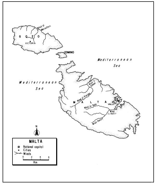
The Maltese Archipelago, whose greatest extent is 47 km, is composed of five islands. The largest of these, Malta is a low almost treeless plateau with terraced slopes and cliffs to 120 m. It has an area of 246 km2, a length of 27.3 km, a width of 14.5 km, and a high point of only 240 m. The second largest, Gozo, has an area of 67 km2, a length of 14.5 km, and a width of 7.2 km. It is similar to Malta but with less altitude. Comino is only 2.7 km2 in area. The other two islets, Comminotto and Filfa, are smaller and uninhabited.
Wild vegetation, a poor garigue and tough grasses, is scarce in these dry, rocky isles. The principal native trees are carob and fig; olive, laurel and various fruit trees have been introduced.
The soils are shallow, largely thin limestones, interspersed with thin beds of crystalline sandstones and clays. Some are rich in phosphates and most of them are very porous.
The west coasts are cliff-like, the east lower. There is a well-indented coastline, some 137 km long on the island of Malta and 43 km on Gozo, and some excellent deepwater harbours cut deep into the rocky plateau. There is almost no tide, perhaps half a metre.
4. CLIMATE
Typically Mediterranean, with mild, rainy winters and hot dry summers.
The mean annual temperature is about 18.5°C (mean range, 14.3°–22.7°C). The average temperature is 12.8°C in January and 27.8°C in August, with maxima over 32°C common in July–September.
The average annual rainfall is about 559 mm. There is usually no rain during the May–September period, and most of the rainfall occurs between November and January.
5. HYDROGRAPHY AND LIMNOLOGY
There are no lakes or permanent streams in Malta, but there are some deeply cut valleys (wieds), and about nine seasonal creeks, including those of Sliema, Lazaretto, Msida and Marisa.
The approximate annual run-off is only 10 mm. Most of the precipitation is absorbed by the porous soil to be held by impervious clay layers and sometimes to issue as springs. Circa 1970, there were about 20 million m3 of ground water - most of the natural water supply except for some small reservoirs impounding rain water.
6. LAND AND WATER USE
About 41 percent of Malta is arable or devoted to permanent crops, the rest is considered builton or unproductive (1986). There are no woodlands nor permanent pasturage, and the only mineral resources are limestone and salt.
The population is about 87 percent urban and 13 percent rural.
Agriculture, limited by the rocky but fertile nature of the islands, is characterized by terracing, the use of partially manufactured and imported soil, and crops such as grain, fodder, vegetables and fruit. There is a little irrigation, some with very saline water, of about 1 000 ha (1986). There is some grazing of sheep and goats.
Aside from its large ship repair yards, Malta has some light industry, e.g., textiles, food processing, electronics. All electrical power is thermal: 252 000 kW installed capacity in 1987.
Tourism has become an attractive type of income and creates a demand for fish. In fact, domestic consumption is lower than the reported per caput supply, 7.6 kg/year, indicates because of a substantial tourist consumption. With 1 302 km of roads, road density is exceptionally high, 4.12 km/km2, and automobile ownership is about 200 per 1 000 people. There are no railways.
There is a small localized marine fishing industry, but it “…plays a rather less important role in the economy than might be expected from an island nation” (FAO, 1979). It remains, in general, a traditional industry carried out by individual families. In 1978, there were only 1 074 registered fishermen, over half of them seasonal. The marine catch in 1987 was only 1 003 t.
Demands for water are severe. About three quarters of the supply is for domestic use alone, followed by commercial and industrial use, and then by irrigation. The natural supply is augmented by distillation of sea water.
7. FISH AND FISHERIES
7.1 Capture Fisheries
Virtually non-existent.
7.2 Aquaculture
In reporting upon a fishery survey of Malta circa 1954, Burdon (1956) stated that fish culture in Malta was restricted to the maintenance of a few ponds in sheltered creeks where grey mullet (Mugil spp.) fry were stocked in the summer to be harvested during the winter. He recommended the establishment of mullet ponds to be operated intensively. Introduction of Tilapia spp. into some irrigation ponds, tanks and salt pans, even if for only short periods, was also recommended.
FAO (1970) suggested the possibility of rearing grey mullets in abandoned salt pans, and using salt pans and associated canals to raise shrimp for bait but warned that such projects would be expensive. See section 9.3. Girin (1989) states that there is little or no aquaculture in Malta.
8. OWNERSHIP, ADMINISTRATION, MANAGEMENT AND INVESTIGATION
Malta has a Fisheries Department, but its work seems to be confined almost entirely to marine fisheries.
Research on biology, fisheries and fish culture is being carried out by university personnel at St. Lucian Marine Station, and Girin (1989) states that there has been some work on introduced freshwater species here (the species are not specified).
9. STATE OF THE FISHERY
9.1 Yield
Apparently negligible.
9.2 Factors Affecting the Fishery
The absence of perennial lakes and streams and the lack of reservoirs of suitable size and retention period preclude the maintenance of an inland capture fishery - except, perhaps, for subsistence or sport in a few small water bodies.
In this country of limited rainfall and high population density, the demands for water for domestic and commercial use (including increasing tourism), as well as for industry and agriculture, are altogether too severe to provide justification for the establishment of conventional freshwater aquaculture. True, the use of highly intensive methods such as those using recirculated water might be considered, but it is hardly thought feasible.
Consideration of use of Malta's fresh water for either fisheries or aquaculture depends upon consideration of their potential values in this dry and sea-girt land with those of already well established and growing uses. The UN (1964) estimated that by 1970, the annual water demand in Malta would be 20 250 000 m, i.e., somewhat more than the amount of fresh ground water available. (Even such an amount would supply the present population with only about 51 m of fresh water per caput annually.)
Under the circumstances, it would appear that some sort of brackish or salt water aquaculture is the only real possibility.
9.3 Prospect
FAO (1979) has suggested that although there exists little possibility of freshwater aquaculture, the future potential in the culture of flatfish as well as sea basses and sea breams is promising, owing to favourable marine water temperatures and the accessibility of a number of inshore areas suitable for cage, ranch, or tank culture. Mollusc cultivation is also believed to have some potential. In fact, some oyster beds were laid out as early as 1867.
Finally, it should be mentioned that despite the apparent absence of either an inland capture fishery or aquacultural development in Malta, its description has been included in this review: (i) because Malta is a member of the European Inland Fisheries Advisory Commission (EIFAC), and is therefore presumed to have an interest in such fisheries, and (ii) to provide a compendium of basic knowledge as background for further action or inaction.
10. REFERENCES SPECIFIC TO MALTA
Burdon, T.W., 1956 A report on the fishing industry of Malta. Govt.Printing Office, 79 p.
FAO, 1970 Report to the Government of Malta on fisheries development. Based on the work of I.D. Richardson. Rep.FAO/UNDP(TA), (2899):19 p.
FAO, 1979 Malta. FAO Fishery Country Profile, FID/CP/MAL, Rev. 2, 4 p.
Galea, J., 1965 Malta since the time of the Knights of St. John. In Malta. Isles of the middle sea. London, George G. Harrap & Co., Ltd., pp. 39–68
Republika ta Malta, 1982 Annual abstract of statistics 1980, No. 34. Malta, Central Office of Statistics. 270 p.
Rychener, H., 1965 Malta: a geographical survey. In Malta. Isles of the middle sea. London, George G. Harrap & Co., ltd., pp. 69–75
UN, 1964 Water desalination in developing countries. Publ. (64). II.B.5 ST/ECA/82
U.S. Department of State, Bureau of Public Affairs, Malta. 1979 Background Notes Series, Dept. of State Publication 8220, Rev. Feb. 1979. Washington, D.C., U.S. Government Printing Office, 4 p.
![]()
![]()
![]()