Mapping the path to sustainable cocoa: FAO and EU launch the Cartography of Cocoa and Forest Impacts project in Cameroon (COCAFORI)
")
The Food and Agriculture Organization of the United Nations (FAO) in collaboration with the European Union Sustainable Cocoa Initiative have recently launched an innovative component “Cartography of Cocoa and Forest Impacts” – or better known as the COCAFORI project to better map and understand the dynamics of cocoa expansion in Cameroon through cutting-edge technology and collaborative efforts. This project will support the cocoa industry in the country while ultimately fostering sustainable practices along with transparency and compliance with European standards.
A journey into the cocoa fields
Cocoa is a major source of income for millions of people worldwide. The top four exporting countries are Cote d’Ivoire, Ghana, Ecuador and Cameroon. As the European Union (EU) accounts for 60% of the world’s imports of cocoa, efforts to improve sustainability and transparency of the cocoa value chain are crucial. In many countries, cocoa production entails environmental and social risks including deforestation and forest degradation, child labour, and low revenues for smallholder farmers. The first step in improving the transparency of cocoa supply chains is to understand where cocoa is harvested – which can be achieved through satellite remote sensing.
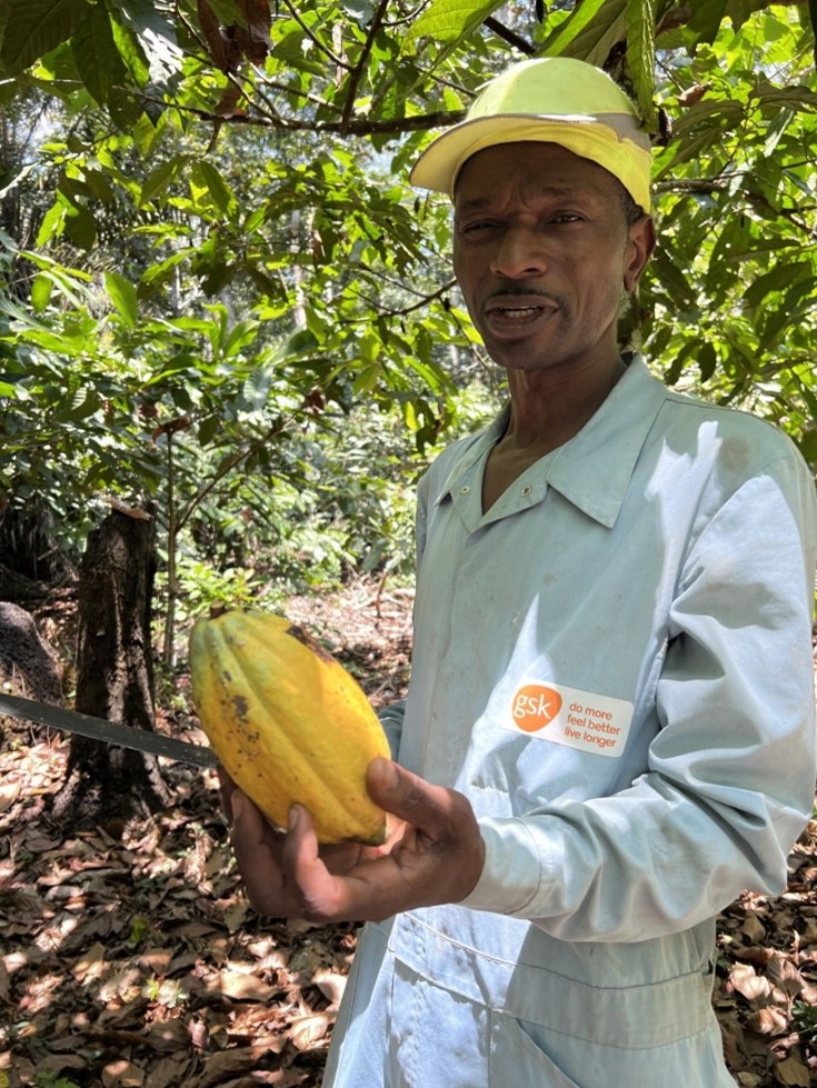
However, mapping cocoa from space is particularly challenging in Cameroon where cocoa is cultivated primarily as agroforestry, meaning under a dense, mixed tree canopy. In the cocoa plantations in and around Ayos, a major cocoa producing area outside the capital, Yaoundé, the project team members experienced firsthand the marvel of traditional cocoa harvesting techniques, along with the challenges of cocoa cultivation in the region. Guided by dedicated cocoa producers from l’Unité moderne de production du cacao d’excellence (UMOPROCAOE), the project team gained insights into the agroforestry practices that define Cameroon’s cocoa cultivation.
“We are confident that the COCAFORI project can provide the information and tools these dedicated cocoa producers need to support their efforts towards EU Regulation on Deforestation-free product compliance”, Aurelie Shapiro, FAO Remote sensing and GIS expert, stated.
Empowering communities
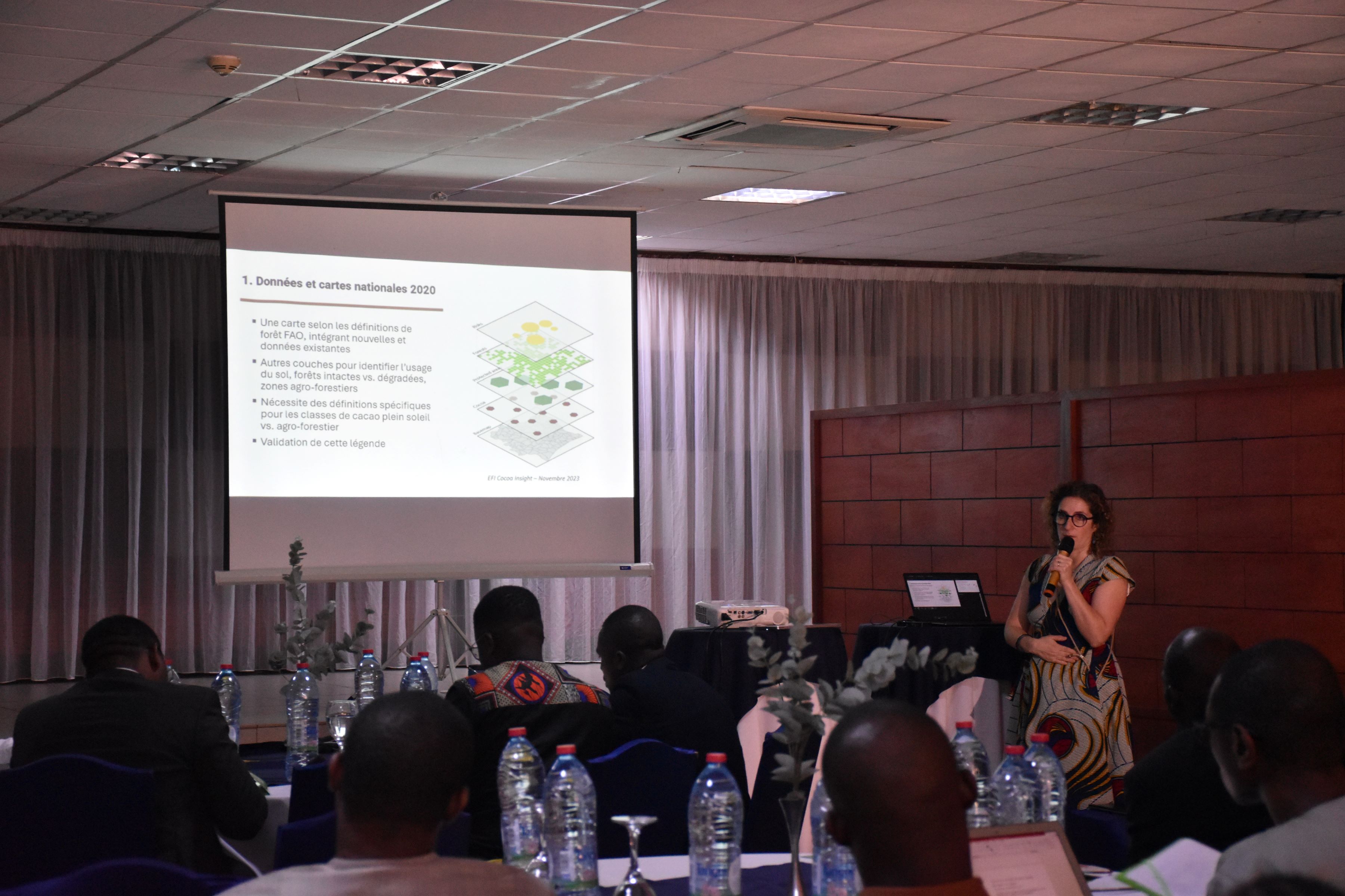
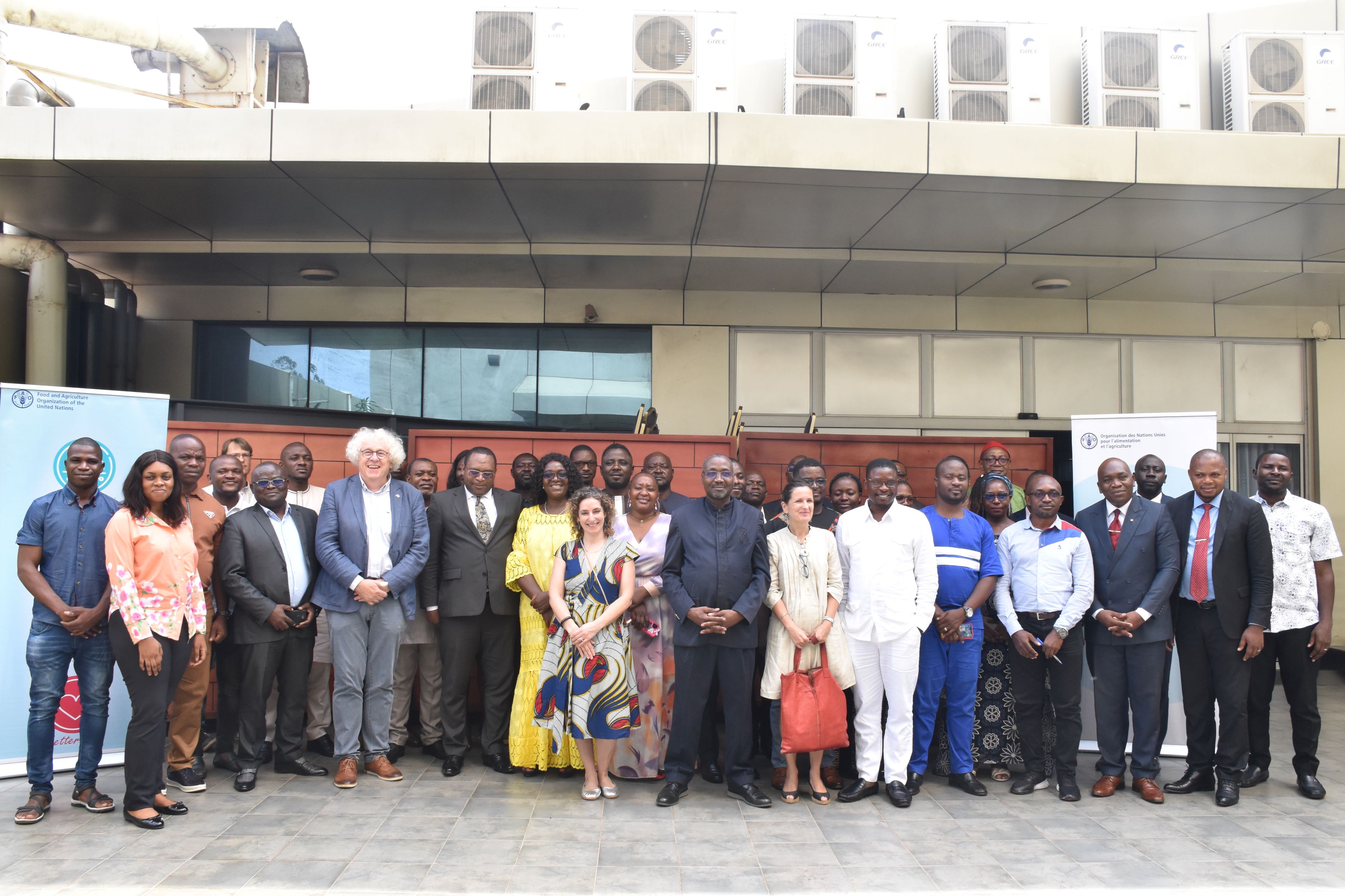
In March, a first technical meeting of the project took place in Yaoundé, bringing together cocoa producers, NGOs, academia, and government partners to collectively determine which kinds of spatial information are needed to meet the specific needs of national counterparts. Participants collectively defined the specific area of interest to be targeted by mapping efforts, while FAO presented the innovative Artificial Intelligence approaches to be employed and the kind of unique training data needed to produce the national cocoa probability map.
Sebastien Mveng Ateba, a cocoa producer from Ayos, Cameroon, who participated in the project launch, reflected on the significance of FAO’s technical support via the project. “I salute FAO's seriousness and dedication to this issue, which is central to the future of cocoa and, more importantly, to those who depend on this product, especially us producers", Sebastien affirmed. Through direct engagement with cocoa producers and stakeholders, COCAFORI aims to empower local communities by providing them with the information and tools necessary to uphold sustainability standards and ensure compliance with EU regulations. A risk analysis of available cocoa plantation data was developed using FAO’s new Whisp solution, which indicated that over 90% of plantations analyzed could be classified as “low risk” for EU regulations.
Driving sustainability
With high-resolution satellite imagery and other earth observation data, COCAFORI aims to produce a comprehensive forest and land cover map, delineating intact forests, degraded or disturbed areas, shade and sun cocoa areas, mixed crops, forests, and non-forest regions. Furthermore, the project seeks to evaluate the impact of cocoa on deforestation since 2010 and develop a deforestation risk map to anticipate future cocoa expansion impacts. A prototype alert system will integrate real-time deforestation alerts in high-risk forest areas.
Romuald Vaudry from the European Forest Institute (EFI) also underscored the impact of COCAFORI's mapping efforts. "This multi-faceted mapping work will enable the EU's Sustainable Cocoa Initiative to better target its support, whether in terms of geo-referencing cocoa farms, and improving the level of traceability in the sector, or assessing the risk of deforestation and degradation linked to cocoa farming, a risk that is particularly high given the current trend in cocoa prices.”
COCAFORI's success lies in collaboration, so bringing together expertise from the Forest Data Partnership, AIM4Forests, the Joint Research Centre (JRC) of the European Commission, the European Forest Institute (EFI), the German Technical Cooperation (GIZ) as well as national institutions, is key for the initiative to harness the power of remote sensing, artificial intelligence, and FAO's Open Foris SEPAL platform. This collaborative synergy enables the development of transparent, reproducible, and open-source tools crucial for mapping cocoa expansion and its impact on forests.
Project outputs will be available in this interactive map of cocoa in Cameroon
More information on our new SEPAL Cocoa website