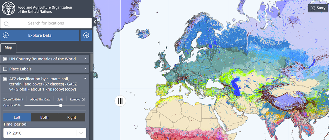
Getting started with HiH Geospatial Platform
2022
The Hand-in-Hand Geospatial Platform is a supporting tool for the Hand-in-Hand (HiH) Initiative, an evidence-based, country-led and country-owned initiative...

The ABCs of APIs
2022
API stands for Application Programming Interface (API)– and the keyword here is interface. In other words, APIs allow two or more digital applications...

Administrative Boundaries Data Sharing
2021
Hand-in-Hand (HiH) is an evidence-based initiative, using multi-sectorial geospatial data to address a wide-spectrum of problems with a system approach....

How to add Tabular Data
2022
This document provides guidance on the entire tabular data workflow, including how to create datasets, update tables, and debug errors in the workflow...

CKAN Metadata Publishing Workflow
2023
Hand-in-Hand is an evidence-based, country-led and country-owned initiative of the Food and Agriculture Organization of the United Nations (FAO) to...
GeoNetwork Metadata Publishing Workflow
2021
This guide provides instructions for data holders on how to publish metadata information associated with their geospatial resources through the FAO...


FAO-GISMGR Project GISMGR 2.0 API Reference
2022
The goal of this document is to provide the reference of the ReST API exposed by the FAO GISMGR 2.0 System. It’s a concise reference manual containing...
FAO-GISMGR Project - GISMGR 2.0 - User Manual
2022
This document, the FAO GISMGR 2.0 WEB UI User Manual, provides information for data owners and supporting officers on using the FAO GISMGR 2.0 Web application...

