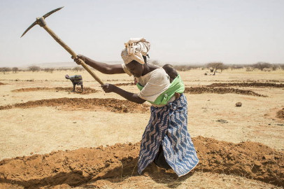
Niger – About the country
Climat

Niger's climate is continental Sahelian, characterized by two seasons: a short rainy season (June to September), and a long dry season (October to May). Annual rainfall is characterized by significant spatio-temporal and interannual variability and a general tendency for isohyets to slide towards the south in the last thirty years. These phenomena increase the risks of drought and desertification, which have consequences on agro-sylvo-pastoral production.
The evaporation varies between 1 700 mm and 2 100 mm of water per year. The climate water deficit is therefore significant during the dry season and is accentuated by the harmattan, a very dry continental trade wind from the Sahara, which blows from the northeast to the southwest from October to February. On the contrary, the monsoon, a southerly trade wind, laden with humidity, blows from the southwest to the northeast from March to September and generates rain.
Water resources
There are two major hydrographic basins in Niger: the hydrographic basin of eastern Niger and the hydrographic basin of western Niger. In addition, Niger's hydrological network includes more than 1 000 ponds, of which around 175 are permanent and generally connected to underground aquifers, such as the Tabalack and Madarounfa ponds.
Surface renewable water resources are estimated at more than 31 km3/year, of which only a very small portion is produced inside the country (1 km3 / year), the vast majority coming from inflows into the country, from Mali (28 km3/year) and to a lesser extent from Burkina Faso (1 km3/year) and Nigeria (0.2 km3/year), as well as from border flows (1.15 km3/year). The dependency index is thus very high (89.6 percent). Renewable internal underground water resources are estimated at 2.5 km3/year.
Niger's hydraulic potential remains poorly mobilized. Indeed, less than 3 percent of total renewable resources were exploited in 2005. The volume of surface water withdrawn for farming from the Niger River and its tributaries was estimated at 0.045 km3 in 2005. The volume of surface water withdrawn for irrigated agriculture from the Niger River and its tributaries was estimated at 0.454 km3 in 2005. Irrigated agriculture also uses groundwater and other surface water sources. The total water withdrawals for agriculture were estimated at 0.66 km3 in 2005.
Land resources and agriculture
Mali is a landlocked country that covers an area of approximately 1.24 million km2, of which 51 percent is desert land. The cultivated areas (arable land and land under permanent crops) occupy 4.7 million ha or 4 percent of the territory. The potential of land suitable for irrigated cultivation is 2 200 000 ha, of which approximately 566 500 ha are easily developable from perennial surface water resources.
Niger is a landlocked country in West Africa, covering an area of 1 267 000 km2. Three-quarters of the country is in the desert zone to the north, while the rest is in the Sahelo-Sudanian zone. The area of cultivated land extended to 15 000 000 ha in 2011. The irrigable land potential of Niger is estimated at 270 000 ha based on exploitable water and soil resources, or 1.8 percent of the cultivated area. The irrigable potential of the Niger river valley is estimated at 142 450 ha, including 110 000 ha of terrace and 32 450 ha of basin.
For more information and country statistics, please visit FAO Aquastat – Niger and FAO Country Profile – Niger.
