Back to contents - Previous file - Next file
Exploring the land resources inventory
Generating yield tables according to moisture
conditions (a)
Generating yield tables according to moisture
conditions (b)
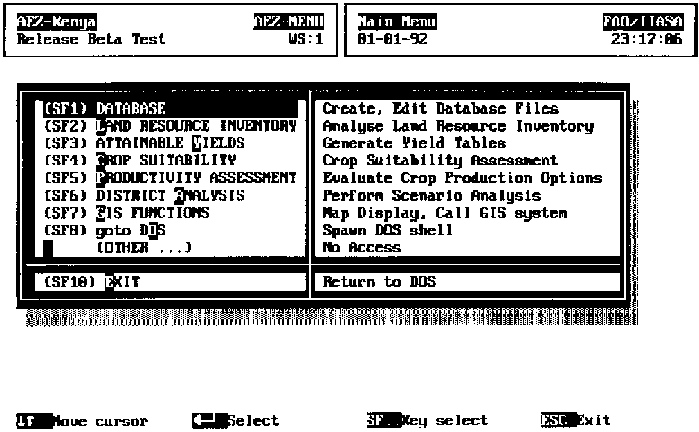
The first step is to install the PC version of the KENYA-AEZ software and go through the brief introduction to the file structure and menu options available using the User Manual. The software and the User Manual are provided as diskette files. Now we will start exploring the database and software system by doing some practical exercises. To print results from these exercises make sure the printer is properly connected, turned on and set to condensed mode (132 character page width). After starting the software the main menu (Figure 2.1) appears on the screen.
FIGURE 2.1 Main menu of KENYA-AEZ system
The second option under the main menu (SF2), LAND RESOURCE INVENTORY, allows for viewing the resource inventory, for compiling 2-way and 3-way cross-tabulation statistics, and viewing and printing these tables.
The land resources inventory brings together several layers of information on physical environmental resources and allows the creation of unique ecological land units (agro-ecological cells) within which landform, soil and climate conditions are quantified and considered nearly homogenous.
The climatic resource inventory of Kenya records both temperature and soil moisture conditions. The quantification of temperature attributes has been achieved by defining reference thermal zones. As temperature seasonality effects of latitude are minor, temperature zones are closely correlated to altitude ranges (Braun, 1982). To cater for differences in temperature adaptability of crops, pasture and fuelwood species, nine thermal zones have been distinguished, based on ranges of 2.5° Celsius.
Quantification of moisture conditions was achieved through the concept of reference length of growing period (LGP). Reference LGP is defined as duration (in days) of the period when temperature permits crop growth and soil moisture supply exceeds half potential evapotranspiration; it includes the time required to evapotranspire up to 100 mm of soil moisture storage (FAO, 1978-81). Growing periods which include a sub-period when precipitation exceeds potential evapotranspiration are termed 'normal' LGPs as compared to 'intermediate' LGPs with no such humid sub-period. The moisture period regime has been inventoried by means of three complementary attributes:
The map of mean total dominant LGP zones and the map of LGP-pattern zones, together with information (in table form) on length and probability of occurrence of associated growing periods, provide the historical moisture profile, compiled from data records of a large number of locations in Kenya.
The Exploratory Soil Map of Kenya (Sombroek et al., 1982), at a scale of 1:1 million, was used to compile the soil resources inventory. 392 different soil map units are distinguished, describing soil associations or soil complexes composed of dominant soils, associated soils and inclusions (390 map units) or relate to water bodies and major urban areas (2 map units). A mapping unit composition table has been provided (van der Pouw, 1983) containing percentage allocation of the map units by soil type, slope class, soil texture and soil phases. It also contains information derived from the legend of the soil map regarding landform and geology/parent material.
In addition to the soil and climate layers, six other layers of information have been incorporated in the land resources database, providing information on cash crop zones, forest zones, national park areas and game reserves, location of irrigation schemes, tse-tse infestation areas, and province and district boundaries.
The individual map layers were digitized and stored in a grid (raster) format of 1085 rows and 900 columns, each grid cell representing an area of one square kilometre. The land resources inventory combines both geo-referenced information as provided in the different map overlays and statistical information (percentage distribution) as contained in the soil mapping unit composition and slope composition tables. The compilation of the resource inventory includes:
This process produced a collection of about 91000 data records, termed agro-ecological cells; these data records are unique in terms of the combination of land and climate characteristics. This level of detail ensures that each agro-ecological cell represents a fairly homogenous set of agroclimatic and soil physical conditions, as is crucial to adequately matching land unit properties with crop requirements.
From the coded information contained in a land inventory record it is possible to identify the respective grid raster points in the GIS to which an entry relates. Because of the disaggregation implied by the mapping unit composition table and the slope composition table, usually more than one land inventory record will refer to the same set of grid points. Therefore, the results to be transferred to the GIS must be aggregated to average values per raster point. 18 attribute fields are distinguished:
| Field | Column | Field contents |
| 1 | 1 - 2 | province code; class values 1 to 8 |
| 2 | 3 - 4 | district code; class values 1 to 13, depending on province |
| 3 | 5 - 6 | thermal zone; 9 classes |
| 4 | 7 - 8 | mean total length of growing period (LGP); 15 classes |
| 5 | 9 - 10 | LGP-Pattern; class values 1 to 22 |
| 6 | 11 - 13 | Kenya Exploratory Soil Map unit; 392 map units |
| 7 | 14 -16 | soil unit code; class values 1 to 135 |
| 8 | 17 | coarse material indicator; class values 0 to 6 |
| 9 | 18 -19 | texture code; class values 1 to 34 |
| 10 | 20 -21 | phase combination; class values 0 to 73 |
| 11 | 22 -23 | slope class; class values 1 to 11 |
| 12 | 24 -26 | slope gradient in 1/10 percent |
| 13 | 27 -28 | cash-crop zone indicator; 19 class values |
| 14 | 29 | forest zone; 4 class values |
| 15 | 30- 31 | irrigation scheme; 21 class values |
| 16 | 32 | Tsetse infestation; 2 class values |
| 17 | 33 | game park; 4 class values |
| 18 | 34 - 41 | cell extent; size of agro-ecological cell in ha |
TABLE 2.1
AEZ cross-tabulation, thermal zone vs. forest zone
Field 3 (Thermal zone) versus Field 14 (Forest
zone)
After ROW - Normalization
| Forest | THZ | F1 | F2 | F3 | Total |
| THZ | 198.9 | .2 | .0 | 1.0 | 66.5 |
| THZ 2 | 100.0 | .0 | .0 | .0 | 9.9 |
| THZ 3 | 99.5 | .5 | .0 | .0 | 7.0 |
| THZ 4 | 97.2 | 2.8 | .0 | .0 | 7.8 |
| THZ 5 | 86.7 | 13.2 | .1 | .0 | 5.9 |
| THZ 6 | 52.5 | 43.5 | 3.9 | .0 | 2.2 |
| THZ 7 | 47.9 | 52.1 | .0 | .0 | .5 |
| THZ 8 | 57.5 | 42.5 | .0 | .0 | .2 |
| THZ 9 | 100.0 | .0 | .0 | .0 | .0 |
| Total | 96.8 | 2.5 | .1 | .7 | 100.0 |
| After COLUMN - Normalization | |||||
| Forest THZ | |||||
| THZ 1 | 67.9 | 4.2 | .0 | 100.0 | 66.5 |
| THZ 2 | 10.2 | .2 | .0 | .0 | 9.9 |
| THZ 3 | 7.2 | 1.5 | .0 | .0 | 7.0 |
| THZ 4 | 7.8 | 8.8 | .0 | .0 | 7.8 |
| THZ 5 | 5.3 | 31.6 | 8.4 | .0 | 5.9 |
| THZ 6 | 1.2 | 39.1 | 91.6 | .0 | 2.2 |
| THZ 7 | .3 | 11.3 | .0 | .0 | .5 |
| THZ 8 | .1 | 3.2 | .0 | .0 | .2 |
| THZ 9 | .0 | .0 | .0 | .0 | .0 |
| Total | 96.8 | 2.5 | .1 | .7 | 100.0 |
The land resource inventory (LRI) file is created by superimposing administrative, climatic, soil and land-use data contained in ten thematic maps. The maps are stored in raster format, i.e., data arranged in 1085 rows and 900 columns of square pixels, each representing an area of one square kilometre. Data is stored by row, from north-west to south-east. In this way, each map contains 976500 pixels, usually stored as one byte each, of which about 40 percent falls outside the national boundaries (in that case coded as pixel value zero). Note that the LRI must be recreated whenever one of the thematic maps is modified. The third item, CREATE INVENTORY, available in the sub-menu under main menu option seven (SF7), GIS-FUNCTIONS, is provided for that purpose.
Example 2.1: Cross-tabulation of land resources data. It provides statistics on the coincidence of pairs of classes of different land resource inventory attributes. For instance, to obtain a crosstable about the occurrence of forest zones according to different thermal zones, proceed as follows:
Step 1: In the main menu of KENYA-AEZ, position the cursor on the second option (SF2), LAND RESOURCE INVENTORY, and press < ENTER> 5.
Step 2: In the sub-menu presented to you, select option two, STATISTICS, and press <ENTER>.
Step 3: The program prompts for the first attribute field to be selected. Classes of this field will form the rows of the cross-table. Enter 3, to choose the thermal zone field.
Step 4: The program prompts for the second attribute field to be selected. Classes of this field will form the columns of the cross-table. Enter 14, to select the forest zone field.
Step 5: The program prompts for the third attribute field to be selected. This is optional and allows for 3-way cross-tables. Enter 0 to obtain a 2-way table.
Now, the program will start processing the land resource inventory and report on progress. Note that processing 3-way cross-tables of the entire LRI may take considerable time.
Depending on software configuration, up to three tables are provided:
(a) percentage of total area occupied by
respective combinations of attribute values.
(b) row normalized percentages, i.e., distribution of extents
with a particular class value of attribute 1 over the entire
range of class values of attribute 2.
(c) column normalized percentages, i.e., distribution of extents with a particular class value of attribute 2 over the entire range of class values of attribute 1.
Table 2.1 shows row and column normalized results of cross-tabulating thermal zones versus forest zones in Kenya.
For instance, the row-normalized table shows that about half the area in thermal zone T7 (52.1 percent) is in forest class F1. The column-normalized table indicates that more than 80 percent (31.6+39.1+11.3 percent) of forest class F1 occur in thermal zones T5 to T7. The border row and column of the tables indicate the percentage of area of classes of attribute 2 and attribute 1, respectively. For instance, the first value in the bottom row of the cross-table shows that most (96.8 percent) Kenyan land falls outside the three forest zone classes; the first value in the last column indicates that about 2/3 of the country (66.5 percent) are in thermal zone T1 (warm tropics, mean annual daily temperature > 25° Celsius).