Drought portal - Knowledge resources on integrated drought management

I&V_ass


National case studies

Country-level drought impact and vulnerability assessments provide a wealth of information that significantly enhances resilience in drought-affected areas. Moreover, they inform global knowledge and methodologies and translate national strategies on integrated drought management into effective action plans based on on-ground conditions.

For this reason, this compendium includes a series of relevant country reports to showcase national impact and vulnerability assessments and highlight drought vulnerability along social, economic, infrastructural, environmental and institutional dimensions.

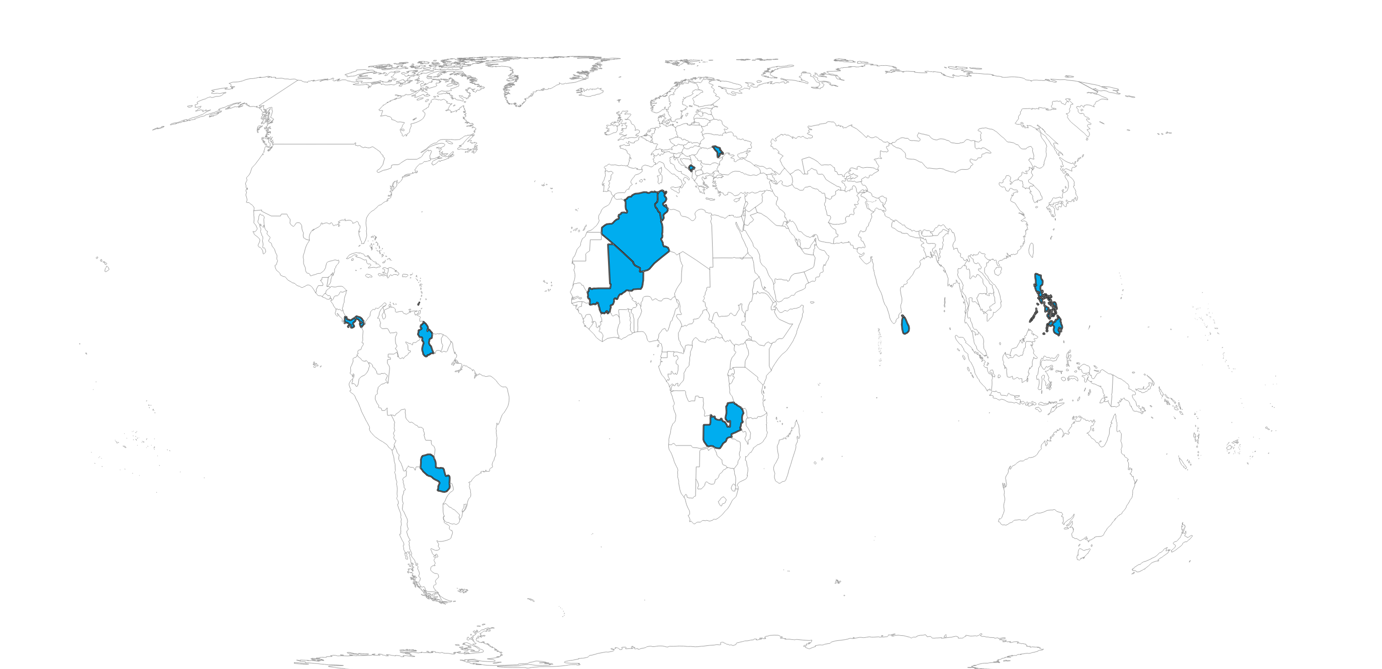
National reports on impact and vulnerability assessment are developed for the following countries.

BurundiGrenadaGuyanaMali
        
MoldovaMontenegroPanamaParaguay
        
Philippines TunisiaSri LankaZambia


Sources: United Nations Geospatial. 2020. Map geodata [shapefiles]. New York, USA, United Nations.
The boundaries and names shown and the designations used on this map do not imply the expression of any opinion whatsoever on the part of FAO concerning the legal status of any country, territory, city or area or of its authorities, or concerning the delimitation of its frontiers and boundaries. Dashed lines on maps represent approximate border lines for which there may not yet be full agreement. Dotted line represents approximately the Line of Control in Jammu and Kashmir agreed upon by India and Pakistan. The final status of Jammu and Kashmir has not yet been agreed upon by the parties. Final boundary between the Sudan and South Sudan has not yet been determined. Final status of the Abyei area is not yet determined.